- Local time
- UTC+00:00
- Europe/London · UTC+00:00
- Elevation
- 84 m
- above sea level
- Airports
- LBA Leeds Bradford Airport37 km
- MAN Manchester Airport58 km
About Oakwell
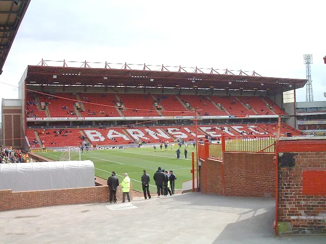
Oakwell is a landmark. Location: Stainborough, Barnsley.
Oakwell is a multi-purpose sports ground in Barnsley, South Yorkshire, England used by Barnsley Football Club for home fixtures, and those of their reserves. From 2023, the Barnsley F.C. Women's team also played at the stadium until the club withdrew them from the 2025/26 season.
Source: Wikipedia · CC BY-SA 4.0
Photos of Oakwell
-

Elsecar Heritage Centre Nigel Homer · CC BY-SA 2.0

Climate of Oakwell
Best months for sightseeingBest months for sightseeing: June–August.
This month · November
A cold month
Day 9° · Night 3° · Rain 69 mm
- Hottest month
- July (day 21°)
- Coldest month
- February (night 1°)
- Wettest month
- December (80 mm)
- Driest month
- July (48 mm)
Bars: average monthly low and high temperature. Below: precipitation. Monthly averages for 1970–2000 at about 18 km resolution, adjusted for elevation. Highlighted months are mild and relatively dry. Source: WorldClim 2.1 (CC BY 4.0).
Show values as a table
| Month | Jan | Feb | Mar | Apr | May | Jun | Jul | Aug | Sep | Oct | Nov | Dec |
|---|---|---|---|---|---|---|---|---|---|---|---|---|
| Average high (°C) | 6° | 6° | 9° | 11° | 15° | 18° | 21° | 21° | 17° | 13° | 9° | 7° |
| Average low (°C) | 1° | 1° | 2° | 4° | 6° | 9° | 11° | 11° | 9° | 6° | 3° | 2° |
| Precipitation (mm) | 76 | 55 | 62 | 55 | 51 | 62 | 48 | 60 | 60 | 66 | 69 | 80 |
How to get to Oakwell
The nearest airport is Leeds Bradford Airport (LBA), 37 km to the north as the crow flies. The nearest large city is Wakefield, 15 km to the north.
Airports
- Leeds Bradford Airport (LBA) Leeds, West Yorkshire 37 kmnorth
- Manchester Airport (MAN) Manchester, Greater Manchester 58 kmwest
- Humberside Airport (HUY) Grimsby, Lincolnshire 74 kmeast
Nearby large cities
- Wakefield Population: 109.8K 15 kmnorth
- Rotherham Population: 117.6K 15 kmsoutheast
- Sheffield Population: 556.5K 19 kmsouth
- Doncaster Population: 113.6K 23 kmeast
- Huddersfield Population: 149K 24 kmnorthwest
Straight-line distances; road distances are longer. Airport data: OurAirports.
Day trips from Oakwell
Within 100 km: 569 historic and cultural sites, 888 natural sites, 180 lakes, rivers and coasts.
0–25 km134 places
- Don Island Island 16 kmSE
- Willow Island Island 23 kmNE
- Calder Island Island 13 kmN
- Stennard Island Island 14 kmN
25–60 km595 places
- Whitton Island Island 55 kmE
- The Island Island 54 kmNE
- Howden Dyke Island Island 44 kmNE
- Beal Island Island 26 kmNE
60–100 km908 places
- Great Britain Island 61 kmNW
- Fraisethorpe Beach Beach 99 kmNE
- The Island Island 77 kmN
- Sunk Island Island 93 kmE
Straight-line distances.
Nearby attractions & nature
Everything nearby-
Monk Bretton Mountain, Barnsley1.6 km N
-
Ardsley Mediumwave Transmitter Landmark, Brierley3.6 km E
-
Darfield New Hall Landmark, Barnsley4.2 km E
-
Stainborough Lowe Historic site, Stainborough5 km SW
-
Elsecar Heritage Centre Museum, Barnsley7.2 km SE
-
Lees Hill Mountain, Barnsley3.4 km E
-
Dodworth Hill Mountain, Barnsley4 km W
-
Stainborough Castle Mountain, Stainborough5.1 km SW
Nearest towns and villages
-
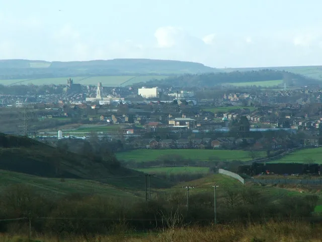 Barnsley City, Barnsley1.1 km W
-
Cudworth Town, Barnsley4 km NE
-
Hoyle Mill Neighbourhood, Barnsley0.6 km E
-
Dodworth Town, Barnsley4.1 km W
Sources & licences
Data last updated: · 2 independent sources