Twerton
Located in Englishcombe, Bath and North East Somerset Coordinates: 51°22′45″ N 2°23′35″ W

- Population
- 5,905
- 5.9K
- Elevation
- 27 m
- above sea level
- Local time
- UTC+00:00
- Europe/London · UTC+00:00
- Airports
- BRS Bristol Airport23 km
- CWL Cardiff International Airport66 km
About Twerton
Twerton is a neighbourhood. Location: Englishcombe, Bath and North East Somerset. Population: 5,905.
Twerton is a suburb of the city of Bath, in the Bath and North East Somerset district, in the ceremonial county of Somerset, England, situated to the west of the city, and home to the city's football club, Bath City. Twerton is served by several bus routes. The service 5 is operated by First West of England, linking Twerton to Bath's centre, running every 12 mins. For a time, there was a duplicate Wessex Connect service, operating under the name Royal Bath. This was discontinued in the summer of 2013.
Source: Wikipedia · CC BY-SA 4.0
Photos of Twerton
-

Lewis Clarke · CC BY-SA 2.0 -

Lewis Clarke · CC BY-SA 2.0 -

Bill Boaden · CC BY-SA 2.0 -

Bill Boaden · CC BY-SA 2.0 -

Michael Dibb · CC BY-SA 2.0


Climate of Twerton
Best months for sightseeingBest months for sightseeing: June–August.
This month · November
A cold month
Day 11° · Night 5° · Rain 81 mm
- Hottest month
- July (day 22°)
- Coldest month
- February (night 2°)
- Wettest month
- December (89 mm)
- Driest month
- July (50 mm)
Bars: average monthly low and high temperature. Below: precipitation. Monthly averages for 1970–2000 at about 18 km resolution, adjusted for elevation. Highlighted months are mild and relatively dry. Source: WorldClim 2.1 (CC BY 4.0).
Show values as a table
| Month | Jan | Feb | Mar | Apr | May | Jun | Jul | Aug | Sep | Oct | Nov | Dec |
|---|---|---|---|---|---|---|---|---|---|---|---|---|
| Average high (°C) | 8° | 8° | 10° | 13° | 16° | 19° | 22° | 21° | 18° | 14° | 11° | 9° |
| Average low (°C) | 2° | 2° | 3° | 4° | 7° | 10° | 13° | 12° | 10° | 8° | 5° | 3° |
| Precipitation (mm) | 87 | 60 | 68 | 54 | 59 | 64 | 50 | 67 | 77 | 79 | 81 | 89 |
How to get to Twerton
The nearest airport is Bristol Airport (BRS), 23 km to the west as the crow flies. The nearest large city is Bath, 2 km to the east.
Airports
- Bristol Airport (BRS) Bristol 23 kmwest
- Cardiff International Airport (CWL) Cardiff 66 kmwest
- Bournemouth Airport (BOH) Bournemouth 77 kmsoutheast
Nearby large cities
- Bath Population: 101.6K 2 kmeast
- Bristol Population: 479K 16 kmnorthwest
- Swindon Population: 201.7K 47 kmnortheast
- Newport Population: 161.5K 48 kmnorthwest
- Gloucester Population: 132.4K 55 kmnorth
Straight-line distances; road distances are longer. Airport data: OurAirports.
Day trips from Twerton
Within 100 km: 712 historic and cultural sites, 1,263 natural sites, 159 lakes, rivers and coasts.
0–25 km112 places
- Denny Island Island 16 kmW
- Chew Valley Lake Lake 16 kmW
- Barrow Gurney Reservoir 1 Lake 19 kmW
- Barrow Gurney Tank 2 Lake 19 kmW
25–60 km662 places
- Steep Holm Island 50 kmW
- Flat Holm Island 51 kmW
- Sully Island Island 56 kmW
- Alney Island Island 55 kmN
60–100 km1,360 places
- Brownsea Island Island 82 kmS
- Avon Beach Beach 86 kmSE
- Chesil Beach Beach 84 kmS
- Calshot Beach Beach 99 kmSE
Straight-line distances.
Nearby attractions & nature
Everything nearby-
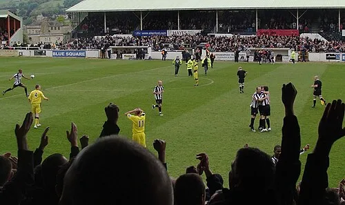 Twerton Park Landmark, Englishcombe0.1 km W
-
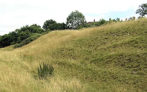 Culverhay Castle Historic site, Englishcombe1.7 km SW
-
Brickfields Park Natural site, Bath and North East Somerset0.5 km E
-
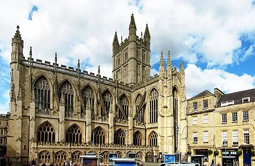 Bath Abbey Attraction, Bath and North East Somerset2.4 km E
-
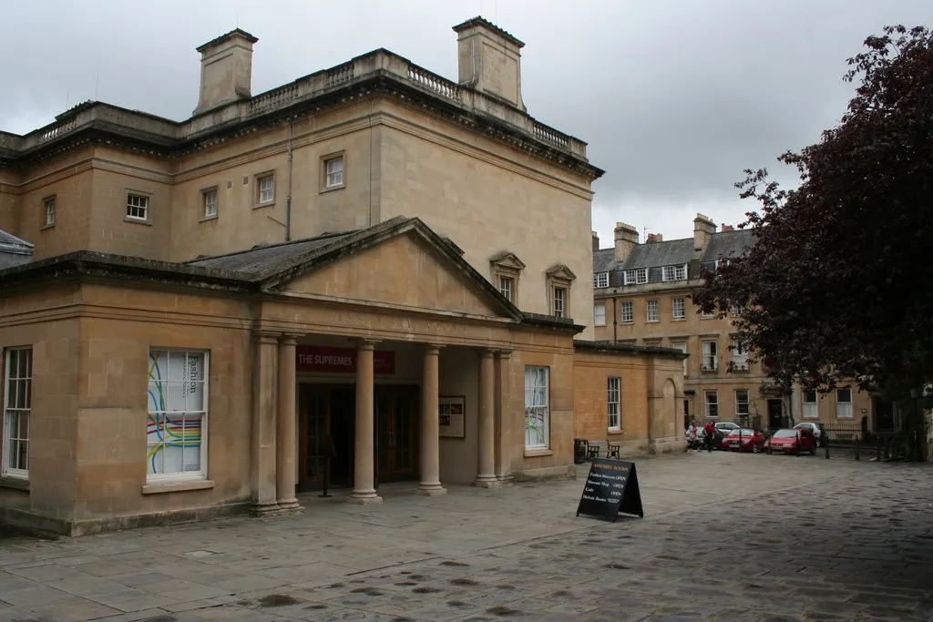 Fashion Museum Museum, Bath and North East Somerset2.3 km E
-
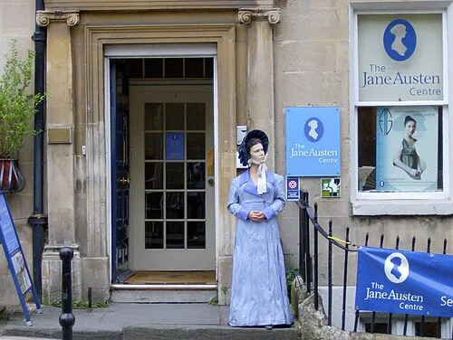 Jane Austen Centre Museum, Bath and North East Somerset2.2 km E
Sources & licences
Data last updated: · 2 independent sources