- Elevation
- 106 m
- above sea level
- Local time
- UTC+00:00
- Europe/London · UTC+00:00
- Airports
- BHX Birmingham Airport10 km
- EMA East Midlands Airport47 km
About Wylde Green
Wylde Green is a village. Location: Birmingham, England. Elevation: 106 m.
Wylde Green is a residential area within the town of Sutton Coldfield in Birmingham, England in the West Midlands. It was historically part of Warwickshire. The area is in the Sutton Vesey ward.
Read more on Wikipedia Text: Wikipedia contributors · CC BY-SA 4.0 · shortened
In comparison
- Nearest larger town: Castle Vale, 2 km SE
- 19 sights and natural places within 10 km River Cole, Castle Bromwich Castle Hill
Climate of Wylde Green
Best months for sightseeingBest months for sightseeing: June–August.
Bars: average monthly low and high temperature. Below: precipitation. Monthly averages for 1970–2000 at about 18 km resolution, adjusted for elevation. Highlighted months are mild and relatively dry. Source: WorldClim 2.1 (CC BY 4.0).
Show values as a table
| Month | Jan | Feb | Mar | Apr | May | Jun | Jul | Aug | Sep | Oct | Nov | Dec |
|---|---|---|---|---|---|---|---|---|---|---|---|---|
| Average high (°C) | 7° | 7° | 9° | 12° | 16° | 18° | 21° | 21° | 17° | 13° | 10° | 7° |
| Average low (°C) | 1° | 1° | 2° | 3° | 6° | 9° | 11° | 11° | 9° | 6° | 3° | 2° |
| Precipitation (mm) | 66 | 48 | 51 | 48 | 52 | 62 | 50 | 64 | 60 | 61 | 66 | 68 |
Airports nearest to Wylde Green
- Birmingham Airport (BHX) Birmingham, West Midlands 10 km
- East Midlands Airport (EMA) Nottingham, Leicestershire 47 km
- Manchester Airport (MAN) Manchester, Greater Manchester 96 km
Straight-line distance; airports with scheduled flights only. Source: OurAirports (public domain).
Nearby attractions & nature
Everything nearby-
River Cole River, England1.9 km S
-
River Rea River, England3.7 km S
-
Castle Bromwich Castle Hill Historic site, Castle Bromwich3.2 km SE
-
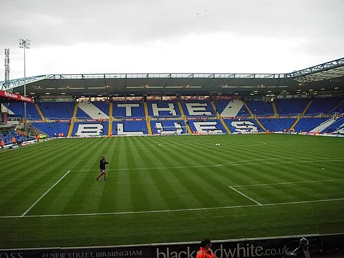 St Andrew's Landmark, Birmingham7.3 km SW
-
Villa Park Landmark, Birmingham5.5 km SW
-
Barr Beacon Mountain, Walsall7.8 km NW
Sources & licences
Data last updated: · 2 independent sources