- Elevation
- 110 m
- above sea level
- Local time
- UTC+00:00
- Europe/London · UTC+00:00
- Airports
- MAN Manchester Airport28 km
- LPL Liverpool John Lennon Airport48 km
About Free Town
Free Town is a neighbourhood. Location: Borough of Bury, England. The best months to visit are June–August. The nearest airport is Manchester Airport (28 km). Nearby sights include Gigg Lane and Birtle Hill.
Photos of Free Town
-
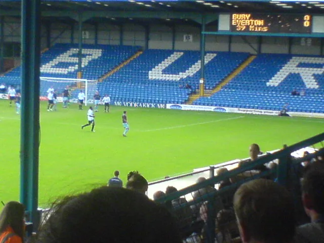
Gigg Lane Kb194buryfc at English Wikipedia · CC BY-SA 3.0 -
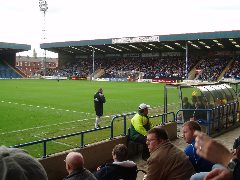
Spotland Stadium Boothman at English Wikipedia · CC BY-SA 3.0


Climate of Free Town
Best months for sightseeingBest months for sightseeing: June–August.
This month · November
A wet month
Day 9° · Night 4° · Rain 114 mm
- Hottest month
- July (day 20°)
- Coldest month
- January (night 1°)
- Wettest month
- November (114 mm)
- Driest month
- May (62 mm)
Bars: average monthly low and high temperature. Below: precipitation. Monthly averages for 1970–2000 at about 18 km resolution, adjusted for elevation. Highlighted months are mild and relatively dry. Source: WorldClim 2.1 (CC BY 4.0).
Show values as a table
| Month | Jan | Feb | Mar | Apr | May | Jun | Jul | Aug | Sep | Oct | Nov | Dec |
|---|---|---|---|---|---|---|---|---|---|---|---|---|
| Average high (°C) | 6° | 7° | 9° | 12° | 15° | 18° | 20° | 20° | 17° | 13° | 9° | 7° |
| Average low (°C) | 1° | 2° | 3° | 4° | 7° | 10° | 12° | 12° | 10° | 7° | 4° | 2° |
| Precipitation (mm) | 104 | 71 | 85 | 65 | 62 | 76 | 72 | 90 | 91 | 112 | 114 | 112 |
How to get to Free Town
The nearest airport is Manchester Airport (MAN), 28 km to the south as the crow flies. The nearest large city is Bolton, 10 km to the west.
Airports
- Manchester Airport (MAN) Manchester, Greater Manchester 28 kmsouth
- Liverpool John Lennon Airport (LPL) Liverpool 48 kmsouthwest
- Leeds Bradford Airport (LBA) Leeds, West Yorkshire 50 kmnortheast
Nearby large cities
- Bolton Population: 141.3K 10 kmwest
- Oldham Population: 237.1K 13 kmsoutheast
- Salford Population: 129.8K 13 kmsouth
- Manchester Population: 569K 14 kmsouth
- Blackburn Population: 146.5K 21 kmnorthwest
Straight-line distances; road distances are longer. Airport data: OurAirports.
Day trips from Free Town
Within 100 km: 675 historic and cultural sites, 1,308 natural sites, 232 lakes, rivers and coasts.
0–25 km162 places
- Saint George's Island Island 14 kmS
- The Island Island 15 kmW
- Pickup Bank Reservoir Lake 14 kmNW
- Hollingworth Lake Lake 12 kmE
25–60 km685 places
- Great Britain Island 48 kmN
- Formby Beach Beach 54 kmW
- Ainsdale Beach Beach 52 kmW
- St Anne's Beach Beach 53 kmW
60–100 km1,368 places
- High Moor Mountain 89 kmNW
- Thurstaston Beach Beach 64 kmSW
- Roanhead Beach Beach 90 kmNW
- The Island Island 82 kmNE
Straight-line distances.
Nearby attractions & nature
Everything nearby-
Gigg Lane Landmark, Borough of Bury2.5 km SW
-
Birtle Hill Mountain, Rossendale District2.3 km NE
-
School Landmark, Borough of Bury3.9 km W
-
Radcliffe Tower Landmark, Borough of Bury4.6 km SW
-
Spotland Stadium Landmark, Rochdale6.9 km E
-
River Roch River, England4 km S
Other cities and towns in Borough of Bury
-
Fishpool Neighbourhood, Borough of Bury2.2 km SW
-
 Walmersley Village, Borough of Bury2.3 km NW
-
Pimhole Neighbourhood, Borough of Bury1.1 km S
-
Woodgate Hill Neighbourhood, Borough of Bury1.1 km E
-
Seedfield Neighbourhood, Borough of Bury1.2 km NW
-
Limefield Neighbourhood, Borough of Bury1.5 km NW
Sources & licences
Data last updated: