South Cambridgeshire District
Located in Cambridgeshire, England Coordinates: 52°10′45″ N 0°05′41″ E
- Population
- 156,468
- 156.5K
- Elevation
- 21 m
- above sea level
- Local time
- UTC+00:00
- Europe/London · UTC+00:00
- Places inside
- 103
- listed under South Cambridgeshire District
- Airports
- STN London Stansted Airport34 km
- LTN London Luton Airport46 km
About South Cambridgeshire District
South Cambridgeshire District is a municipality. Location: Cambridgeshire, England. Population: 156,468. Elevation: 21 m. The best months to visit are June–August. The nearest airport is London Stansted Airport (34 km). Nearby sights include Grantchester Road and Cambridge Castle.
Photos of South Cambridgeshire District
-
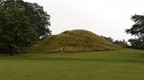
Cambridge Castle Myself · CC BY 3.0 -
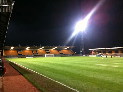
Abbey Stadium CU4ever · CC BY-SA 3.0


Climate of South Cambridgeshire District
Best months for sightseeingBest months for sightseeing: June–August.
This month · November
A cold month
Day 10° · Night 4° · Rain 52 mm
- Hottest month
- July (day 22°)
- Coldest month
- February (night 1°)
- Wettest month
- June (52 mm)
- Driest month
- February (33 mm)
Bars: average monthly low and high temperature. Below: precipitation. Monthly averages for 1970–2000 at about 18 km resolution, adjusted for elevation. Highlighted months are mild and relatively dry. Source: WorldClim 2.1 (CC BY 4.0).
Show values as a table
| Month | Jan | Feb | Mar | Apr | May | Jun | Jul | Aug | Sep | Oct | Nov | Dec |
|---|---|---|---|---|---|---|---|---|---|---|---|---|
| Average high (°C) | 7° | 7° | 10° | 13° | 17° | 20° | 22° | 22° | 19° | 15° | 10° | 8° |
| Average low (°C) | 1° | 1° | 3° | 4° | 7° | 10° | 12° | 12° | 10° | 7° | 4° | 2° |
| Precipitation (mm) | 46 | 33 | 42 | 43 | 43 | 52 | 41 | 49 | 51 | 51 | 52 | 48 |
How to get to South Cambridgeshire District
The nearest airport is London Stansted Airport (STN), 34 km to the south as the crow flies. The nearest large city is Cambridge, 3 km to the northeast.
Airports
- London Stansted Airport (STN) London, Essex 34 kmsouth
- London Luton Airport (LTN) Luton, Luton 46 kmsouthwest
- London City Airport (LCY) London 75 kmsouth
Nearby large cities
- Cambridge Population: 145.7K 3 kmnortheast
- Bedford Population: 106.9K 39 kmwest
- Luton Population: 225.3K 48 kmsouthwest
- Peterborough Population: 163.4K 50 kmnorthwest
- Chelmsford Population: 111.5K 56 kmsoutheast
Straight-line distances; road distances are longer. Airport data: OurAirports.
Day trips from South Cambridgeshire District
Within 100 km: 823 historic and cultural sites, 350 natural sites, 284 lakes, rivers and coasts.
0–25 km60 places
- Duck Island Island 20 kmSE
- The Island Island 24 kmNW
- The Island Island 24 kmE
- Battcock's Island Island 22 kmNW
25–60 km335 places
- Park Island Island 58 kmNW
- Heron Island Island 47 kmW
- Apple Island Island 42 kmW
- Dog Island Island 56 kmNE
60–100 km1,062 places
- White Hart Lane Landmark 65 kmS
- Spotlites @ Kings Theatre Attraction 94 kmS
- Snettisham Beach Beach 80 kmN
- West Mersea Beach Beach 73 kmSE
Straight-line distances.
South Cambridgeshire District and similar cities
Side by side with cities of similar size in the same country: population, elevation and climate.
| Measure | South Cambridgeshire District | York | Enfield | Telford |
|---|---|---|---|---|
| Population | 156.5K | 156.1K | 156.9K | 155.6K |
| Elevation | 21 m | 17 m | 33 m | 163 m |
| Summer day (hottest month) | 22° | 21° | 23° | 20° |
| Winter night (coldest month) | 1° | 1° | 2° | 0° |
| Annual rainfall | 551 mm | 595 mm | 624 mm | 716 mm |
| Best months | Jun–Aug | Jun–Aug | Jun–Aug | Jun–Aug |
| Distance | — | 213 km | 60 km | 182 km |
Climate values are 1970–2000 monthly averages; straight-line distance.
Places in South Cambridgeshire District
103 placesCities & villages60
- Abington Pigotts · Village
- Arrington · Village
- Babraham · Village
- Balsham · Village
- Bar Hill · Village
- Barrington · Village
- Bartlow · Village
- Barton · Village
- Bassingbourn cum Kneesworth · Village
- Bourn · Village
- Boxworth · Village
- Burrough Green · Village
- Caldecote · Village
- Cambourne · Village
- Carlton · Village
- Castle Camps · Village
- Caxton · Village
- Childerley · Village
- Comberton · Village
- Conington · Village
- Coton · Village
- Cottenham · Village
- Croxton · Village
- Croydon · Village
- Dry Drayton · Village
- Duxford · Village
- Elsworth · Village
- Eltisley · Village
- Fen Ditton · Village
- Fen Drayton · Village
- Fowlmere · Village
- Foxton · Village
- Fulbourn · Village
- Gamlingay · Village
- Girton · Village
- Grantchester · Village
- Graveley · Village
- Great Abington · Village
- Great and Little Chishill · Village
- Great Eversden · Village
- Great Shelford · Village
- Great Wilbraham · Village
- Guilden Morden · Village
- Hardwick · Village
- Harlton · Village
- Harston · Village
- Haslingfield · Village
- Hatley · Village
- Hauxton · Village
- Heydon · Village
- Hildersham · Village
- Hinxton · Village
- Histon · Village
- Horningsea · Village
- Horseheath · Village
- Ickleton · Village
- Impington · Village
- Kingston · Village
- Knapwell · Village
- Landbeach · Village
Nearby attractions & nature
Everything nearby-
Grantchester Road Landmark, Cambridge District1.7 km N
-
Cambridge Castle Historic site, Cambridge District3.9 km N
-
Cambridge University Botanic Garden Attraction, Cambridge District2.7 km NE
-
The Fitzwilliam Museum Museum, Cambridge District2.9 km NE
-
River Cam River, Cambridge District2.7 km NE
-
Museum of Archaeology and Anthropology Museum, Cambridge District3.2 km NE
-
Abbey Stadium Landmark, Cambridge District5.5 km NE
-
Chesterton Tower Landmark, Cambridge District5.2 km NE
Sources & licences
Data last updated: