Leighton Buzzard
Located in Leighton-Linslade, Central Bedfordshire Coordinates: 51°55′02″ N 0°39′29″ W
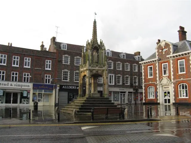
- Population
- 42,727
- 42.7K
- Elevation
- 97 m
- above sea level
- Local time
- UTC+00:00
- Europe/London · UTC+00:00
- Airports
- LTN London Luton Airport20 km
- LHR London Heathrow Airport52 km
About Leighton Buzzard
Leighton Buzzard is a town. Location: Leighton-Linslade, Central Bedfordshire. Population: 42,727. Elevation: 97 m.
Leighton Buzzard ( LAY-tən BUZ-ərd) is a market town in the civil parish of Leighton–Linslade, in the Central Bedfordshire district, in Bedfordshire, England, in the southwest of the county and close to the Buckinghamshire border. It lies between Aylesbury, Tring, Luton/Dunstable and Milton Keynes, near the Chiltern Hills. It is 36 miles (58 km) northwest of Central London and linked to the capital by the Grand Union Canal and the West Coast Main Line.
Source: Wikipedia · CC BY-SA 4.0
Photos of Leighton Buzzard
-

Neil Carmichael · CC BY-SA 4.0 -

Neil Carmichael · CC BY-SA 4.0 -

Matt Brown · CC BY 2.0 -

Simon Burchell · CC BY-SA 4.0 -

Barry Lewis · CC BY 2.0


Travel notes for Leighton Buzzard
From Wikivoyage
Leighton Buzzard is a town in Bedfordshire, England.
Understand+
Leighton Buzzard is probably best known for the Grand Union Canal and the Great Train Robbery (1963) which took place just outside the town. Nowadays, it is considered a commuter town with good transport links to London and Milton Keynes.
Get in+
By road:
The town lies 5 miles from the A5 main London to Holyhead main road.
The town is bypassed by the A4146 Milton Keynes to Hemel Hempstead main road.
The A418 connects the town to Aylesbury
By train:
1 Railway Station, Station Approach, Leighton Buzzard LU7 2LY. On the West Coast Main Line, trains run into London Euston station and Bletchley & Milton Keynes. Station managed and services operated by London Northwestern Railway. (updated May 2017)
By bus:
Arriva service 150 and RedRose 100 runs between the town and Aylesbury and services F70 & F77 connects to Luton, whilst routes 150 & F70 run to Milton Keynes.
By air:
Luton Airport is 18 mi (29 km) east of the town.
By bicycle:
Leighton Buzzard is on National Cycle Route 6 from London to the Lake District.
Source: Wikivoyage · CC BY-SA 4.0 · abridged
Places bordering Leighton Buzzard
- Bletchley
Climate of Leighton Buzzard
Best months for sightseeingBest months for sightseeing: June–August.
This month · November
A cold month
Day 10° · Night 4° · Rain 64 mm
- Hottest month
- July (day 22°)
- Coldest month
- February (night 1°)
- Wettest month
- October (65 mm)
- Driest month
- February (45 mm)
Bars: average monthly low and high temperature. Below: precipitation. Monthly averages for 1970–2000 at about 18 km resolution, adjusted for elevation. Highlighted months are mild and relatively dry. Source: WorldClim 2.1 (CC BY 4.0).
Show values as a table
| Month | Jan | Feb | Mar | Apr | May | Jun | Jul | Aug | Sep | Oct | Nov | Dec |
|---|---|---|---|---|---|---|---|---|---|---|---|---|
| Average high (°C) | 7° | 7° | 10° | 12° | 16° | 19° | 22° | 22° | 18° | 14° | 10° | 8° |
| Average low (°C) | 2° | 1° | 3° | 4° | 7° | 10° | 12° | 12° | 10° | 7° | 4° | 2° |
| Precipitation (mm) | 62 | 45 | 54 | 51 | 53 | 59 | 46 | 55 | 60 | 65 | 64 | 65 |
How to get to Leighton Buzzard
The nearest airport is London Luton Airport (LTN), 20 km to the east as the crow flies. The nearest large city is Milton Keynes, 15 km to the northwest.
Airports
- London Luton Airport (LTN) Luton, Luton 20 kmeast
- London Heathrow Airport (LHR) London 52 kmsouth
- London Stansted Airport (STN) London, Essex 62 kmeast
Nearby large cities
- Milton Keynes Population: 256.4K 15 kmnorthwest
- Luton Population: 225.3K 17 kmeast
- Bedford Population: 106.9K 28 kmnortheast
- High Wycombe Population: 133.2K 33 kmsouth
- Watford Population: 125.7K 34 kmsoutheast
Straight-line distances; road distances are longer. Airport data: OurAirports.
Day trips from Leighton Buzzard
Within 100 km: 898 historic and cultural sites, 557 natural sites, 266 lakes, rivers and coasts.
0–25 km159 places
- Bird Island Island 18 kmNE
- Tongwell Lake Lake 18 kmN
- Reservoir Lake 14 kmE
- Stewartby Lake Lake 19 kmNE
25–60 km682 places
- White Hart Lane Landmark 54 kmSE
- The Lynch Island 50 kmS
- Holm Island Island 54 kmS
- Sunbury Court Island 59 kmS
60–100 km880 places
- Northey Island Island 97 kmE
- Canvey Island Island 96 kmSE
- Two Tree Island Island 99 kmSE
- Ravens Ait Island 62 kmSE
Straight-line distances.
Nearby attractions & nature
Everything nearby-
Billington Hill Mountain, Great Billington3.2 km SE
-
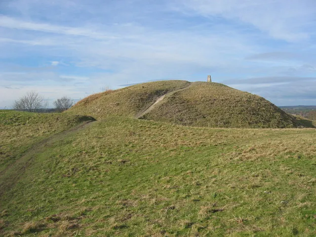 Totternhoe Castle Historic site, Totternhoe6.3 km SE
-
Warren Knoll Historic site, Tilsworth5.2 km E
-
Wing Historic site, Wing4.9 km SW
-
Methodist Chapel Attraction, Stoke Hammond6.2 km NW
-
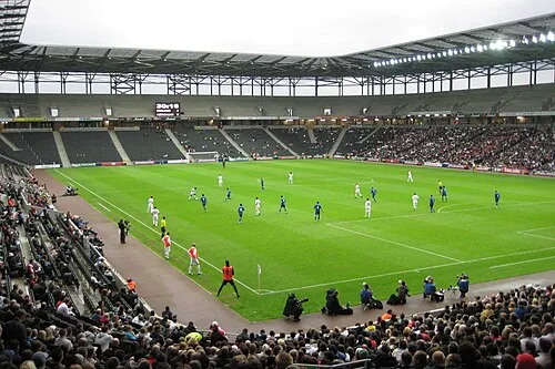 Stadium MK Landmark, Bletchley and Fenny Stratford12 km NW
-
St. Lukes (Church of England) Attraction, Stoke Hammond6.4 km NW
-
Sir Joseph Paxton, Blue Plaque Landmark, Milton Bryan7.2 km NE
Sources & licences
Data last updated: · 2 independent sources