- Elevation
- 353 m
- above sea level
- Local time
- UTC+00:00
- Europe/London · UTC+00:00
- Airports
- EXT Exeter International Airport52 km
- NQY Cornwall Airport Newquay65 km
About Gibbet Hill
Gibbet Hill is a mountain. Location: Mary Tavy, West Devon District. Elevation: 353 m. The best months to visit are June–August. The nearest airport is Exeter International Airport (52 km). Nearby sights include Wastor Hill and Brent Tor.
Climate of Gibbet Hill
Best months for sightseeingBest months for sightseeing: June–August.
This month · November
A wet month
Day 10° · Night 4° · Rain 141 mm
- Hottest month
- July (day 18°)
- Coldest month
- February (night 1°)
- Wettest month
- December (152 mm)
- Driest month
- July (70 mm)
Bars: average monthly low and high temperature. Below: precipitation. Monthly averages for 1970–2000 at about 18 km resolution, adjusted for elevation. Highlighted months are mild and relatively dry. Source: WorldClim 2.1 (CC BY 4.0).
Show values as a table
| Month | Jan | Feb | Mar | Apr | May | Jun | Jul | Aug | Sep | Oct | Nov | Dec |
|---|---|---|---|---|---|---|---|---|---|---|---|---|
| Average high (°C) | 7° | 7° | 9° | 11° | 14° | 16° | 18° | 18° | 16° | 13° | 10° | 8° |
| Average low (°C) | 2° | 1° | 2° | 3° | 6° | 9° | 11° | 11° | 9° | 7° | 4° | 3° |
| Precipitation (mm) | 146 | 110 | 102 | 80 | 78 | 76 | 70 | 86 | 100 | 128 | 141 | 152 |
How to get to Gibbet Hill
The nearest airport is Exeter International Airport (EXT), 52 km to the east as the crow flies. For international flights: Cardiff International Airport (CWL) (103 km). The nearest large city is Plymouth, 27 km to the south.
Airports
- Exeter International Airport (EXT) Exeter, Devon 52 kmeast
- Cornwall Airport Newquay (NQY) Newquay 65 kmwest
- Cardiff International Airport (CWL) Cardiff 103 kmnortheast
Nearby large cities
- Plymouth Population: 260.2K 27 kmsouth
- Exeter Population: 130.7K 44 kmeast
- Swansea Population: 300.4K 113 kmnorth
- Cardiff Population: 372.1K 117 kmnortheast
- Newport Population: 161.5K 134 kmnortheast
Straight-line distances; road distances are longer. Airport data: OurAirports.
Day trips from Gibbet Hill
Within 100 km: 196 historic and cultural sites, 898 natural sites, 125 lakes, rivers and coasts.
0–25 km140 places
- Wellsfoot Island Island 23 kmSE
- Bellpool Island Island 22 kmSE
- Combestone Island Island 19 kmSE
- Island of Rocks Island 11 kmNE
25–60 km651 places
- Burgh Island Island 40 kmSE
- Goodrington Sands Beach 45 kmSE
- Saunton Sands Beach 55 kmN
- Oddicombe Beach Beach 45 kmE
60–100 km428 places
- Charmouth Beach Beach 87 kmE
- Vault Beach Beach 64 kmSW
- Gylly Beach Beach 85 kmSW
- Swanpool Beach Beach 86 kmSW
Straight-line distances.
Nearest towns and villages
Nearby attractions & nature
Everything nearby-
Wastor Hill Mountain, Brentor2 km NW
-
Brent Tor Mountain, Brentor3.3 km W
-
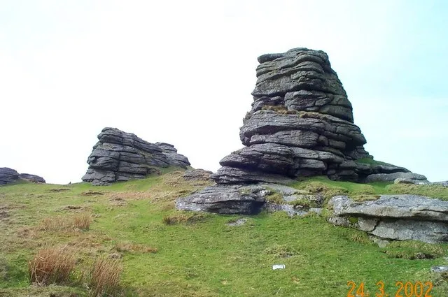 Great Links Tor Mountain, Lydford6.4 km NE
-
White Tor Mountain, Peter Tavy4.7 km SE
-
Burley Down Mountain, Lewtrenchard5.6 km N
-
Cox Tor Mountain, Peter Tavy5.7 km SE
-
Hare Tor Mountain, Peter Tavy5.7 km NE
-
Roos Tor Mountain, Peter Tavy6.1 km SE
Sources & licences
Data last updated: