
- Elevation
- 77 m
- above sea level
- Local time
- UTC+00:00
- Europe/London · UTC+00:00
- Airports
- BOH Bournemouth Airport15 km
- SOU Southampton Airport37 km
About Cripplestyle
Cripplestyle is a village. Location: Alderholt, East Dorset District. Elevation: 77 m.
Cripplestyle is a hamlet in the civil parish of Alderholt in the county of Dorset, England. It lies close to the Dorset-Hampshire border. The nearest town is Verwood, which lies approximately 2 miles (3.2 km) to the south. Prior to 1894 Cripplestyle was in the parish of Cranborne. The Ebenezer Congregational Chapel was opened in Cripplestyle on 11 December 1807. William Bailey became the first pastor in December 1808. He died in August 1838.
Source: Wikipedia · CC BY-SA 4.0
Photos of Cripplestyle
-

Stuart Logan · CC BY-SA 2.0

Climate of Cripplestyle
Best months for sightseeingBest months for sightseeing: June–August.
This month · November
A cold month
Day 11° · Night 4° · Rain 84 mm
- Hottest month
- July (day 21°)
- Coldest month
- February (night 1°)
- Wettest month
- December (94 mm)
- Driest month
- July (41 mm)
Bars: average monthly low and high temperature. Below: precipitation. Monthly averages for 1970–2000 at about 18 km resolution, adjusted for elevation. Highlighted months are mild and relatively dry. Source: WorldClim 2.1 (CC BY 4.0).
Show values as a table
| Month | Jan | Feb | Mar | Apr | May | Jun | Jul | Aug | Sep | Oct | Nov | Dec |
|---|---|---|---|---|---|---|---|---|---|---|---|---|
| Average high (°C) | 8° | 8° | 10° | 12° | 16° | 19° | 21° | 21° | 18° | 15° | 11° | 9° |
| Average low (°C) | 2° | 1° | 3° | 4° | 7° | 10° | 12° | 11° | 9° | 7° | 4° | 3° |
| Precipitation (mm) | 88 | 62 | 64 | 50 | 49 | 55 | 41 | 55 | 70 | 80 | 84 | 94 |
How to get to Cripplestyle
The nearest airport is Bournemouth Airport (BOH), 15 km to the south as the crow flies. For international flights: Bristol Airport (BRS) (79 km). The nearest large city is Bournemouth, 21 km to the south.
Airports
- Bournemouth Airport (BOH) Bournemouth 15 kmsouth
- Southampton Airport (SOU) Southampton 37 kmeast
- Bristol Airport (BRS) Bristol 79 kmnorthwest
Nearby large cities
- Bournemouth Population: 163.6K 21 kmsouth
- Poole Population: 151.5K 23 kmsouth
- Southampton Population: 269.8K 33 kmeast
- Portsmouth Population: 208.1K 57 kmeast
- Bath Population: 101.6K 62 kmnorthwest
Straight-line distances; road distances are longer. Airport data: OurAirports.
Day trips from Cripplestyle
Within 100 km: 343 historic and cultural sites, 726 natural sites, 153 lakes, rivers and coasts.
0–25 km94 places
- Avon Beach Beach 22 kmSE
- Harnham Water Meadows Island 18 kmN
- Otter Island Island 24 kmSW
- Ham Island Island 15 kmNE
25–60 km458 places
- Portsea Island Natural site 58 kmE
- Isle of Wight Island 49 kmSE
- Brownsea Island Island 25 kmS
- Chesil Beach Beach 58 kmSW
60–100 km670 places
- Charmouth Beach Beach 75 kmW
- Kilve Beach Beach 100 kmW
- Climping Beach Beach 92 kmE
- Pagham Beach Beach 82 kmE
Straight-line distances.
Nearby attractions & nature
Everything nearby-
Pistle Down Mountain, Alderholt1.6 km SE
-
Cranborne Castle Hill Historic site, Cranborne3 km W
-
Pentridge Hill - Penbury Knoll Mountain, Pentridge6.8 km NW
-
Damerham Knoll Mountain, Damerham6.4 km N
-
Godshill Castle Hill Historic site, Woodgreen8.6 km NE
-
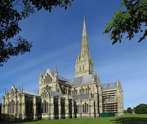 Salisbury Cathedral Attraction, Salisbury18 km N
Sources & licences
Data last updated: · 2 independent sources