Sherborne Abbey
Located in Sherborne, West Dorset District Coordinates: 50°56′48″ N 2°31′00″ W
- Local time
- UTC+00:00
- Europe/London · UTC+00:00
- Elevation
- 63 m
- above sea level
- Airports
- BRS Bristol Airport50 km
- BOH Bournemouth Airport51 km
About Sherborne Abbey
Sherborne Abbey is a tourist attraction. Location: Sherborne, West Dorset District.
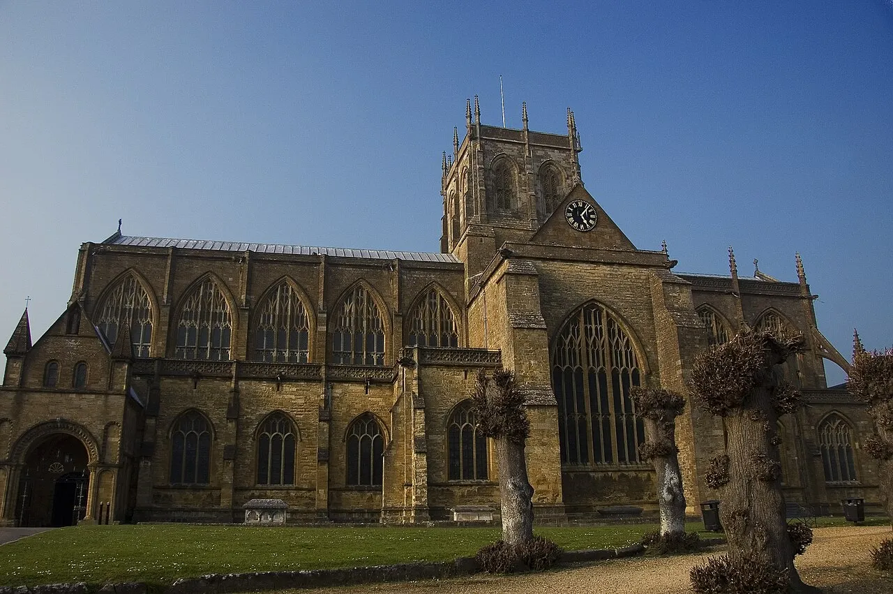
Sherborne Abbey, otherwise the Abbey Church of St. Mary the Virgin, is a Church of England church in Sherborne in the English county of Dorset. It was formerly a Saxon Catholic cathedral (705–1075) and a Benedictine abbey church (998–1539), before becoming a Church of England parish church in 1539 during the dissolution of the monasteries. In England's Thousand Best Churches (1999) by Simon Jenkins, it is one of only 18 churches given a five-star rating.
Source: Wikipedia · CC BY-SA 4.0
At a glance
- Built
- 10th century
- Heritage designation
- Grade I listed building, scheduled monument
- Official website
- sherborneabbey.com
Source: Wikidata
Photos of Sherborne Abbey
-

Tilman2007 · CC BY-SA 4.0 -

Colin Smith · CC BY-SA 2.0 -
Sherborne Old Castle Pengannel · CC BY 2.0


Climate of Sherborne Abbey
Best months for sightseeingBest months for sightseeing: June–August.
This month · November
A cold month
Day 11° · Night 5° · Rain 75 mm
- Hottest month
- July (day 21°)
- Coldest month
- February (night 2°)
- Wettest month
- December (90 mm)
- Driest month
- July (52 mm)
Bars: average monthly low and high temperature. Below: precipitation. Monthly averages for 1970–2000 at about 18 km resolution, adjusted for elevation. Highlighted months are mild and relatively dry. Source: WorldClim 2.1 (CC BY 4.0).
Show values as a table
| Month | Jan | Feb | Mar | Apr | May | Jun | Jul | Aug | Sep | Oct | Nov | Dec |
|---|---|---|---|---|---|---|---|---|---|---|---|---|
| Average high (°C) | 8° | 8° | 10° | 12° | 16° | 19° | 21° | 21° | 18° | 15° | 11° | 9° |
| Average low (°C) | 2° | 2° | 3° | 4° | 7° | 10° | 12° | 12° | 10° | 7° | 5° | 3° |
| Precipitation (mm) | 87 | 66 | 63 | 53 | 54 | 57 | 52 | 59 | 67 | 75 | 75 | 90 |
How to get to Sherborne Abbey
The nearest airport is Bristol Airport (BRS), 50 km to the north as the crow flies. The nearest large city is Poole, 46 km to the southeast.
Airports
- Bristol Airport (BRS) Bristol 50 kmnorth
- Bournemouth Airport (BOH) Bournemouth 51 kmeast
- Exeter International Airport (EXT) Exeter, Devon 67 kmwest
Nearby large cities
- Poole Population: 151.5K 46 kmsoutheast
- Bath Population: 101.6K 49 kmnorth
- Bournemouth Population: 163.6K 51 kmsoutheast
- Bristol Population: 479K 57 kmnorth
- Cardiff Population: 372.1K 75 kmnorthwest
Straight-line distances; road distances are longer. Airport data: OurAirports.
Day trips from Sherborne Abbey
Within 100 km: 466 historic and cultural sites, 1,079 natural sites, 128 lakes, rivers and coasts.
0–25 km110 places
- Bathing Island Island 15 kmE
- Fish's Island Island 15 kmE
- Hod Hill Mountain 22 kmE
- Bulbarrow Hill Mountain 18 kmSE
25–60 km518 places
- Brownsea Island Island 48 kmSE
- Chesil Beach Beach 35 kmS
- Studland Beach Beach 51 kmSE
- Man O'War Beach Beach 40 kmSE
60–100 km1,045 places
- Isle of Wight Island 92 kmE
- Avon Beach Beach 60 kmSE
- Goodrington Sands Beach 95 kmSW
- Calshot Beach Beach 86 kmE
Straight-line distances.
Nearby attractions & nature
Everything nearby-
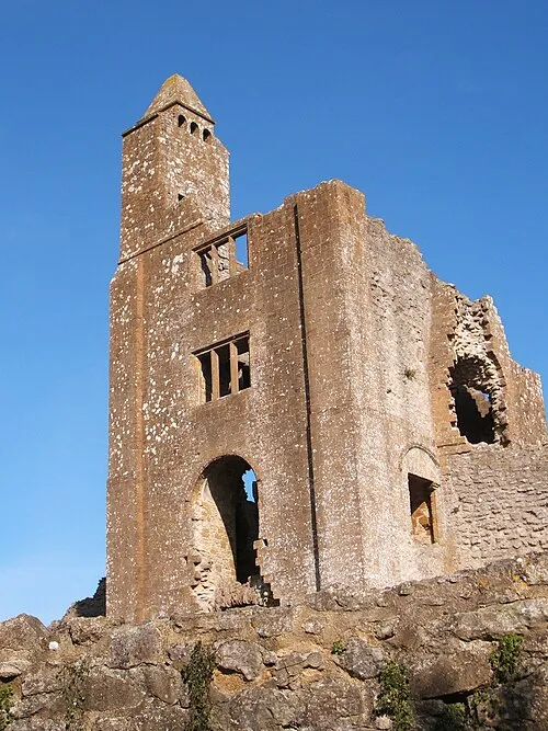
Sherborne Old Castle Historic site, Castleton1.1 km E
-
Honeycombe Tout Mountain, Lillington2.5 km S
-
Round Hill Mountain, Castleton3 km NW
-
Highmore's Hill Mountain, Milborne Port3.3 km NE
-
Muse Hill Mountain, Goathill4.1 km E
-
Babylon Hill Mountain, Nether Compton4.2 km W
-
Holway Hill Mountain, Poyntington4.3 km N
-
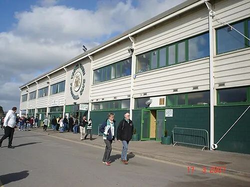 Huish Park Landmark, Brympton11 km W
Nearest towns and villages
-
Sherborne Town, Sherborne0.1 km SW
-
Castleton Village, West Dorset District2.1 km E
-
North Wootton Village, West Dorset District2.4 km SE
-
Long Burton Village, Longburton3.5 km S
Sources & licences
Data last updated: · 2 independent sources