- Elevation
- 541 m
- above sea level
- Local time
- UTC+00:00
- Europe/London · UTC+00:00
- Airports
- NCL Newcastle International Airport37 km
- MME Teesside International Airport53 km
About Bolt's Law
Bolt's Law is a mountain. Location: Hunstanworth, Durham. Elevation: 541 m. The best months to visit are July–August. The nearest airport is Newcastle International Airport (37 km). Nearby sights include Horseshoe Hill and Dry Rigg.
Photos of Bolt's Law
-
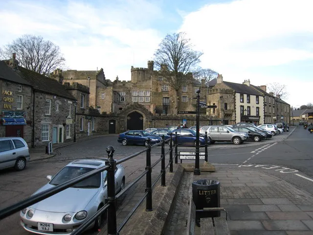
Stanhope Castle Philip Barker · CC BY-SA 2.0

Climate of Bolt's Law
Best months for sightseeingBest months for sightseeing: July–August.
This month · November
A wet month
Day 6° · Night 1° · Rain 132 mm
- Hottest month
- July (day 17°)
- Coldest month
- January (night -2°)
- Wettest month
- January (141 mm)
- Driest month
- June (80 mm)
Bars: average monthly low and high temperature. Below: precipitation. Monthly averages for 1970–2000 at about 18 km resolution, adjusted for elevation. Highlighted months are mild and relatively dry. Source: WorldClim 2.1 (CC BY 4.0).
Show values as a table
| Month | Jan | Feb | Mar | Apr | May | Jun | Jul | Aug | Sep | Oct | Nov | Dec |
|---|---|---|---|---|---|---|---|---|---|---|---|---|
| Average high (°C) | 4° | 4° | 6° | 8° | 12° | 15° | 17° | 17° | 13° | 10° | 6° | 5° |
| Average low (°C) | -2° | -1° | -1° | 1° | 3° | 6° | 8° | 8° | 6° | 4° | 1° | -1° |
| Precipitation (mm) | 141 | 98 | 115 | 82 | 81 | 80 | 88 | 104 | 110 | 127 | 132 | 138 |
How to get to Bolt's Law
The nearest airport is Newcastle International Airport (NCL), 37 km to the northeast as the crow flies. The nearest large city is Newcastle upon Tyne, 36 km to the northeast.
Airports
- Newcastle International Airport (NCL) Newcastle upon Tyne, Tyne and Wear 37 kmnortheast
- Teesside International Airport (MME) Darlington, Durham 53 kmsoutheast
- Leeds Bradford Airport (LBA) Leeds, West Yorkshire 107 kmsouth
Nearby large cities
- Newcastle upon Tyne Population: 300.1K 36 kmnortheast
- Sunderland Population: 170.1K 47 kmeast
- Middlesbrough Population: 142.7K 60 kmsoutheast
- Burnley Population: 149.4K 112 kmsouth
- Bradford Population: 366.2K 114 kmsouth
Straight-line distances; road distances are longer. Airport data: OurAirports.
Day trips from Bolt's Law
Within 100 km: 850 historic and cultural sites, 2,163 natural sites, 403 lakes, rivers and coasts.
0–25 km130 places
- Broomhaugh Island Island 19 kmN
- Grassholme Reservoir Lake 23 kmS
- Selset Reservoir Lake 24 kmS
- Three Pikes Mountain 15 kmSW
25–60 km899 places
- Saint Mary’s Island Island 51 kmNE
- Batt Island Island 56 kmS
- Michell's Island Island 37 kmSE
- Wood Howe Island 57 kmSW
60–100 km2,387 places
- Great Britain Island 89 kmS
- High Moor Mountain 94 kmSW
- Powillimount Beach Beach 96 kmW
- Longhoughton Beach Beach 78 kmNE
Straight-line distances.
Nearest towns and villages
-
Rookhope Village, Stanhope2.2 km S
-
Townfield Village, Hunstanworth3.4 km N
-
Lintzgarth Village, Stanhope2.9 km SW
-
Hunstanworth Village, Hunstanworth4.1 km N
-
Stanhope Village, Stanhope7 km SE
-
Newbiggin Village, Blanchland4.9 km N
Nearby attractions & nature
Everything nearby-
Horseshoe Hill Mountain, Stanhope3.9 km E
-
Dry Rigg Mountain, Hunstanworth4 km W
-
Beldon Burn River River, England4 km N
-
Hope Fell Mountain, Blanchland5.9 km N
-
Hunstanworth Tower Landmark, Hunstanworth4.1 km N
-
Collier Law Mountain, LCPs of Stanhope, Wolsingham and Tow Law7.7 km SE
-
Burtree Fell Mountain, Stanhope8.5 km W
-
Lilswood Moor Mountain, Hexhamshire9.3 km NW
Sources & licences
Data last updated: