- Elevation
- 251 m
- above sea level
- Local time
- UTC+00:00
- Europe/London · UTC+00:00
- Airports
- MME Teesside International Airport32 km
- NCL Newcastle International Airport32 km
About LCPs of Brancepeth and Brandon and Byshottles
LCPs of Brancepeth and Brandon and Byshottles is a municipality. Location: Durham, England. Elevation: 251 m. The best months to visit are June–August. The nearest airport is Teesside International Airport (32 km). Nearby sights include Wooley Hill and Brandon Hill.
Photos of LCPs of Brancepeth and Brandon and Byshottles
-
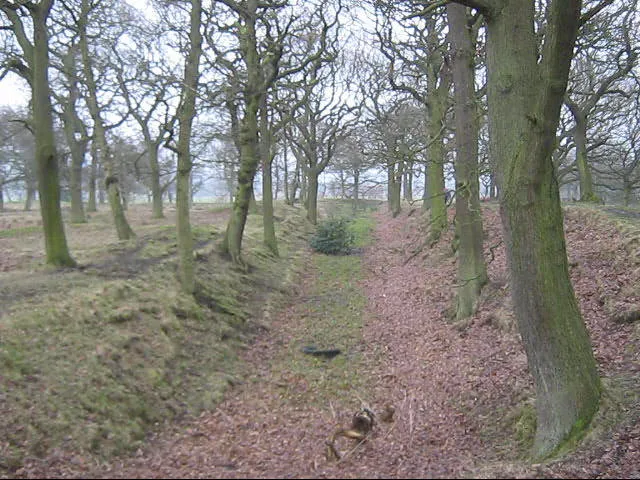
Castle Steads peter robinson · CC BY-SA 2.0 -
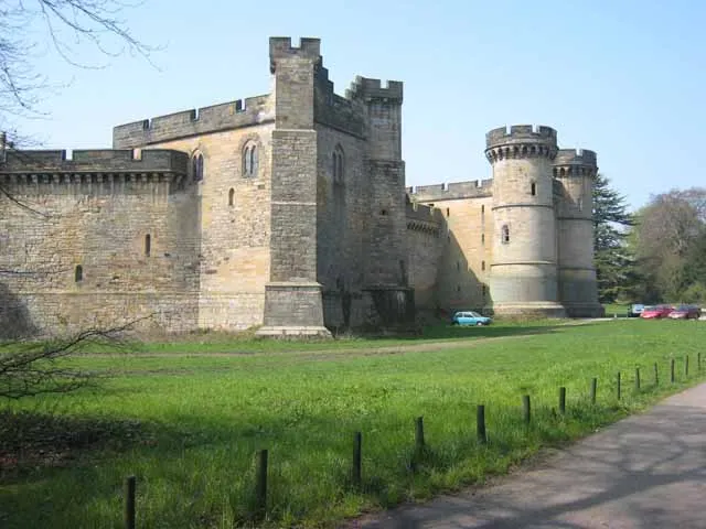
Brancepeth Castle Oliver Dixon · CC BY-SA 2.0


Climate of LCPs of Brancepeth and Brandon and Byshottles
Best months for sightseeingBest months for sightseeing: June–August.
This month · November
A cold month
Day 8° · Night 3° · Rain 70 mm
- Hottest month
- July (day 19°)
- Coldest month
- January (night 0°)
- Wettest month
- December (73 mm)
- Driest month
- February (50 mm)
Bars: average monthly low and high temperature. Below: precipitation. Monthly averages for 1970–2000 at about 18 km resolution, adjusted for elevation. Highlighted months are mild and relatively dry. Source: WorldClim 2.1 (CC BY 4.0).
Show values as a table
| Month | Jan | Feb | Mar | Apr | May | Jun | Jul | Aug | Sep | Oct | Nov | Dec |
|---|---|---|---|---|---|---|---|---|---|---|---|---|
| Average high (°C) | 6° | 6° | 8° | 10° | 13° | 16° | 19° | 18° | 15° | 12° | 8° | 7° |
| Average low (°C) | 0° | 0° | 1° | 2° | 5° | 7° | 10° | 10° | 8° | 5° | 3° | 1° |
| Precipitation (mm) | 72 | 50 | 65 | 54 | 55 | 56 | 56 | 70 | 67 | 68 | 70 | 73 |
How to get to LCPs of Brancepeth and Brandon and Byshottles
The nearest airport is Teesside International Airport (MME), 32 km to the southeast as the crow flies. For international flights: Newcastle International Airport (NCL) (32 km). The nearest large city is Newcastle upon Tyne, 26 km to the north.
Airports
- Teesside International Airport (MME) Darlington, Durham 32 kmsoutheast
- Newcastle International Airport (NCL) Newcastle upon Tyne, Tyne and Wear 32 kmnorth
- Leeds Bradford Airport (LBA) Leeds, West Yorkshire 98 kmsouth
Nearby large cities
- Newcastle upon Tyne Population: 300.1K 26 kmnorth
- Sunderland Population: 170.1K 27 kmnortheast
- Middlesbrough Population: 142.7K 36 kmsoutheast
- York Population: 156.1K 97 kmsoutheast
- Bradford Population: 366.2K 106 kmsouth
Straight-line distances; road distances are longer. Airport data: OurAirports.
Day trips from LCPs of Brancepeth and Brandon and Byshottles
Within 100 km: 783 historic and cultural sites, 1,592 natural sites, 304 lakes, rivers and coasts.
0–25 km89 places
- Michell's Island Island 23 kmS
- Match Island Island 20 kmNE
- Warden Law Mountain 21 kmNE
- Collier Law Mountain 17 kmW
25–60 km621 places
- Seaton Carew Beach Beach 35 kmE
- Redcar Beach Beach 43 kmE
- The Island Island 57 kmS
- Saint Mary’s Island Island 40 kmNE
60–100 km1,969 places
- Great Britain Island 85 kmS
- Longhoughton Beach Beach 77 kmN
- Whitby Beach Beach 74 kmE
- Tuft Rock Island 89 kmSW
Straight-line distances.
Nearby attractions & nature
Everything nearby-
Wooley Hill Mountain, Brandon and Byshottles0.7 km NW
-
Brandon Hill Mountain, Brandon and Byshottles2 km NE
-
Billy Hill Mountain, Durham3.2 km W
-
Brancepeth Castle Historic site, Brancepeth3.9 km E
-
Castle Steads Historic site, Cornsay3.7 km N
-
Cobby Castle Historic site, Durham5.2 km W
-
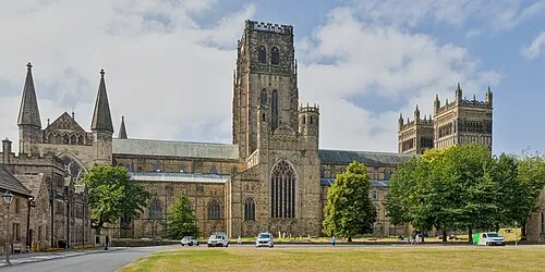 Durham Cathedral Attraction, Durham9.1 km E
-
Greenland Bank Mountain, Esh4.5 km N
Sources & licences
Data last updated: