- Population
- 101,381
- 101.4K
- Elevation
- 5 m
- above sea level
- Local time
- UTC+00:00
- Europe/London · UTC+00:00
- Places inside
- 30
- listed under Lewes
- Airports
- LGW London Gatwick Airport33 km
- LCY London City Airport70 km
About Lewes
Lewes is a municipality. Location: East Sussex, England. Population: 101,381. Elevation: 5 m. The best months to visit are June–August. The nearest airport is London Gatwick Airport (33 km). Nearby sights include Bullock Hill and AmEx Stadium.
Photos of Lewes
-
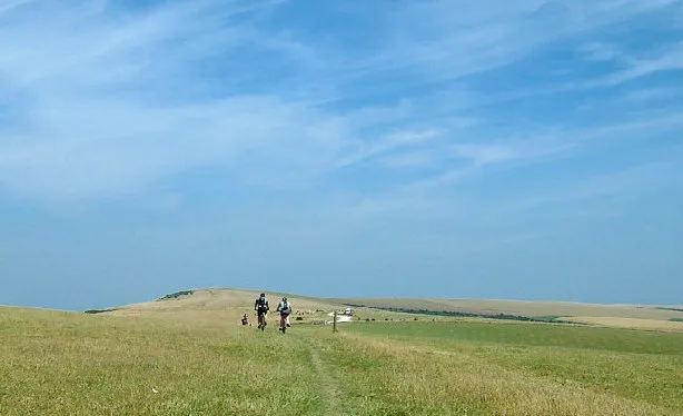
Firle Beacon Alan Rolfe · CC BY-SA 2.0 -
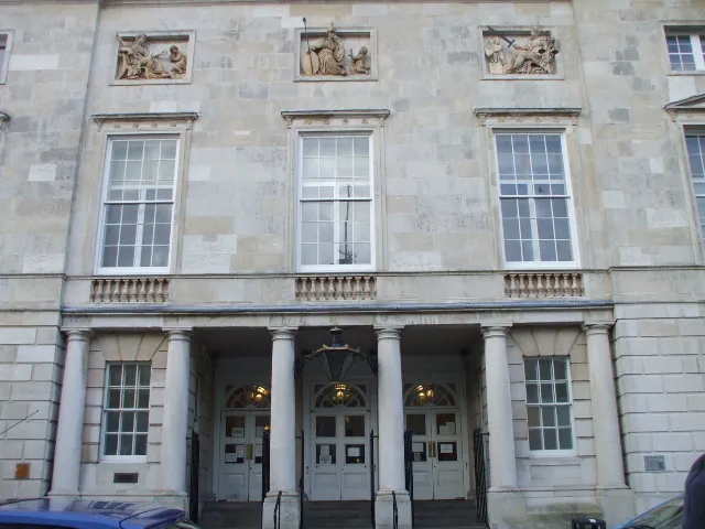
Lewes Crown Court Sussexonian · Public domain -
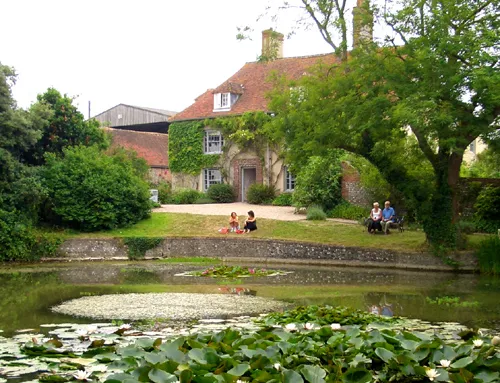
Charleston Farmhouse APB-CMX at English Wikipedia · Public domain


Climate of Lewes
Best months for sightseeingBest months for sightseeing: June–August.
This month · November
A cold month
Day 11° · Night 5° · Rain 89 mm
- Hottest month
- August (day 21°)
- Coldest month
- February (night 2°)
- Wettest month
- November (89 mm)
- Driest month
- July (43 mm)
Bars: average monthly low and high temperature. Below: precipitation. Monthly averages for 1970–2000 at about 18 km resolution, adjusted for elevation. Highlighted months are mild and relatively dry. Source: WorldClim 2.1 (CC BY 4.0).
Show values as a table
| Month | Jan | Feb | Mar | Apr | May | Jun | Jul | Aug | Sep | Oct | Nov | Dec |
|---|---|---|---|---|---|---|---|---|---|---|---|---|
| Average high (°C) | 8° | 8° | 10° | 13° | 16° | 19° | 21° | 21° | 19° | 15° | 11° | 9° |
| Average low (°C) | 2° | 2° | 3° | 4° | 8° | 10° | 13° | 12° | 10° | 8° | 5° | 3° |
| Precipitation (mm) | 87 | 56 | 60 | 49 | 47 | 56 | 43 | 51 | 71 | 86 | 89 | 88 |
How to get to Lewes
The nearest airport is London Gatwick Airport (LGW), 33 km to the northwest as the crow flies. The nearest large city is Brighton, 12 km to the southwest.
Airports
- London Gatwick Airport (LGW) London 33 kmnorthwest
- London City Airport (LCY) London 70 kmnorth
- London Heathrow Airport (LHR) London 74 kmnorthwest
Nearby large cities
- Brighton Population: 283.9K 12 kmsouthwest
- Eastbourne Population: 101.7K 23 kmsoutheast
- Worthing Population: 113.9K 28 kmwest
- Crawley Population: 124K 30 kmnorthwest
- Sutton Population: 187.6K 55 kmnorth
Straight-line distances; road distances are longer. Airport data: OurAirports.
Day trips from Lewes
Within 100 km: 602 historic and cultural sites, 492 natural sites, 250 lakes, rivers and coasts.
0–25 km90 places
- St Nicholas Church Shoreham Attraction 21 kmW
- The Marlipins Museum Museum 21 kmW
- The Island Island 9 kmS
- Hawk Island Island 13 kmN
25–60 km307 places
- Camber Sands Beach 55 kmE
- Hastings Beach Beach 39 kmE
- Climping Beach Beach 42 kmW
- Pagham Beach Beach 54 kmW
60–100 km947 places
- Portsea Island Natural site 76 kmW
- Isle of Wight Island 94 kmW
- Isle of Sheppey Island 82 kmNE
- White Hart Lane Landmark 81 kmN
Straight-line distances.
Lewes and similar cities
Side by side with cities of similar size in the same country: population, elevation and climate.
| Measure | Lewes | Bath | Gillingham | Worcester |
|---|---|---|---|---|
| Population | 101.4K | 101.6K | 101.2K | 101.7K |
| Elevation | 5 m | 96 m | 31 m | 29 m |
| Summer day (hottest month) | 21° | 21° | 22° | 21° |
| Winter night (coldest month) | 2° | 2° | 2° | 1° |
| Annual rainfall | 783 mm | 835 mm | 590 mm | 824 mm |
| Best months | Jun–Aug | Jun–Aug | Jun–Aug | Jun–Aug |
| Distance | — | 175 km | 68 km | 213 km |
Climate values are 1970–2000 monthly averages; straight-line distance.
Places in Lewes
30 placesBar: population relative to the most populous place in this list.
Cities & villages29
- Barcombe · Village
- Beddingham · Village
- Chailey · Village
- Ditchling · Village
- East Chiltington · Village
- Falmer · Village
- Firle · Village
- Glynde · Village
- Hamsey · Village
- Iford · Village
- Kingston Near Lewes · Village
- Lewes · Village
- Newhaven · Village
- Newick · Village
- Peacehaven · Village
- Piddinghoe · Village
- Plumpton · Village
- Ringmer · Village
- Rodmell · Village
- Seaford · Village
- Southease · Village
- South Heighton · Village
- St. Ann (Without) · Village
- St. John (Without) · Village
- Streat · Village
- Tarring Neville · Village
- Telscombe · Village
- Westmeston · Village
- Wivelsfield · Village
Nearby attractions & nature
Everything nearby-
Bullock Hill Mountain, Brighton and Hove6.5 km SW
-
AmEx Stadium Landmark, Brighton and Hove6.9 km W
-
Isfield Motte Historic site, Isfield7.9 km N
-
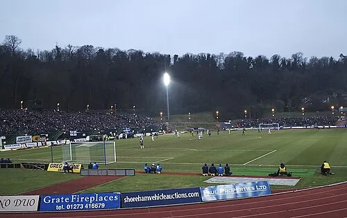 Withdean Stadium Landmark, Brighton and Hove12 km W
-
Kingley Vale Natural site, England7.1 km W
-
Hollingbury Castle Mountain, Brighton and Hove9.8 km W
-
Burghlow Historic site, Long Man13 km SE
-
Arlington Castle Historic site, Long Man13 km SE
Sources & licences
Data last updated: