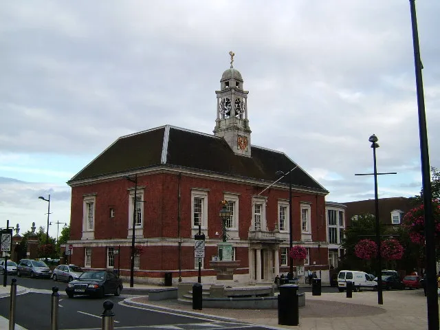
- Population
- 53,477
- 53.5K
- Elevation
- 68 m
- above sea level
- Local time
- UTC+00:00
- Europe/London · UTC+00:00
- Airports
- STN London Stansted Airport22 km
- SEN London Southend Airport36 km
About Braintree
Braintree is a town. Location: Braintree District, Essex. Population: 53,477. Elevation: 68 m.
Braintree is a town in Essex, England. At the 2021 census the built up area as defined by the Office for National Statistics had a population of 43,190. It is the largest settlement in the Braintree District, which also covers an extensive surrounding area. The town has grown contiguously with several surrounding settlements. The original settlement and parish of Braintree lay on the River Brain and was bounded on the north by Stane Street, the Roman road from Braughing to Colchester.
Source: Wikipedia · CC BY-SA 4.0
Photos of Braintree
-

kitmasterbloke · CC BY 2.0 -

kitmasterbloke · CC BY 2.0 -

CalderUK · CC BY-SA 4.0 -

Lankyrider · CC BY-SA 4.0 -

PAUL FARMER · CC BY-SA 2.0


Travel notes for Braintree
From Wikivoyage
Braintree is a town in Essex, England. For a town of its size it boasts very few amenities. However, a shopping village on the outskirts, 'Freeport', has roughly 80 shops. It mainly specialise in clothing, along with a bowling alley and a cinema, which makes Braintree worth visiting.
Understand+
The town has expanded to include neighbouring settlements (the 2011 population of Braintree town was 41,634 whilst the population of the urban area was 53,477). The town lies on the River Brain and south of Stane Street whilst Bocking lies on the River Blackwater to the north. Sometimes the two area is referred to as Braintree & Bocking although they form a single urban area.
The town dates back to habitation in the Bronze and Iron Ages. Later the settlement was used by the Saxons after the Romans left. The town was recorded in the Doomsday Book then called Branchetreu. By the 14th century the town was manufacturing woollen cloth and by the 17th century Flemish immigrants contributed to this making the town famous and bringing prosperity. In the 19th century silk manufacture replaced wool and the town benefitted from a rail link to London.
Get in+
By plane:
Braintree's nearest airport is London Stansted ('STN' IATA), around 15 mi (24 km) to the west. Stansted is a major international airport, with flights from destinations throughout the UK, Europe, the Middle East and North Africa. The dual-carriageway is a direct road connection between Stansted and Braintree. Bus routes Airlink X20 and Arriva 133 operate between Stansted and Braintree throughout early mornings, daytimes and late evenings.
London City Airport (LCY IATA) is a small international airport in East London, with a selection of routes from major cities throughout the UK and Europe. Use DLR from London City Airport to Stratford and change for National Rail services to Braintree.
London Heathrow Airport (LHR IATA) is one of the world's largest airports with routes from destinations throughout the UK, Europe, Africa, Asia, the Middle East and North and South America. Use ELI from London Heathrow Airport to Liverpool Street/Stratford/Shenfield and change for National Rail services to Braintree.
London Southend Airport (SEN IATA) lies in southern Essex, with a selection of routes from destinations in Europe.
By train:
1 Braintree railway station lies in Braintree Approach. Greater Anglia trains serve the station, part of the National Rail network. Travel direct to Braintree from London Liverpool Street in The City, London Stratford in East London, Shenfield, Chelmsford, Witham, White Notley, Cressing and Braintree Freeport. From Ipswich, Clacton and Colchester, change at Witham for trains to Braintree.
2 Braintree Freeport railway station lies near the Braintree Village outlet shopping centre, to the south of the town.
3 Cressing railway station lies between Cressing village and Black Notley, south of Braintree.
Stations further afield include:
Source: Wikivoyage · CC BY-SA 4.0 · abridged
Climate of Braintree
Best months for sightseeingBest months for sightseeing: June–August.
This month · November
A cold month
Day 10° · Night 3° · Rain 58 mm
- Hottest month
- August (day 22°)
- Coldest month
- February (night 1°)
- Wettest month
- November (58 mm)
- Driest month
- February (35 mm)
Bars: average monthly low and high temperature. Below: precipitation. Monthly averages for 1970–2000 at about 18 km resolution, adjusted for elevation. Highlighted months are mild and relatively dry. Source: WorldClim 2.1 (CC BY 4.0).
Show values as a table
| Month | Jan | Feb | Mar | Apr | May | Jun | Jul | Aug | Sep | Oct | Nov | Dec |
|---|---|---|---|---|---|---|---|---|---|---|---|---|
| Average high (°C) | 7° | 7° | 10° | 12° | 16° | 19° | 22° | 22° | 19° | 14° | 10° | 7° |
| Average low (°C) | 1° | 1° | 2° | 4° | 6° | 9° | 12° | 12° | 10° | 7° | 3° | 2° |
| Precipitation (mm) | 53 | 35 | 44 | 42 | 43 | 53 | 42 | 49 | 53 | 56 | 58 | 53 |
How to get to Braintree
The nearest airport is London Stansted Airport (STN), 22 km to the west as the crow flies. The nearest large city is Chelmsford, 17 km to the south.
Airports
- London Stansted Airport (STN) London, Essex 22 kmwest
- London Southend Airport (SEN) Southend-on-Sea, Essex 36 kmsouth
- London City Airport (LCY) London 54 kmsouthwest
Nearby large cities
- Chelmsford Population: 111.5K 17 kmsouth
- Colchester Population: 130.2K 24 kmeast
- Basildon Population: 144.9K 35 kmsouth
- Southend-on-Sea Population: 295.3K 39 kmsouth
- Dagenham Population: 108.4K 45 kmsouthwest
Straight-line distances; road distances are longer. Airport data: OurAirports.
Day trips from Braintree
Within 100 km: 794 historic and cultural sites, 379 natural sites, 287 lakes, rivers and coasts.
0–25 km50 places
- Osea Island Island 23 kmSE
- Northey Island Island 21 kmSE
- Treasure Island Island 14 kmS
- Aberton Reservoir Lake 22 kmE
25–60 km390 places
- Isle of Sheppey Island 57 kmS
- White Hart Lane Landmark 53 kmSW
- Spotlites @ Kings Theatre Attraction 56 kmS
- West Mersea Beach Beach 29 kmSE
60–100 km1,020 places
- Aldeburgh's Beach Beach 79 kmNE
- Sunny Sands Beach 99 kmSE
- Isle of Oxney Island 97 kmS
- Holm Island Island 90 kmSW
Straight-line distances.
Braintree and similar cities
Side by side with cities of similar size in the same country: population, elevation and climate.
| Measure | Braintree | Hamilton | Barry | Castlereagh |
|---|---|---|---|---|
| Population | 53.5K | 54.5K | 54.7K | 56.7K |
| Elevation | 68 m | 68 m | 25 m | 29 m |
| Summer day (hottest month) | 22° | 19° | 21° | 20° |
| Winter night (coldest month) | 1° | 1° | 2° | 1° |
| Annual rainfall | 581 mm | 1,363 mm | 1,019 mm | 880 mm |
| Best months | Jun–Aug | Jun–Aug | Jun–Aug | Jun–Aug |
| Distance | — | 528 km | 271 km | 524 km |
Climate values are 1970–2000 monthly averages; straight-line distance.
Nearby attractions & nature
Everything nearby-
Cressing Road Landmark, Braintree District1.4 km E
-
Bocking Mill Hill Historic site, Braintree District4.8 km N
-
Quarkers Mount Historic site, Felsted6.8 km W
-
River Pant River, England6.7 km E
-
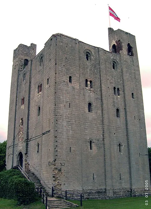 Hedingham Castle Historic site, Castle Hedingham13 km N
-
Holy Cross church Attraction, Felsted8.6 km W
-
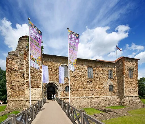 Colchester Castle Historic site, Colchester District24 km E
-
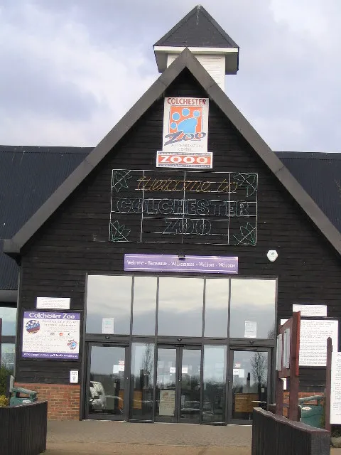 Colchester Zoo Attraction, Stanway19 km E
Sources & licences
Data last updated: · 2 independent sources