
- Elevation
- 65 m
- above sea level
- Local time
- UTC+00:00
- Europe/London · UTC+00:00
- Airports
- SEN London Southend Airport24 km
- LCY London City Airport25 km
About Hutton
Hutton is a village. Location: Brentwood District, Essex. Elevation: 65 m.
Hutton is a suburb of Brentwood, in Essex, England. It lies 3 miles (5 km) east of the town centre, on the eastern edge of the built up area. The area is split between modest housing estates and the largely affluent Hutton Mount. Hutton was formerly a separate village and parish. The civil parish was abolished in 1934 and absorbed into Brentwood. It has good transport links to Central London (around 20 miles (32 km) to the south-west) via Shenfield railway station which is just 1 mile (1.6 km) from Hutton.
Source: Wikipedia · CC BY-SA 4.0
Photos of Hutton
-

Des Blenkinsopp · CC BY-SA 2.0 -

Des Blenkinsopp · CC BY-SA 2.0 -

Roger Jones · CC BY-SA 2.0 -

Adrian Cable · CC BY-SA 2.0 -

Adrian Cable · CC BY-SA 2.0


Climate of Hutton
Best months for sightseeingBest months for sightseeing: June–August.
This month · November
A cold month
Day 10° · Night 4° · Rain 59 mm
- Hottest month
- July (day 22°)
- Coldest month
- February (night 1°)
- Wettest month
- November (59 mm)
- Driest month
- February (36 mm)
Bars: average monthly low and high temperature. Below: precipitation. Monthly averages for 1970–2000 at about 18 km resolution, adjusted for elevation. Highlighted months are mild and relatively dry. Source: WorldClim 2.1 (CC BY 4.0).
Show values as a table
| Month | Jan | Feb | Mar | Apr | May | Jun | Jul | Aug | Sep | Oct | Nov | Dec |
|---|---|---|---|---|---|---|---|---|---|---|---|---|
| Average high (°C) | 7° | 7° | 10° | 12° | 16° | 19° | 22° | 22° | 19° | 14° | 10° | 7° |
| Average low (°C) | 1° | 1° | 2° | 4° | 7° | 10° | 12° | 12° | 10° | 7° | 4° | 2° |
| Precipitation (mm) | 58 | 36 | 44 | 41 | 44 | 51 | 40 | 49 | 53 | 57 | 59 | 55 |
How to get to Hutton
The nearest airport is London Southend Airport (SEN), 24 km to the east as the crow flies. For international flights: London Stansted Airport (STN) (30 km). The nearest large city is Basildon, 10 km to the southeast.
Airports
- London Southend Airport (SEN) Southend-on-Sea, Essex 24 kmeast
- London City Airport (LCY) London 25 kmsouthwest
- London Stansted Airport (STN) London, Essex 30 kmnorth
Nearby large cities
- Basildon Population: 144.9K 10 kmsoutheast
- Chelmsford Population: 111.5K 14 kmnortheast
- Dagenham Population: 108.4K 16 kmsouthwest
- Ilford Population: 168.2K 22 kmwest
- Barking Population: 218.5K 22 kmsouthwest
Straight-line distances; road distances are longer. Airport data: OurAirports.
Day trips from Hutton
Within 100 km: 810 historic and cultural sites, 504 natural sites, 318 lakes, rivers and coasts.
0–25 km84 places
- Canvey Island Island 19 kmSE
- Two Tree Island Island 21 kmSE
- Rook Island Island 23 kmW
- Lower Horse Island 18 kmSE
25–60 km699 places
- Isle of Sheppey Island 42 kmSE
- White Hart Lane Landmark 30 kmW
- Spotlites @ Kings Theatre Attraction 30 kmSE
- West Mersea Beach Beach 43 kmE
60–100 km849 places
- St Nicholas Church Shoreham Attraction 99 kmSW
- The Marlipins Museum Museum 99 kmSW
- Camber Sands Beach 83 kmS
- Sunny Sands Beach 84 kmSE
Straight-line distances.
Nearby attractions & nature
Everything nearby-
Bell Hill Mountain, Billericay4.2 km E
-
Brentwood Park Mountain, Brentwood District5.8 km SW
-
Langdon Hill Mountain, Basildon District9.7 km SE
-
Baker's Wood Mediumwave Transmitter Landmark, Margaretting8.7 km N
-
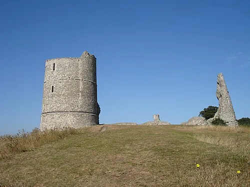 Hadleigh Castle Historic site, Castle Point District20 km SE
-
Navestock Slades Historic site, Navestock8.8 km NW
Other cities and towns in Brentwood District
-
Herongate and Ingrave Village, Brentwood District3.7 km S
-
 Little Warley Village, Brentwood District5.5 km SW
-
Doddinghurst Village, Brentwood District5.1 km NW
-
Ingatestone and Fryerning Village, Brentwood District5.4 km N
-
 South Weald Village, Brentwood District6.5 km W
-
Coxtie Green Village, Brentwood District7.2 km W
Sources & licences
Data last updated: · 2 independent sources