- Population
- 85,995
- 86K
- Elevation
- 68 m
- above sea level
- Local time
- UTC+00:00
- Europe/London · UTC+00:00
- Places inside
- 25
- listed under Harlow District
- Airports
- STN London Stansted Airport16 km
- LCY London City Airport29 km
About Harlow District
Harlow District is a municipality. Location: Essex, England. Population: 85,995. Elevation: 68 m. The best months to visit are June–August. The nearest airport is London Stansted Airport (16 km). Nearby sights include Harlow Town Park and Latton Island.
Climate of Harlow District
Best months for sightseeingBest months for sightseeing: June–August.
This month · November
A cold month
Day 10° · Night 4° · Rain 60 mm
- Hottest month
- July (day 22°)
- Coldest month
- February (night 1°)
- Wettest month
- January (60 mm)
- Driest month
- February (40 mm)
Bars: average monthly low and high temperature. Below: precipitation. Monthly averages for 1970–2000 at about 18 km resolution, adjusted for elevation. Highlighted months are mild and relatively dry. Source: WorldClim 2.1 (CC BY 4.0).
Show values as a table
| Month | Jan | Feb | Mar | Apr | May | Jun | Jul | Aug | Sep | Oct | Nov | Dec |
|---|---|---|---|---|---|---|---|---|---|---|---|---|
| Average high (°C) | 7° | 7° | 10° | 12° | 16° | 19° | 22° | 22° | 19° | 14° | 10° | 8° |
| Average low (°C) | 1° | 1° | 3° | 4° | 7° | 10° | 12° | 12° | 10° | 7° | 4° | 2° |
| Precipitation (mm) | 60 | 40 | 47 | 44 | 46 | 51 | 44 | 49 | 57 | 60 | 60 | 58 |
How to get to Harlow District
The nearest airport is London Stansted Airport (STN), 16 km to the northeast as the crow flies. The nearest large city is Enfield, 19 km to the southwest.
Airports
- London Stansted Airport (STN) London, Essex 16 kmnortheast
- London City Airport (LCY) London 29 kmsouth
- London Luton Airport (LTN) Luton, Luton 35 kmwest
Nearby large cities
- Enfield Population: 156.9K 19 kmsouthwest
- Walthamstow Population: 109.4K 22 kmsouthwest
- Tottenham Population: 130K 22 kmsouthwest
- Ilford Population: 168.2K 23 kmsouth
- Dagenham Population: 108.4K 24 kmsouth
Straight-line distances; road distances are longer. Airport data: OurAirports.
Day trips from Harlow District
Within 100 km: 813 historic and cultural sites, 460 natural sites, 317 lakes, rivers and coasts.
0–25 km105 places
- White Hart Lane Landmark 22 kmSW
- Rook Island Island 22 kmS
- Lincoln Island Island 22 kmS
- Latton Island Island 3 kmN
25–60 km784 places
- Spotlites @ Kings Theatre Attraction 52 kmSE
- West Mersea Beach Beach 56 kmE
- Yantlet beach Beach 51 kmSE
- Osea Island Island 45 kmE
60–100 km701 places
- Isle of Sheppey Island 64 kmSE
- Central Beach Beach 69 kmSE
- The Lynch Island 76 kmSW
- Isle of Oxney Island 94 kmSE
Straight-line distances.
Harlow District and similar cities
Side by side with cities of similar size in the same country: population, elevation and climate.
| Measure | Harlow District | Grimsby | South Shields | Londonderry |
|---|---|---|---|---|
| Population | 86K | 86.1K | 83.7K | 83.7K |
| Elevation | 68 m | 4 m | 12 m | 24 m |
| Summer day (hottest month) | 22° | 21° | 20° | 18° |
| Winter night (coldest month) | 1° | 1° | 2° | 3° |
| Annual rainfall | 616 mm | 626 mm | 673 mm | 1,561 mm |
| Best months | Jun–Aug | Jun–Sep | Jun–Sep | Jun–Aug |
| Distance | — | 201 km | 374 km | 611 km |
Climate values are 1970–2000 monthly averages; straight-line distance.
Places in Harlow District
25 placesBar: population relative to the most populous place in this list.
Cities & villages22
- Brays Grove · Neighbourhood
- Churchgate Street · Neighbourhood
- Church Langley · Neighbourhood
- Eastend · Neighbourhood
- Great Parndon · Village
- Hare Street · Neighbourhood
- Harlow Common · Neighbourhood
- Katherines · Neighbourhood
- Kingsmoor · Neighbourhood
- Latton Bush · Neighbourhood
- Little Parndon · Village
- Mark Hall North · Neighbourhood
- Mark Hall South · Neighbourhood
- Netteswell · Neighbourhood
- Passmores · Neighbourhood
- Pinnacles · Neighbourhood
- Potter Street · Village
- Stewards · Neighbourhood
- Sumners · Neighbourhood
- Temple Fields · Neighbourhood
- The High · Neighbourhood
- Tye Green · Neighbourhood
Heritage & sights1
- Harlow Mill · Historic site
Nearby attractions & nature
Everything nearby-
Harlow Town Park Natural site, England1.8 km NW
-
Latton Island Island, Gilston2.6 km N
-
St. James Church Attraction, High Wych4.6 km N
-
Sheering Hall Ringwork Historic site, Sheering4.9 km NE
-
Hunsdon House Landmark, Hunsdon5.1 km NW
-
Magdalen Laver Motte Historic site, Magdalen Laver5.8 km E
-
River Stort River, England5.5 km W
-
Down Hall Motte Historic site, Hatfield Heath7.4 km NE
Other cities and towns in Essex
-
Epping Forest District Municipality, Essex6.9 km SE
-
Brentwood District Municipality, Essex19 km SE
-
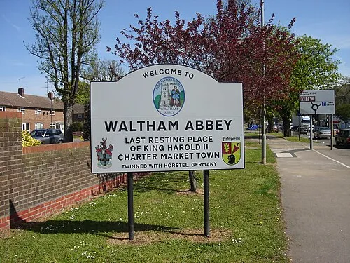 Waltham Abbey Town, Waltham Abbey12 km SW
-
Uttlesford District Municipality, Essex22 km NE
-
Epping Town, Epping7.5 km S
-
Chelmsford District Municipality, Essex26 km E
Sources & licences
Data last updated: