- Elevation
- 31 m
- above sea level
- Local time
- UTC+00:00
- Europe/London · UTC+00:00
- Places inside
- 2
- listed under Bradfield
- Airports
- SEN London Southend Airport49 km
- STN London Stansted Airport61 km
About Bradfield
Bradfield is a village. Location: Tendring District, Essex. Elevation: 31 m. The best months to visit are June–August. The nearest airport is London Southend Airport (49 km). Nearby sights include Manningtree Transmitting Station and Colchester Castle.
Climate of Bradfield
Best months for sightseeingBest months for sightseeing: June–August.
This month · November
A cold month
Day 10° · Night 3° · Rain 60 mm
- Hottest month
- August (day 22°)
- Coldest month
- February (night 1°)
- Wettest month
- November (60 mm)
- Driest month
- February (35 mm)
Bars: average monthly low and high temperature. Below: precipitation. Monthly averages for 1970–2000 at about 18 km resolution, adjusted for elevation. Highlighted months are mild and relatively dry. Source: WorldClim 2.1 (CC BY 4.0).
Show values as a table
| Month | Jan | Feb | Mar | Apr | May | Jun | Jul | Aug | Sep | Oct | Nov | Dec |
|---|---|---|---|---|---|---|---|---|---|---|---|---|
| Average high (°C) | 7° | 7° | 10° | 12° | 16° | 20° | 22° | 22° | 19° | 15° | 10° | 8° |
| Average low (°C) | 1° | 1° | 2° | 4° | 7° | 9° | 12° | 12° | 10° | 7° | 3° | 2° |
| Precipitation (mm) | 52 | 35 | 40 | 43 | 41 | 49 | 38 | 50 | 51 | 59 | 60 | 54 |
How to get to Bradfield
The nearest airport is London Southend Airport (SEN), 49 km to the southwest as the crow flies. For international flights: London Stansted Airport (STN) (61 km). The nearest large city is Ipswich, 15 km to the north.
Airports
- London Southend Airport (SEN) Southend-on-Sea, Essex 49 kmsouthwest
- London Stansted Airport (STN) London, Essex 61 kmwest
- Norwich Airport (NWI) Norwich, Norfolk 84 kmnorth
Nearby large cities
- Ipswich Population: 178.8K 15 kmnorth
- Colchester Population: 130.2K 15 kmwest
- Chelmsford Population: 111.5K 49 kmsouthwest
- Southend-on-Sea Population: 295.3K 51 kmsouthwest
- Basildon Population: 144.9K 60 kmsouthwest
Straight-line distances; road distances are longer. Airport data: OurAirports.
Day trips from Bradfield
Within 100 km: 550 historic and cultural sites, 179 natural sites, 170 lakes, rivers and coasts.
0–25 km69 places
- West Mersea Beach Beach 21 kmSW
- Mersea Island Island 20 kmSW
- Ray Island Island 21 kmSW
- Horsey Island Island 11 kmSE
25–60 km146 places
- Aldeburgh's Beach Beach 42 kmNE
- Yantlet beach Beach 59 kmSW
- Osea Island Island 34 kmSW
- Northey Island Island 36 kmSW
60–100 km684 places
- Isle of Sheppey Island 62 kmS
- White Hart Lane Landmark 89 kmSW
- Spotlites @ Kings Theatre Attraction 73 kmSW
- Hemsby Beach Beach 95 kmNE
Straight-line distances.
Places in Bradfield
2 placesCities & villages2
- Bradfield · Village
- Bradfield Heath · Village
Nearby attractions & nature
Everything nearby-
Manningtree Transmitting Station Landmark, Mistley2 km W
-
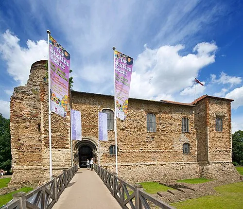 Colchester Castle Historic site, Colchester District15 km W
-
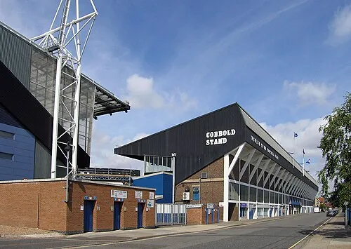 Portman Road Landmark, Ipswich District14 km N
-
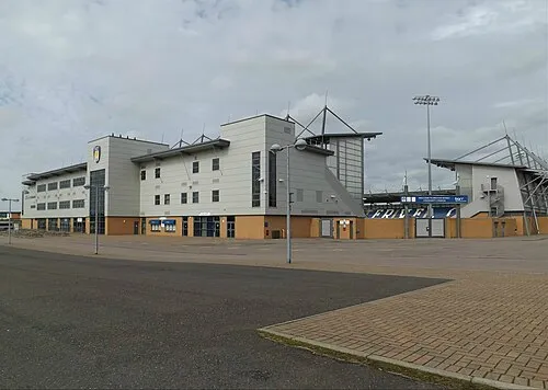 Colchester Community Stadium Landmark, Myland15 km W
-
Garnham's Island Island, Beaumont-cum-Moze8.4 km SE
-
Skipper's Island Island, Thorpe-le-Soken9.2 km SE
Sources & licences
Data last updated: