
- Population
- 5,157
- 5.2K
- Elevation
- 14 m
- above sea level
- Local time
- UTC+00:00
- Europe/London · UTC+00:00
- Places inside
- 8
- listed under St. Osyth
- Airports
- SEN London Southend Airport37 km
- STN London Stansted Airport58 km
About St. Osyth
St. Osyth is a village. Location: Tendring District, Essex. Population: 5,157. Elevation: 14 m.
St Osyth is an English village and civil parish in the Tendring District of north-east Essex, about five miles (eight kilometres) west of Clacton-on-Sea and 12 miles (19 km) southeast of Colchester. It lies on the B1027, Colchester–Clacton road. The village is named after Osgyth, a seventh-century saint and princess. Locally, the name is sometimes pronounced "Toosey". It is claimed to be the driest recorded place in the United Kingdom. At the 2021 census the parish had a population of 5,157.
Source: Wikipedia · CC BY-SA 4.0
Population of St. Osyth over time
| 2001 | 4,119 | |
|---|---|---|
| 2011 | 4,277 | |
| 2021 | 5,157 |
Censuses and official estimates; source: Wikidata.
Climate of St. Osyth
Best months for sightseeingBest months for sightseeing: June–August.
This month · November
A cold month
Day 10° · Night 4° · Rain 58 mm
- Hottest month
- August (day 22°)
- Coldest month
- February (night 1°)
- Wettest month
- October (58 mm)
- Driest month
- February (33 mm)
Bars: average monthly low and high temperature. Below: precipitation. Monthly averages for 1970–2000 at about 18 km resolution, adjusted for elevation. Highlighted months are mild and relatively dry. Source: WorldClim 2.1 (CC BY 4.0).
Show values as a table
| Month | Jan | Feb | Mar | Apr | May | Jun | Jul | Aug | Sep | Oct | Nov | Dec |
|---|---|---|---|---|---|---|---|---|---|---|---|---|
| Average high (°C) | 7° | 7° | 10° | 12° | 16° | 19° | 22° | 22° | 19° | 15° | 10° | 8° |
| Average low (°C) | 1° | 1° | 3° | 4° | 7° | 10° | 12° | 12° | 10° | 7° | 4° | 2° |
| Precipitation (mm) | 49 | 33 | 38 | 39 | 38 | 48 | 37 | 48 | 50 | 58 | 58 | 52 |
How to get to St. Osyth
The nearest airport is London Southend Airport (SEN), 37 km to the southwest as the crow flies. For international flights: London Stansted Airport (STN) (58 km). The nearest large city is Colchester, 15 km to the northwest.
Airports
- London Southend Airport (SEN) Southend-on-Sea, Essex 37 kmsouthwest
- London Stansted Airport (STN) London, Essex 58 kmwest
- London City Airport (LCY) London 78 kmsouthwest
Nearby large cities
- Colchester Population: 130.2K 15 kmnorthwest
- Ipswich Population: 178.8K 29 kmnorth
- Southend-on-Sea Population: 295.3K 39 kmsouthwest
- Chelmsford Population: 111.5K 42 kmwest
- Basildon Population: 144.9K 50 kmsouthwest
Straight-line distances; road distances are longer. Airport data: OurAirports.
Day trips from St. Osyth
Within 100 km: 588 historic and cultural sites, 232 natural sites, 175 lakes, rivers and coasts.
0–25 km50 places
- West Mersea Beach Beach 10 kmW
- Osea Island Island 23 kmSW
- Mersea Island Island 9 kmW
- Ray Island Island 12 kmW
25–60 km204 places
- Isle of Sheppey Island 48 kmS
- Aldeburgh's Beach Beach 54 kmNE
- Yantlet beach Beach 46 kmSW
- Central Beach Beach 46 kmS
60–100 km741 places
- White Hart Lane Landmark 82 kmW
- Spotlites @ Kings Theatre Attraction 60 kmSW
- Camber Sands Beach 99 kmS
- Sunny Sands Beach 81 kmS
Straight-line distances.
Places in St. Osyth
8 placesBar: population relative to the most populous place in this list.
Cities & villages5
- Lee-over-Sands · Village
- Point Clear · Village
- Row Heath · Village
- Seawick · Village
- St Osyth Heath · Village
Lakes, rivers & coasts2
- Colne Bar · Island
- Pincushion Island · Island
Nearby attractions & nature
Everything nearby-
Cindery Island Island, Brightlingsea2.8 km W
-
Rat Island Island, Fingringhoe6.3 km W
-
Pewit Island Island, Langenhoe6.7 km W
-
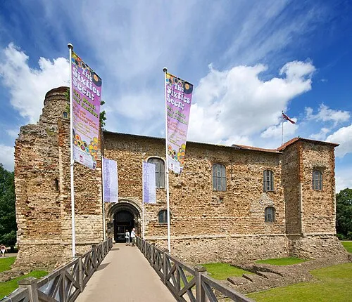 Colchester Castle Historic site, Colchester District15 km NW
-
River Colne River, England7.7 km NW
-
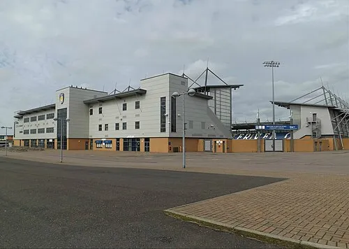 Colchester Community Stadium Landmark, Myland18 km NW
Other cities and towns in Tendring District
-
Great Bentley Village, Tendring District4.5 km N
-
 Great Clacton Village, Tendring District5.8 km E
-
Bocking's Elm Neighbourhood, Tendring District4.1 km E
-
Rush Green Neighbourhood, Tendring District4.3 km E
-
Weeley Village, Tendring District6.3 km NE
-
Jaywick Village, Tendring District4.4 km SE
Sources & licences
Data last updated: · 2 independent sources