
- Elevation
- 23 m
- above sea level
- Local time
- UTC+00:00
- Europe/London · UTC+00:00
- Airports
- BRS Bristol Airport43 km
- CWL Cardiff International Airport71 km
About Purton
Purton is a village. Location: Lydney, Forest of Dean. Elevation: 23 m.
Purton is a hamlet on the west bank of the River Severn, in the civil parish of Lydney in Gloucestershire, England. It lies opposite the village of Purton near Berkeley on the east bank of the river. The name of the place derives from the Old English pirige tun, meaning "pear orchard". It was mentioned in the Domesday Book. Purton was a small port, and there was a ferry across the river, Purton Passage, to the other Purton by 1282.
Source: Wikipedia · CC BY-SA 4.0
Photos of Purton
-

Gareth James · CC BY-SA 2.0 -

Gareth James · CC BY-SA 2.0 -

Ruth Sharville · CC BY-SA 2.0 -

Ruth Sharville · CC BY-SA 2.0 -

Roger Davies · CC BY-SA 2.0


Climate of Purton
Best months for sightseeingBest months for sightseeing: June–August.
This month · November
A cold month
Day 11° · Night 5° · Rain 69 mm
- Hottest month
- July (day 21°)
- Coldest month
- February (night 2°)
- Wettest month
- December (77 mm)
- Driest month
- July (44 mm)
Bars: average monthly low and high temperature. Below: precipitation. Monthly averages for 1970–2000 at about 18 km resolution, adjusted for elevation. Highlighted months are mild and relatively dry. Source: WorldClim 2.1 (CC BY 4.0).
Show values as a table
| Month | Jan | Feb | Mar | Apr | May | Jun | Jul | Aug | Sep | Oct | Nov | Dec |
|---|---|---|---|---|---|---|---|---|---|---|---|---|
| Average high (°C) | 7° | 8° | 10° | 12° | 16° | 19° | 21° | 21° | 18° | 14° | 11° | 8° |
| Average low (°C) | 2° | 2° | 3° | 5° | 8° | 10° | 13° | 12° | 10° | 8° | 5° | 3° |
| Precipitation (mm) | 74 | 52 | 58 | 51 | 52 | 59 | 44 | 62 | 68 | 66 | 69 | 77 |
How to get to Purton
The nearest airport is Bristol Airport (BRS), 43 km to the southwest as the crow flies. The nearest large city is Gloucester, 22 km to the northeast.
Airports
- Bristol Airport (BRS) Bristol 43 kmsouthwest
- Cardiff International Airport (CWL) Cardiff 71 kmsouthwest
- Birmingham Airport (BHX) Birmingham, West Midlands 94 kmnortheast
Nearby large cities
- Gloucester Population: 132.4K 22 kmnortheast
- Bristol Population: 479K 33 kmsouth
- Cheltenham Population: 118.8K 33 kmnortheast
- Newport Population: 161.5K 40 kmsouthwest
- Bath Population: 101.6K 41 kmsouth
Straight-line distances; road distances are longer. Airport data: OurAirports.
Day trips from Purton
Within 100 km: 905 historic and cultural sites, 1,605 natural sites, 144 lakes, rivers and coasts.
0–25 km181 places
- Alney Island Island 21 kmNE
- Hobbs Mountain 15 kmN
- May Hill Mountain 17 kmN
- Robins Wood Hill Mountain 20 kmNE
25–60 km786 places
- Knightstone Island 56 kmSW
- Glover's Island Island 54 kmNE
- Denny Island Island 32 kmSW
- Denny Island Island 45 kmS
60–100 km1,687 places
- Kilve Beach Beach 80 kmSW
- Steep Holm Island 62 kmSW
- Flat Holm Island 60 kmSW
- Barry Island Island 67 kmSW
Straight-line distances.
Nearby attractions & nature
Everything nearby-
Blakeney Hill Mountain, Awre3.2 km N
-
Kingsland Hill Mountain, Awre3.7 km N
-
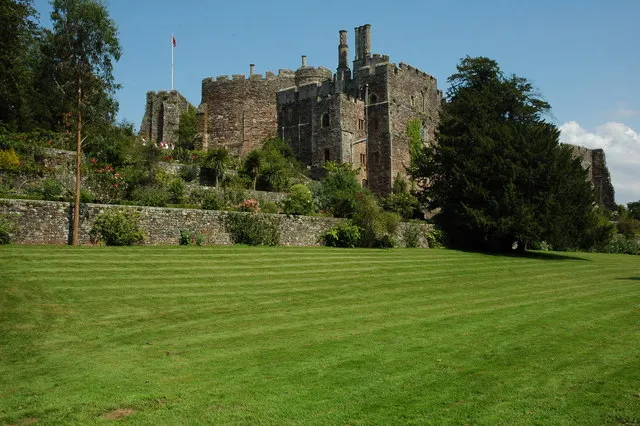 Berkeley Castle Historic site, Berkeley5.9 km S
-
St Mary's Church Attraction, Lydney4.2 km SW
-
Bailey Hill Mountain, West Dean4.3 km NW
-
Cern Hill Historic site, Newnham4.3 km N
Sources & licences
Data last updated: · 2 independent sources