- Elevation
- 201 m
- above sea level
- Local time
- UTC+00:00
- Europe/London · UTC+00:00
- Airports
- BRS Bristol Airport45 km
- CWL Cardiff International Airport64 km
About Old Hills
Old Hills is a mountain. Location: Newland, Forest of Dean. Elevation: 201 m. The best months to visit are June–August. The nearest airport is Bristol Airport (45 km). Nearby sights include Astridge Hill and Bircham Wood.
Photos of Old Hills
-
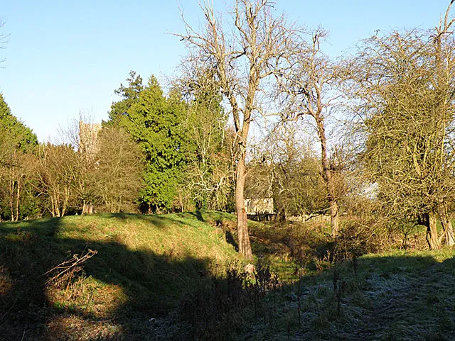
English Bicknor Castle Stuart Wilding · CC BY-SA 2.0 -
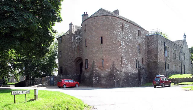
St Briavels Castle Roy Parkhouse · CC BY-SA 2.0 -
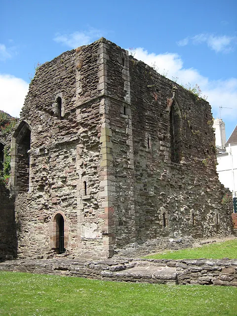
Monmouth Castle Pauline Eccles · CC BY-SA 2.0


Climate of Old Hills
Best months for sightseeingBest months for sightseeing: June–August.
This month · November
A cold month
Day 9° · Night 4° · Rain 83 mm
- Hottest month
- July (day 20°)
- Coldest month
- February (night 1°)
- Wettest month
- December (91 mm)
- Driest month
- July (46 mm)
Bars: average monthly low and high temperature. Below: precipitation. Monthly averages for 1970–2000 at about 18 km resolution, adjusted for elevation. Highlighted months are mild and relatively dry. Source: WorldClim 2.1 (CC BY 4.0).
Show values as a table
| Month | Jan | Feb | Mar | Apr | May | Jun | Jul | Aug | Sep | Oct | Nov | Dec |
|---|---|---|---|---|---|---|---|---|---|---|---|---|
| Average high (°C) | 6° | 6° | 9° | 11° | 15° | 18° | 20° | 19° | 17° | 13° | 9° | 7° |
| Average low (°C) | 1° | 1° | 2° | 4° | 7° | 10° | 12° | 12° | 10° | 7° | 4° | 2° |
| Precipitation (mm) | 89 | 62 | 68 | 59 | 60 | 62 | 46 | 69 | 77 | 77 | 83 | 91 |
How to get to Old Hills
The nearest airport is Bristol Airport (BRS), 45 km to the south as the crow flies. The nearest large city is Gloucester, 30 km to the east.
Airports
- Bristol Airport (BRS) Bristol 45 kmsouth
- Cardiff International Airport (CWL) Cardiff 64 kmsouthwest
- Birmingham Airport (BHX) Birmingham, West Midlands 97 kmnortheast
Nearby large cities
- Gloucester Population: 132.4K 30 kmeast
- Newport Population: 161.5K 32 kmsouthwest
- Bristol Population: 479K 37 kmsouth
- Cheltenham Population: 118.8K 42 kmeast
- Cardiff Population: 372.1K 49 kmsouthwest
Straight-line distances; road distances are longer. Airport data: OurAirports.
Day trips from Old Hills
Within 100 km: 943 historic and cultural sites, 1,853 natural sites, 146 lakes, rivers and coasts.
0–25 km244 places
- Llandegfedd Reservoir Lake 24 kmSW
- Hobbs Mountain 18 kmNE
- May Hill Mountain 19 kmNE
- Ysgyryd Fawr Mountain 23 kmW
25–60 km932 places
- Steep Holm Island 59 kmSW
- Flat Holm Island 56 kmSW
- Sully Island Island 57 kmSW
- Alney Island Island 29 kmE
60–100 km1,766 places
- Kilve Beach Beach 77 kmSW
- Barry Island Island 61 kmSW
- Andersey Island Island 97 kmE
- Rose Isle Island 99 kmE
Straight-line distances.
Nearest towns and villages
-
Lower Redbrook Village, Newland0.6 km SW
-
Coleford Town, Coleford3.6 km E
-
Newland Village, Newland1.1 km SE
-
Upper Redbrook Village, Monmouth0.6 km W
-
Clearwell Village, Newland3.8 km SE
-
Monmouth Town, Monmouth4.4 km NW
Nearby attractions & nature
Everything nearby-
Astridge Hill Mountain, Newland1.7 km S
-
Bircham Wood Mountain, Newland1.8 km E
-
Buck Stone Mountain, Staunton Coleford2.2 km N
-
Blake's Wood Mountain, Staunton Coleford2.3 km NE
-
Church Hill Mountain, Trellech United2.5 km W
-
Kymin Mountain, Monmouth2.9 km NW
-
River Trothy River, Wales2.5 km W
-
Berry Hill Mountain, West Dean3.9 km NE
Sources & licences
Data last updated: