Gloucester District
Located in Gloucestershire, England Coordinates: 51°50′46″ N 2°14′17″ W
- Population
- 128,488
- 128.5K
- Elevation
- 29 m
- above sea level
- Local time
- UTC+00:00
- Europe/London · UTC+00:00
- Places inside
- 31
- listed under Gloucester District
About Gloucester District
Gloucester District is a municipality. Location: Gloucestershire, England. Population: 128,488. Elevation: 29 m.
In comparison
- Most populous of 6 places in Gloucestershire
- Nearest larger town: Gloucester, 2 km N
- 31 sights and natural places within 10 km Robins Wood Hill, Gloucester Park
- Listed here: Neighbourhood: 18, Village: 6, Natural site: 3, Attraction: 1
Places in Gloucester District
31 places-
Gloucester City132.4K
-
Barnwood Village2.5K
-
Abbeydale Neighbourhood
-
Abbeymead Village
-
Alney Island Island
-
Barton Neighbourhood
-
Coney Hill Neighbourhood
-
Elmbridge Neighbourhood
-
Gelvum Way Park Natural site
-
Gloucester Cathedral Attraction
-
Gloucester Park Natural site
-
Hempsted Village
-
High Orchard Neighbourhood
-
Hucclecote Village
-
Kingsholm Neighbourhood
-
Linden Neighbourhood
-
Lobley's Drive Park Natural site
-
Longlevens Neighbourhood
-
Lower Tuffley Neighbourhood
-
Matson Village
-
Podsmead Neighbourhood
-
Pool Meadow Neighbourhood
-
Quedgeley Village
-
Robinswood Neighbourhood
-
Robins Wood Hill Mountain
-
Saintbridge Neighbourhood
-
St Paul's Neighbourhood
-
The Island Neighbourhood
-
Tredworth Neighbourhood
-
Tuffley Neighbourhood
-
Wotton Neighbourhood
Nearby attractions & nature
Everything nearby-
River Leadon River, England3 km NW
-
Nut Hill Mountain, Upton St. Leonards4 km E
-
Churchdown Hill Mountain, Churchdown5 km NE
-
Harescombe Castle Historic site, Harescombe6 km S
-
Painswick Beacon Mountain, Painswick5.4 km SE
-
Haresfield Mount Historic site, Haresfield6.5 km SW
-
Hockley Hill Mountain, Hardwicke5.9 km SW
-
High Brotheridge Mountain, Cranham6 km SE
Other cities and towns in Gloucestershire
-
Stroud Municipality, Gloucestershire11 km S
-
Cheltenham Municipality, Gloucestershire13 km NE
-
Tewkesbury Municipality, Gloucestershire15 km NE
-
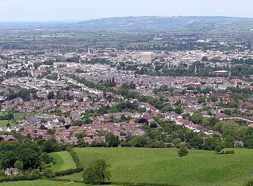 Cheltenham City, Cheltenham12 km NE
-
Cotswold District Municipality, Gloucestershire19 km E
-
Forest of Dean Municipality, Gloucestershire21 km W
Sources & licences
Data last updated: