- Elevation
- 159 m
- above sea level
- Local time
- UTC+00:00
- Europe/London · UTC+00:00
- Airports
- MME Teesside International Airport103 km
- LBA Leeds Bradford Airport108 km
About Great Langdale Beck
Great Langdale Beck is a river. Location: England, United Kingdom. The best months to visit are June–August. The nearest airport is Teesside International Airport (103 km). Nearby sights include Bowfell and Park Fell.
Climate of Great Langdale Beck
Best months for sightseeingBest months for sightseeing: June–August.
This month · November
A wet month
Day 8° · Night 3° · Rain 197 mm
- Hottest month
- July (day 18°)
- Coldest month
- January (night 1°)
- Wettest month
- December (205 mm)
- Driest month
- June (101 mm)
Bars: average monthly low and high temperature. Below: precipitation. Monthly averages for 1970–2000 at about 18 km resolution, adjusted for elevation. Highlighted months are mild and relatively dry. Source: WorldClim 2.1 (CC BY 4.0).
Show values as a table
| Month | Jan | Feb | Mar | Apr | May | Jun | Jul | Aug | Sep | Oct | Nov | Dec |
|---|---|---|---|---|---|---|---|---|---|---|---|---|
| Average high (°C) | 6° | 6° | 8° | 11° | 14° | 17° | 18° | 18° | 15° | 12° | 8° | 6° |
| Average low (°C) | 1° | 1° | 2° | 3° | 6° | 9° | 11° | 11° | 9° | 6° | 3° | 1° |
| Precipitation (mm) | 200 | 144 | 160 | 107 | 103 | 101 | 110 | 137 | 155 | 201 | 197 | 205 |
How to get to Great Langdale Beck
The nearest airport is Teesside International Airport (MME), 103 km to the east as the crow flies. For international flights: Leeds Bradford Airport (LBA) (108 km). The nearest large city is Blackpool, 67 km to the south.
Airports
- Teesside International Airport (MME) Darlington, Durham 103 kmeast
- Leeds Bradford Airport (LBA) Leeds, West Yorkshire 108 kmsoutheast
- Newcastle International Airport (NCL) Newcastle upon Tyne, Tyne and Wear 110 kmnortheast
Nearby large cities
- Blackpool Population: 145K 67 kmsouth
- Preston Population: 313.3K 76 kmsouth
- Blackburn Population: 146.5K 82 kmsoutheast
- Burnley Population: 149.4K 86 kmsoutheast
- Bolton Population: 141.3K 100 kmsoutheast
Straight-line distances; road distances are longer. Airport data: OurAirports.
Nearest towns and villages
-
Skelwith Village, Westmorland and Furness0.3 km S
-
Skelwith Bridge Village, Lakes0.8 km NE
-
Lakes Village, Westmorland and Furness2.7 km N
-
Little Loughrigg Village, Lakes1.2 km N
-
Ambleside Village, Lakes4 km NE
-
Waterhead Neighbourhood, Lakes3.5 km E
Nearby attractions & nature
Everything nearby-
Bowfell Mountain, Skelwith0.1 km E
-
Park Fell Mountain, Skelwith0.5 km SW
-
Nab Island Island, Skelwith1.5 km NW
-
Little Loughrigg Mountain, Lakes1.2 km N
-
Black Fell Mountain, Hawkshead1.2 km S
-
River Rothay River, England3.2 km E
-
River Brathay River, England3.2 km E
-
Little Langdale Natural site, England2.2 km W
More lakes, rivers and coasts in United Kingdom
-
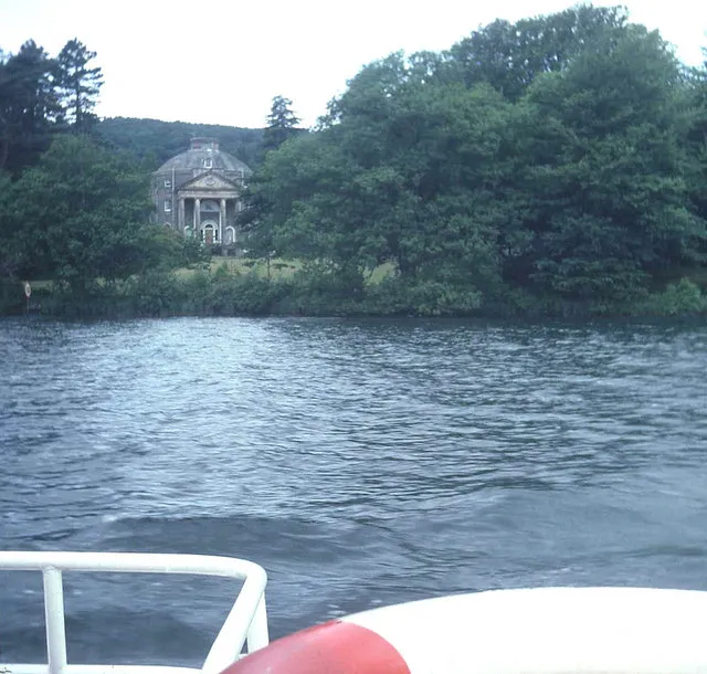 Belle Isle Island, Windermere8 km SE
-
Rydal Water Lake, England3.6 km N
-
Grasmere Lake, England3.7 km N
-
Lake Windermere Lake, Cumbria7.2 km SE
-
Seamew Crag Island, Lakes2.9 km E
-
Coniston Water Lake, Cumbria9.8 km SW
Sources & licences
Data last updated: