
- Elevation
- 49 m
- above sea level
- Local time
- UTC+00:00
- Europe/London · UTC+00:00
- Airports
- LCY London City Airport18 km
- LHR London Heathrow Airport31 km
About Winchmore Hill
Winchmore Hill is a village. Location: Enfield, Greater London. Elevation: 49 m.
Winchmore Hill is a suburb in the London Borough of Enfield, north London, England, in the N21 postal district. The Winchmore Hill conservation area serves as the focal point of the district. Geographically, it is bounded on the east by Green Lanes (the A105 road), Barrowell Green, Firs Lane and Fords Grove. To the northwest, it is bordered by Grovelands Park. The southern boundary extends to part of Aldermans Hill, while the northern boundary reaches Vicars Moor Lane and Houndsden Road.
Source: Wikipedia · CC BY-SA 4.0
Photos of Winchmore Hill
-

Richard Nevell · CC BY-SA 4.0 -

Philafrenzy · CC BY-SA 4.0 -

Philafrenzy · CC BY-SA 4.0 -

Lemur12 · CC BY-SA 3.0 -

David Howard · CC BY-SA 2.0


Climate of Winchmore Hill
Best months for sightseeingBest months for sightseeing: June–August.
This month · November
A cold month
Day 10° · Night 4° · Rain 61 mm
- Hottest month
- July (day 23°)
- Coldest month
- February (night 2°)
- Wettest month
- January (62 mm)
- Driest month
- February (40 mm)
Bars: average monthly low and high temperature. Below: precipitation. Monthly averages for 1970–2000 at about 18 km resolution, adjusted for elevation. Highlighted months are mild and relatively dry. Source: WorldClim 2.1 (CC BY 4.0).
Show values as a table
| Month | Jan | Feb | Mar | Apr | May | Jun | Jul | Aug | Sep | Oct | Nov | Dec |
|---|---|---|---|---|---|---|---|---|---|---|---|---|
| Average high (°C) | 7° | 8° | 10° | 13° | 17° | 20° | 23° | 23° | 19° | 15° | 10° | 8° |
| Average low (°C) | 2° | 2° | 3° | 4° | 7° | 10° | 13° | 12° | 10° | 7° | 4° | 3° |
| Precipitation (mm) | 62 | 40 | 47 | 45 | 48 | 53 | 42 | 49 | 57 | 61 | 61 | 59 |
How to get to Winchmore Hill
The nearest airport is London City Airport (LCY), 18 km to the southeast as the crow flies. For international flights: London Heathrow Airport (LHR) (31 km). The nearest large city is Enfield, 2 km to the northeast.
Airports
- London City Airport (LCY) London 18 kmsoutheast
- London Heathrow Airport (LHR) London 31 kmsouthwest
- London Luton Airport (LTN) Luton, Luton 33 kmnorthwest
Nearby large cities
- Enfield Population: 156.9K 2 kmnortheast
- Tottenham Population: 130K 4 kmsoutheast
- Walthamstow Population: 109.4K 7 kmsoutheast
- Archway Population: 215.7K 8 kmsouth
- Islington Population: 319.1K 11 kmsouth
Straight-line distances; road distances are longer. Airport data: OurAirports.
Day trips from Winchmore Hill
Within 100 km: 839 historic and cultural sites, 580 natural sites, 327 lakes, rivers and coasts.
0–25 km385 places
- White Hart Lane Landmark 4 kmSE
- Lot's Ait Island 22 kmSW
- Rook Island Island 12 kmSE
- Glover's Island Island 25 kmSW
25–60 km598 places
- Spotlites @ Kings Theatre Attraction 52 kmSE
- Yantlet beach Beach 57 kmE
- The Lynch Island 57 kmW
- Northey Island Island 57 kmE
60–100 km763 places
- Isle of Sheppey Island 70 kmE
- St Nicholas Church Shoreham Attraction 89 kmS
- The Marlipins Museum Museum 90 kmS
- Camber Sands Beach 100 kmSE
Straight-line distances.
Nearby attractions & nature
Everything nearby-
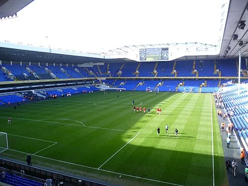 White Hart Lane Landmark, Haringey4.1 km SE
-
New Testament Church of God Attraction, Haringey3.1 km S
-
Woodside Park Natural site, Haringey3.3 km S
-
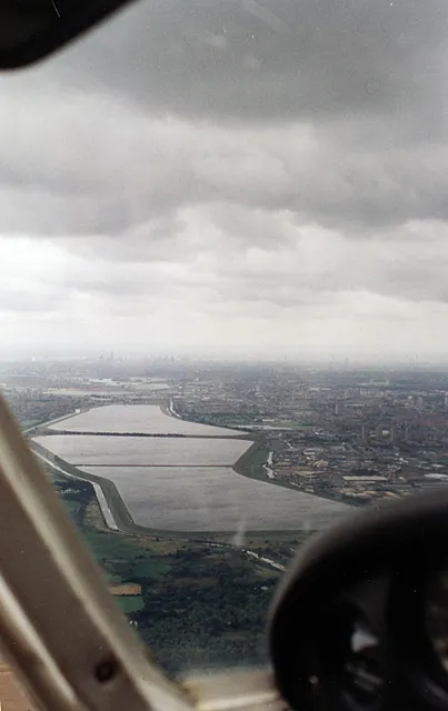 William Girling Reservoir Lake, Enfield5.2 km E
-
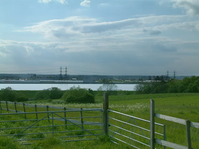 King George V Reservoir Lake, Enfield6.1 km E
-
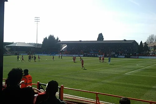 Underhill Stadium Landmark, Barnet6.5 km W
Other cities and towns in Enfield
-
 Upper Edmonton Neighbourhood, Enfield3.9 km SE
-
 Cockfosters Neighbourhood, Enfield3.8 km NW
-
Grange Neighbourhood, Enfield1.3 km NE
-
Bush Hill Park Neighbourhood, Enfield1.5 km E
-
Highlands Village Neighbourhood, Enfield1.5 km NW
-
Southgate Neighbourhood, Enfield1.6 km W
Sources & licences
Data last updated: · 2 independent sources