
- Population
- 879
- 879
- Elevation
- 29 m
- above sea level
- Local time
- UTC+00:00
- Europe/London · UTC+00:00
- Airports
- LHR London Heathrow Airport2 km
- LCY London City Airport37 km
About Harmondsworth
Harmondsworth is a village. Location: Hillingdon, Greater London. Population: 879. Elevation: 29 m.
Harmondsworth is a village in the London Borough of Hillingdon in the county of Greater London with a short border to the south onto London Heathrow Airport and close to the Berkshire county border. The village has no railway stations, but adjoins the M4 motorway and the A4 road (the Bath Road). Harmondsworth was in the historic county of Middlesex until 1965. It is an ancient parish that once included the large hamlets of Heathrow, Longford and Sipson.
Source: Wikipedia · CC BY-SA 4.0
Climate of Harmondsworth
Best months for sightseeingBest months for sightseeing: June–August.
This month · November
A cold month
Day 11° · Night 4° · Rain 58 mm
- Hottest month
- July (day 23°)
- Coldest month
- February (night 2°)
- Wettest month
- October (62 mm)
- Driest month
- February (38 mm)
Bars: average monthly low and high temperature. Below: precipitation. Monthly averages for 1970–2000 at about 18 km resolution, adjusted for elevation. Highlighted months are mild and relatively dry. Source: WorldClim 2.1 (CC BY 4.0).
Show values as a table
| Month | Jan | Feb | Mar | Apr | May | Jun | Jul | Aug | Sep | Oct | Nov | Dec |
|---|---|---|---|---|---|---|---|---|---|---|---|---|
| Average high (°C) | 8° | 8° | 11° | 13° | 17° | 21° | 23° | 23° | 19° | 15° | 11° | 9° |
| Average low (°C) | 2° | 2° | 3° | 5° | 8° | 11° | 13° | 13° | 10° | 7° | 4° | 3° |
| Precipitation (mm) | 59 | 38 | 45 | 44 | 48 | 51 | 40 | 48 | 56 | 62 | 58 | 59 |
How to get to Harmondsworth
The nearest airport is London Heathrow Airport (LHR), 2 km to the southeast as the crow flies. The nearest large city is Slough, 9 km to the west.
Airports
- London Heathrow Airport (LHR) London 2 kmsoutheast
- London City Airport (LCY) London 37 kmeast
- London Gatwick Airport (LGW) London 43 kmsoutheast
Nearby large cities
- Slough Population: 164.8K 9 kmwest
- Harrow Population: 149.2K 14 kmnortheast
- Watford Population: 125.7K 19 kmnorth
- Woking Population: 103.9K 20 kmsouth
- City of Westminster Population: 247.6K 24 kmeast
Straight-line distances; road distances are longer. Airport data: OurAirports.
Day trips from Harmondsworth
Within 100 km: 872 historic and cultural sites, 672 natural sites, 314 lakes, rivers and coasts.
0–25 km325 places
- Holm Island Island 7 kmSW
- Sunbury Court Island 11 kmSE
- Rivermead Island 10 kmSE
- Lot's Ait Island 12 kmE
25–60 km707 places
- White Hart Lane Landmark 31 kmNE
- The Lynch Island 29 kmW
- Andersey Island Island 59 kmW
- Wargrave Island Island 28 kmW
60–100 km826 places
- Portsea Island Natural site 87 kmSW
- Isle of Sheppey Island 92 kmE
- Spotlites @ Kings Theatre Attraction 71 kmE
- St Nicholas Church Shoreham Attraction 73 kmS
Straight-line distances.
Nearby attractions & nature
Everything nearby-
Heathrow Airport Mediumwave Transmitter Landmark, Hillingdon2.2 km E
-
Cranford Bridge Historic site, Hounslow4.3 km E
-
Church Road Landmark, Hillingdon4.9 km NE
-
The Vale (Heston) Mountain, Hounslow6.5 km E
-
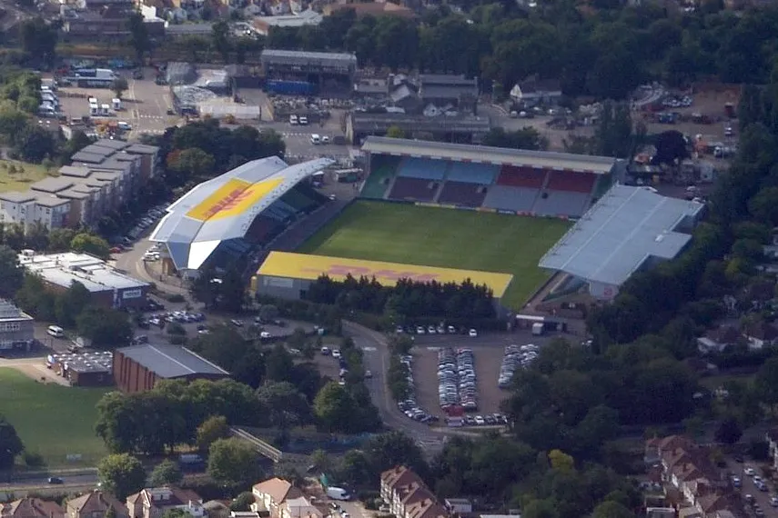 The Stoop Landmark, Richmond upon Thames10 km SE
-
Runnymede Bridge Late Bronze Age Site Historic site, Wraysbury6.9 km SW
Other cities and towns in Hillingdon
-
 Yeading Neighbourhood, Hillingdon7 km NE
-
South Ruislip Neighbourhood, Hillingdon8.8 km NE
-
Ruislip Manor Neighbourhood, Hillingdon10 km NE
-
Sipson Neighbourhood, Hillingdon1.5 km E
-
West Drayton Neighbourhood, Hillingdon1.7 km N
-
Heathrow Villages Neighbourhood, Hillingdon1.8 km SE
Sources & licences
Data last updated: · 2 independent sources