- Population
- 81,952
- 82K
- Elevation
- 5 m
- above sea level
- Local time
- UTC+00:00
- Europe/London · UTC+00:00
- Airports
- SOU Southampton Airport24 km
- BOH Bournemouth Airport50 km
About Gosport
Gosport is a town. Location: Gosport District, Hampshire. Population: 81,952. Elevation: 5 m.
Gosport ( GOS-port) is a town and non-metropolitan district with borough status in Hampshire, England. At the 2021 Census, the town had a population of 70,131 and the district had a population of 81,952. Gosport is situated on a peninsula on the western side of Portsmouth Harbour, opposite the city of Portsmouth, to which it is linked by the Gosport Ferry.
Source: Wikipedia · CC BY-SA 4.0
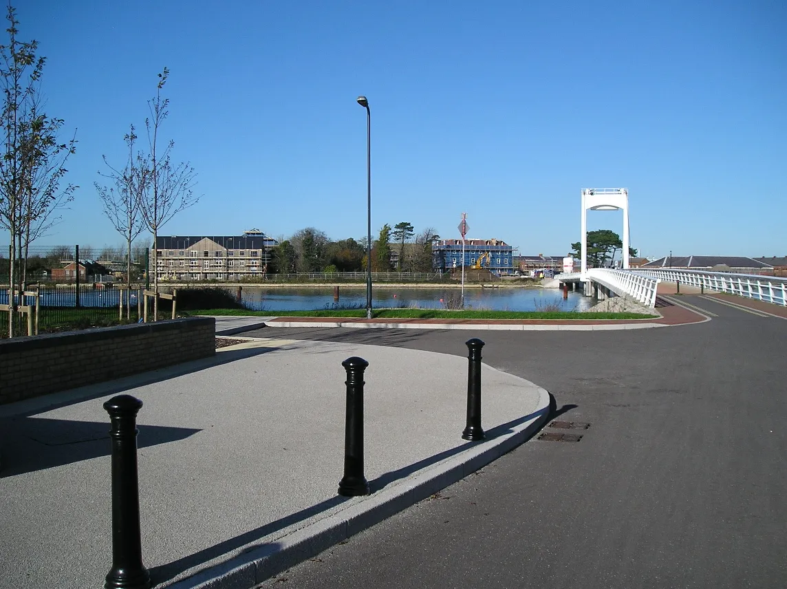
Photos of Gosport
-

Tim Sheerman-Chase · CC BY 4.0 -

Tim Sheerman-Chase · CC BY 2.0 -

Barry Shimmon · CC BY-SA 2.0 -

HantsAV · CC BY-SA 4.0 -

Peter Trimming from Croydon, England · CC BY 2.0


Travel notes for Gosport
From Wikivoyage
Gosport is a town in Hampshire, a short water ride away from Portsmouth. Although not a traditional destination, it does have some attractions if you are interested in maritime history.
Understand+
Local council website
Get in+
By road:
Leave the M27 at Junction 11 and follow the A32. At rush hour, and sometimes at weekends, this is a busy road with long delays.
By ferry:
Gosport Ferry. 05:30-Midnight. Most convenient way to get to Gosport from Portsmouth. A supplement is payable for bikes and e-scooters. Combination tickets are also available giving unlimited bus travel for a day in Hampshire. The website has details of ferry schedules. Round-trip £5.6/adult, £3.6/child, £3.6/senior. (updated Aug 2026)
Source: Wikivoyage · CC BY-SA 4.0 · abridged
Climate of Gosport
Best months for sightseeingBest months for sightseeing: June–August.
This month · November
A cold month
Day 11° · Night 5° · Rain 93 mm
- Hottest month
- July (day 22°)
- Coldest month
- February (night 2°)
- Wettest month
- November (93 mm)
- Driest month
- July (43 mm)
Bars: average monthly low and high temperature. Below: precipitation. Monthly averages for 1970–2000 at about 18 km resolution, adjusted for elevation. Highlighted months are mild and relatively dry. Source: WorldClim 2.1 (CC BY 4.0).
Show values as a table
| Month | Jan | Feb | Mar | Apr | May | Jun | Jul | Aug | Sep | Oct | Nov | Dec |
|---|---|---|---|---|---|---|---|---|---|---|---|---|
| Average high (°C) | 8° | 8° | 10° | 13° | 17° | 19° | 22° | 22° | 19° | 15° | 11° | 9° |
| Average low (°C) | 3° | 2° | 4° | 5° | 8° | 11° | 13° | 13° | 11° | 8° | 5° | 4° |
| Precipitation (mm) | 92 | 60 | 67 | 50 | 46 | 53 | 43 | 52 | 71 | 87 | 93 | 91 |
How to get to Gosport
The nearest airport is Southampton Airport (SOU), 24 km to the northwest as the crow flies. For international flights: London Gatwick Airport (LGW) (77 km). The nearest large city is Portsmouth, 3 km to the east.
Airports
- Southampton Airport (SOU) Southampton 24 kmnorthwest
- Bournemouth Airport (BOH) Bournemouth 50 kmwest
- London Gatwick Airport (LGW) London 77 kmnortheast
Nearby large cities
- Portsmouth Population: 208.1K 3 kmeast
- Southampton Population: 269.8K 23 kmnorthwest
- Basingstoke Population: 107.6K 52 kmnorth
- Worthing Population: 113.9K 53 kmeast
- Bournemouth Population: 163.6K 54 kmwest
Straight-line distances; road distances are longer. Airport data: OurAirports.
Day trips from Gosport
Within 100 km: 343 historic and cultural sites, 605 natural sites, 217 lakes, rivers and coasts.
0–25 km156 places
- Portsea Island Natural site 4 kmE
- Isle of Wight Island 17 kmSW
- Calshot Beach Beach 13 kmW
- Bembridge Beach Beach 12 kmS
25–60 km281 places
- St Nicholas Church Shoreham Attraction 60 kmE
- Avon Beach Beach 43 kmW
- Studland Beach Beach 59 kmW
- Climping Beach Beach 39 kmE
60–100 km728 places
- Brownsea Island Island 61 kmW
- The Marlipins Museum Museum 60 kmE
- Man O'War Beach Beach 83 kmW
- Round Island Island 64 kmW
Straight-line distances.
Gosport and similar cities
Side by side with cities of similar size in the same country: population, elevation and climate.
| Measure | Gosport | Scunthorpe | Halifax | Weston-super-Mare |
|---|---|---|---|---|
| Population | 82K | 81.6K | 82.6K | 82.9K |
| Elevation | 5 m | 46 m | 150 m | 13 m |
| Summer day (hottest month) | 22° | 21° | 20° | 21° |
| Winter night (coldest month) | 2° | 1° | 1° | 2° |
| Annual rainfall | 805 mm | 603 mm | 1,157 mm | 901 mm |
| Best months | Jun–Aug | Jun–Sep | Jun–Aug | Jun–Aug |
| Distance | — | 311 km | 329 km | 143 km |
Climate values are 1970–2000 monthly averages; straight-line distance.
Nearby attractions & nature
Everything nearby-
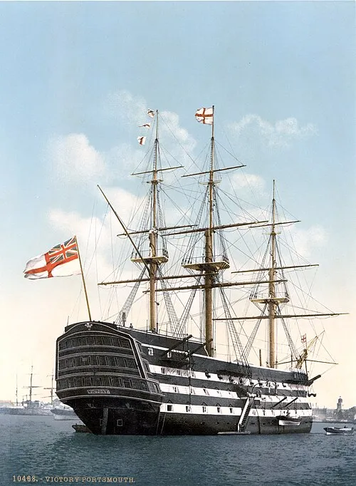 HMS Victory Museum, Portsmouth1.6 km NE
-
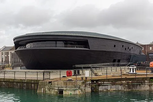 Mary Rose Museum Museum, Portsmouth1.6 km NE
-
Haslar Tower Landmark, Gosport District1 km S
-
Blockhouse Fort Historic site, Gosport District1.3 km SE
-
Gosport Tower Landmark, Gosport District1.3 km SE
-
HMS Warrior Museum, Portsmouth1.4 km E
-
Royal Navy Museum Museum, Portsmouth1.5 km NE
-
Burrow Island Island, Portsmouth1.1 km NE
Sources & licences
Data last updated: · 2 independent sources