- Population
- 45,574
- 45.6K
- Elevation
- 12 m
- above sea level
- Local time
- UTC+00:00
- Europe/London · UTC+00:00
- Airports
- SOU Southampton Airport28 km
- BOH Bournemouth Airport61 km
About Havant
Havant is a town. Location: Havant District, Hampshire. Population: 45,574. Elevation: 12 m.
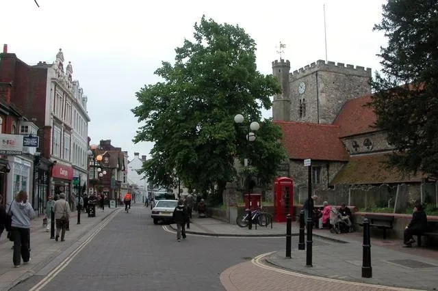
Havant ( HAV-ənt) is a town in the south-east corner of Hampshire, England. Nearby places include Portsmouth to the south-west, Southampton to the west, Waterlooville to north, Chichester to the east and Hayling Island to the south. The wider borough comprises the town (45,826), the resort of Hayling Island, the town of Waterlooville, and the town of Emsworth.
Source: Wikipedia · CC BY-SA 4.0
Photos of Havant
-

Tim Sheerman-Chase · CC BY 2.0 -

Djm-leighpark · CC BY-SA 4.0 -

Davidstephencrowley · CC BY-SA 4.0 -

Davidstephencrowley · CC BY-SA 4.0 -

Graham Mitchell · CC BY 2.0


Travel notes for Havant
From Wikivoyage
Havant is a town in Hampshire on the south coast of England. It's midway between Portsmouth and Chichester and stands at the head of the causeway to Hayling Island. It was a small village (known to the Saxons as "Hamafunta") making parchment and gloves and growing watercress, that grew up post-war when Portsmouth was bombed out and new housing was hurriedly developed here.
Get in+
By car:
Havant is just off the A3(M) Motorway from London and A27 south coast trunk route.
By rail:
1 Havant station is a major stop on the London Waterloo to Portsmouth direct line. It is also served by regular service on the Southern Railway West Coastway route from London Victoria with direct trains from Gatwick Airport, Southampton and Brighton.
By bicycle:
National cycle routes 2 and 22 converge in Havant.
By bus:
Havant is on the Stagecoach Coastliner 700 bus route. One National Express bus from London stops in Havant each day.
Source: Wikivoyage · CC BY-SA 4.0 · abridged
Climate of Havant
Best months for sightseeingBest months for sightseeing: June–August.
This month · November
A cold month
Day 11° · Night 5° · Rain 98 mm
- Hottest month
- July (day 22°)
- Coldest month
- February (night 2°)
- Wettest month
- January (100 mm)
- Driest month
- July (51 mm)
Bars: average monthly low and high temperature. Below: precipitation. Monthly averages for 1970–2000 at about 18 km resolution, adjusted for elevation. Highlighted months are mild and relatively dry. Source: WorldClim 2.1 (CC BY 4.0).
Show values as a table
| Month | Jan | Feb | Mar | Apr | May | Jun | Jul | Aug | Sep | Oct | Nov | Dec |
|---|---|---|---|---|---|---|---|---|---|---|---|---|
| Average high (°C) | 8° | 8° | 10° | 13° | 17° | 19° | 22° | 22° | 19° | 15° | 11° | 9° |
| Average low (°C) | 2° | 2° | 3° | 4° | 8° | 10° | 13° | 12° | 10° | 8° | 5° | 3° |
| Precipitation (mm) | 100 | 65 | 76 | 57 | 52 | 58 | 51 | 60 | 79 | 93 | 98 | 99 |
How to get to Havant
The nearest airport is Southampton Airport (SOU), 28 km to the west as the crow flies. For international flights: London Gatwick Airport (LGW) (65 km). The nearest large city is Portsmouth, 10 km to the southwest.
Airports
- Southampton Airport (SOU) Southampton 28 kmwest
- Bournemouth Airport (BOH) Bournemouth 61 kmwest
- London Gatwick Airport (LGW) London 65 kmnortheast
Nearby large cities
- Portsmouth Population: 208.1K 10 kmsouthwest
- Southampton Population: 269.8K 30 kmwest
- Worthing Population: 113.9K 43 kmeast
- Basingstoke Population: 107.6K 46 kmnorth
- Woking Population: 103.9K 59 kmnortheast
Straight-line distances; road distances are longer. Airport data: OurAirports.
Day trips from Havant
Within 100 km: 536 historic and cultural sites, 649 natural sites, 236 lakes, rivers and coasts.
0–25 km145 places
- Portsea Island Natural site 9 kmSW
- Calshot Beach Beach 24 kmW
- Pagham Beach Beach 20 kmSE
- Bembridge Beach Beach 19 kmS
25–60 km318 places
- Isle of Wight Island 29 kmSW
- St Nicholas Church Shoreham Attraction 49 kmE
- The Marlipins Museum Museum 50 kmE
- Avon Beach Beach 55 kmW
60–100 km958 places
- Brownsea Island Island 72 kmW
- Studland Beach Beach 71 kmW
- Man O'War Beach Beach 94 kmW
- Round Island Island 75 kmW
Straight-line distances.
Nearby attractions & nature
Everything nearby-
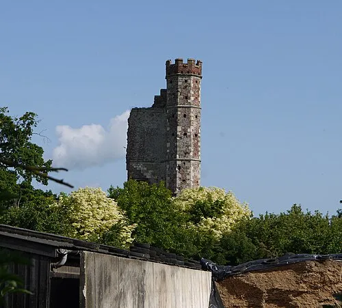 Warblington Castle Historic site, Havant District1.9 km SE
-
Long Island Island, Havant District3 km SW
-
North Binness Island Island, Havant District3.3 km SW
-
Comley Hill Mountain, Rowlands Castle3 km NE
-
Fort Purbrook Historic site, Havant District3.7 km W
-
Farlington Marshes Mediumwave Transmitter Landmark, Portsmouth3.2 km SW
-
Fowley Island Island, Havant District3.7 km SE
-
Baker's Island Island, Havant District3.8 km SW
Sources & licences
Data last updated: · 2 independent sources