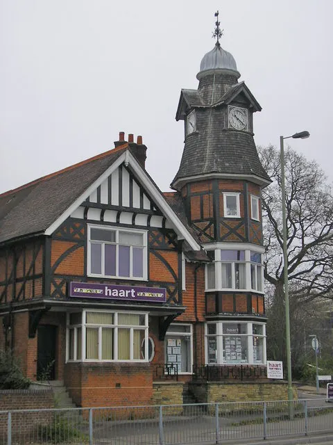
- Population
- 60,652
- 60.7K
- Elevation
- 69 m
- above sea level
- Local time
- UTC+00:00
- Europe/London · UTC+00:00
- Airports
- LHR London Heathrow Airport28 km
- LGW London Gatwick Airport43 km
About Farnborough
Farnborough is a town. Location: Rushmoor District, Hampshire. Population: 60,652. Elevation: 69 m.
Farnborough is a town located in the Rushmoor district of Hampshire, England. It has a population of around 60,652 as of the 2021 census and is an important centre of aviation, engineering and technology. The town is probably best known for its association with aviation, including Samuel Cody, Farnborough Airport, the Farnborough International Airshow, Royal Aircraft Establishment and the Air Accidents Investigation Branch.
Source: Wikipedia · CC BY-SA 4.0
Photos of Farnborough
-

Steve Elliott from UK · CC BY-SA 2.0 -

jabberwock · CC BY-SA 2.0 -

jabberwock · CC BY-SA 2.0 -

Tohaklim · CC BY-SA 4.0 -

Mr Ignavy · CC BY-SA 2.0


Travel notes for Farnborough
From Wikivoyage
Farnborough is a town in the northeastern corner of the English county of Hampshire, adjacent to the borders with Surrey and Berkshire. Once an isolated hamlet, Farnborough grew into a medium-sized town over the course of the 20th century. This growth was built on the back of the aviation industry; Farnborough was the site of the first powered flight in Britain, made by Samuel Cody in 1904. Today, the aerospace, defence and technology industries thrive and aviation heritage is evident all around the town. Farnborough is best known as the home of the biennial Farnborough International Airshow, which has been running since 1948.
The town is also the final resting place of deposed French Emperor Napoléon III and his wife Eugénie de Montijo.
Understand+
Orientation:
The northeasternmost town in Hampshire, Farnborough is contiguous with Aldershot (with which it shares a local authority, the Borough of Rushmoor) to the south, and Camberley (in Surrey) to the north. The town's eastern boundary is marked by the River Blackwater, on the other side of which are the suburban villages Ash, Frimley and Mytchett, which are nowadays considered part of Camberley. Farnborough Airport is immediately to the south-west of the town centre, and west of that is beautiful mixed forest and heathland leading to Fleet.
Although locals divide Farnborough north and south, and into other named areas not relevant here, the visitor may understand it better as a town of four quadrants:
The north-west covers the mostly residential areas known as Cove and Southwood, which were formerly independent villages. Although there are some older buildings, the bulk of this part's urbanisation took place in the mid- to late 20th century, and there is little here of interest to a visitor.
The north-east is separated from the NW by Farnborough Road. This is the oldest part of town and contains the former village centre (Farnborough Street), the parish church of St Peter, St Michael's Abbey and Farnborough Hill House (Farnborough Park).
The south-east was Farnborough's 19th-century town centre, and is still today predominantly Victorian in character, known as South Farnborough or North Camp. It is mixed residential and commercial, and has many of the best restaurants and pubs.
The south-west is dominated by Farnborough Airport, and the high-tech industry, business parks and hotels which surround it. This is also the location of the RAE Heritage Quarter and FAST Museum.
The modern town centre sits where these four quadrants meet.
Early history:
Get in+
Farnborough is 35 miles (56 km) south-west of central London.
By car:
Farnborough is served by the M3 motorway (junctions 4 and 4a) which runs from London to Southampton. The town is about an hour's drive from central London, and 15 minutes from junction 12 of the M25. The A331 Blackwater Valley Road is a fast dual carriageway running from junction 4 along the eastern edge of Farnborough and Aldershot to the A31 Hog's Back Road (which links the A3 at Guildford with the M3 at Winchester).
All listed 'see' and 'do' attractions, and most of the sleep listings, have on-site or nearby parking, and visitors to the town in general won't have trouble finding a car park. The Meads multi-storey car park on Kingsmead is particularly helpful, as are the Pinehurst car parks slightly further down the same road. Less useful is the "secret car park" on the roof of Sainsbury's; since it was painted up, it has only been accessible to pedestrians, as a ramp up from the road was never built! Its 'discovery' by a reporter in 2016 prompted much derision in the national media.
By train:
Farnborough is served by five railway stations, listed in decreasing order of utility:
Source: Wikivoyage · CC BY-SA 4.0 · abridged
Climate of Farnborough
Best months for sightseeingBest months for sightseeing: June–August.
This month · November
A cold month
Day 10° · Night 4° · Rain 78 mm
- Hottest month
- July (day 22°)
- Coldest month
- February (night 2°)
- Wettest month
- December (81 mm)
- Driest month
- July (46 mm)
Bars: average monthly low and high temperature. Below: precipitation. Monthly averages for 1970–2000 at about 18 km resolution, adjusted for elevation. Highlighted months are mild and relatively dry. Source: WorldClim 2.1 (CC BY 4.0).
Show values as a table
| Month | Jan | Feb | Mar | Apr | May | Jun | Jul | Aug | Sep | Oct | Nov | Dec |
|---|---|---|---|---|---|---|---|---|---|---|---|---|
| Average high (°C) | 7° | 8° | 10° | 13° | 17° | 20° | 22° | 22° | 18° | 14° | 10° | 8° |
| Average low (°C) | 2° | 2° | 3° | 4° | 7° | 10° | 12° | 12° | 10° | 7° | 4° | 3° |
| Precipitation (mm) | 80 | 53 | 61 | 53 | 53 | 58 | 46 | 57 | 70 | 78 | 78 | 81 |
How to get to Farnborough
The nearest airport is London Heathrow Airport (LHR), 28 km to the northeast as the crow flies. The nearest large city is Woking, 14 km to the east.
Airports
- London Heathrow Airport (LHR) London 28 kmnortheast
- London Gatwick Airport (LGW) London 43 kmeast
- Southampton Airport (SOU) Southampton 57 kmsouthwest
Nearby large cities
- Woking Population: 103.9K 14 kmeast
- Basingstoke Population: 107.6K 23 kmwest
- Reading Population: 318K 23 kmnorthwest
- Slough Population: 164.8K 26 kmnortheast
- High Wycombe Population: 133.2K 37 kmnorth
Straight-line distances; road distances are longer. Airport data: OurAirports.
Day trips from Farnborough
Within 100 km: 815 historic and cultural sites, 732 natural sites, 292 lakes, rivers and coasts.
0–25 km164 places
- The Lynch Island 24 kmNW
- Holm Island Island 22 kmNE
- Windsor Racecourse Island Island 23 kmN
- Loddon Island Island 21 kmN
25–60 km796 places
- Portsea Island Natural site 59 kmS
- White Hart Lane Landmark 59 kmNE
- Climping Beach Beach 57 kmS
- Pagham Beach Beach 59 kmS
60–100 km879 places
- Isle of Wight Island 78 kmSW
- Spotlites @ Kings Theatre Attraction 90 kmE
- St Nicholas Church Shoreham Attraction 60 kmSE
- The Marlipins Museum Museum 61 kmSE
Straight-line distances.
Farnborough and similar cities
Side by side with cities of similar size in the same country: population, elevation and climate.
| Measure | Farnborough | Hereford | Bangor | Bury |
|---|---|---|---|---|
| Population | 60.7K | 60.4K | 61K | 61K |
| Elevation | 69 m | 61 m | 19 m | 93 m |
| Summer day (hottest month) | 22° | 22° | 20° | 20° |
| Winter night (coldest month) | 2° | 1° | 1° | 2° |
| Annual rainfall | 768 mm | 707 mm | 850 mm | 1,054 mm |
| Best months | Jun–Aug | Jun–Aug | Jun–Aug | Jun–Aug |
| Distance | — | 160 km | 499 km | 277 km |
Climate values are 1970–2000 monthly averages; straight-line distance.
Nearby attractions & nature
Everything nearby-
Farnborough Air Sciences Trust Museum Museum, Rushmoor District1.3 km S
-
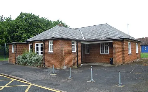 Aldershot Military Museum Museum, Rushmoor District2.7 km S
-
Ramillies Park Natural site, Rushmoor District2.7 km SE
-
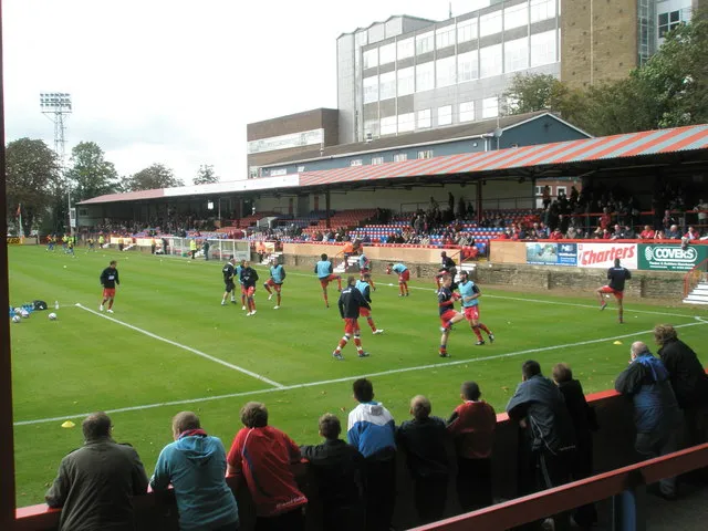 Recreation Ground Landmark, Rushmoor District5.1 km S
-
Hawley Hill Mountain, Blackwater and Hawley3.3 km NW
-
Romping Downs Mountain, Normandy4.9 km SE
-
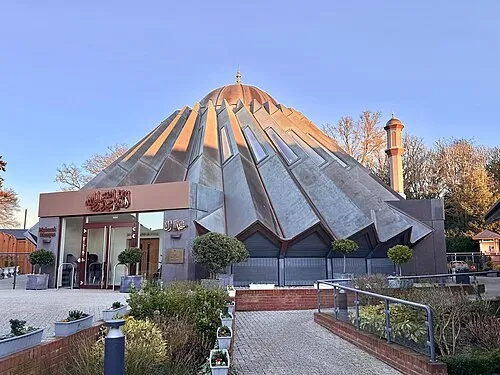 Mubarak Mosque Attraction, Tilford12 km S
-
Bricksbury Hill Mountain, Farnham7.5 km SW
Sources & licences
Data last updated: · 2 independent sources