- Elevation
- 272 m
- above sea level
- Local time
- UTC+00:00
- Europe/London · UTC+00:00
- Airports
- BHX Birmingham Airport61 km
- BRS Bristol Airport78 km
About Swinyard Hill
Swinyard Hill is a mountain. Location: Eastnor, Herefordshire. Elevation: 272 m. The best months to visit are June–August. The nearest airport is Birmingham Airport (61 km). Nearby sights include Midsummer Hill and Herefordshire Beacon.
Photos of Swinyard Hill
-
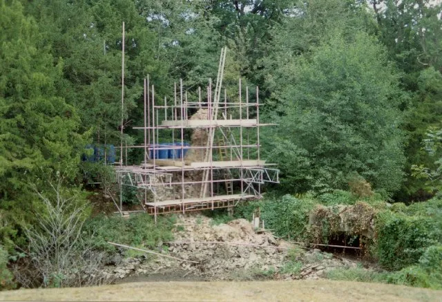
Bronsil Castle Bob Embleton · CC BY-SA 2.0

Climate of Swinyard Hill
Best months for sightseeingBest months for sightseeing: June–August.
This month · November
A cold month
Day 9° · Night 2° · Rain 82 mm
- Hottest month
- July (day 20°)
- Coldest month
- February (night 0°)
- Wettest month
- December (90 mm)
- Driest month
- July (54 mm)
Bars: average monthly low and high temperature. Below: precipitation. Monthly averages for 1970–2000 at about 18 km resolution, adjusted for elevation. Highlighted months are mild and relatively dry. Source: WorldClim 2.1 (CC BY 4.0).
Show values as a table
| Month | Jan | Feb | Mar | Apr | May | Jun | Jul | Aug | Sep | Oct | Nov | Dec |
|---|---|---|---|---|---|---|---|---|---|---|---|---|
| Average high (°C) | 6° | 6° | 8° | 11° | 15° | 17° | 20° | 19° | 16° | 13° | 9° | 7° |
| Average low (°C) | 0° | 0° | 1° | 2° | 5° | 8° | 10° | 10° | 8° | 5° | 2° | 1° |
| Precipitation (mm) | 88 | 61 | 69 | 59 | 58 | 67 | 54 | 71 | 76 | 78 | 82 | 90 |
How to get to Swinyard Hill
The nearest airport is Birmingham Airport (BHX), 61 km to the northeast as the crow flies. The nearest large city is Worcester, 18 km to the northeast.
Airports
- Birmingham Airport (BHX) Birmingham, West Midlands 61 kmnortheast
- Bristol Airport (BRS) Bristol 78 kmsouth
- Cardiff International Airport (CWL) Cardiff 100 kmsouthwest
Nearby large cities
- Worcester Population: 101.7K 18 kmnortheast
- Gloucester Population: 132.4K 21 kmsouth
- Cheltenham Population: 118.8K 25 kmsoutheast
- Dudley Population: 199.1K 54 kmnorth
- Solihull Population: 126.6K 56 kmnortheast
Straight-line distances; road distances are longer. Airport data: OurAirports.
Day trips from Swinyard Hill
Within 100 km: 1,009 historic and cultural sites, 1,642 natural sites, 144 lakes, rivers and coasts.
0–25 km180 places
- Alney Island Island 21 kmS
- Bevere Island Island 22 kmN
- Kemerton Lake 18 kmE
- Hobbs Mountain 20 kmS
25–60 km799 places
- Glover's Island Island 28 kmE
- The Island Island 35 kmNW
- Withymoor Island Island 53 kmN
- Friday Island Island 50 kmSE
60–100 km1,816 places
- Steep Holm Island 94 kmSW
- Flat Holm Island 91 kmSW
- Barry Island Island 97 kmSW
- Sully Island Island 93 kmSW
Straight-line distances.
Nearest towns and villages
-
Wayend Street Village, Eastnor2.6 km SW
-
Hollybush Neighbourhood, Castlemorton1.7 km S
-
Little Malvern Village, Malvern Hills District1.9 km NE
-
Eastnor Village, Eastnor3.2 km SW
-
Evendine Village, Colwall2.7 km N
-
Castlemorton Village, Malvern Hills District3 km E
Nearby attractions & nature
Everything nearby-
Midsummer Hill Mountain, Eastnor1.1 km S
-
Herefordshire Beacon Mountain, Colwall1.5 km N
-
Ragged Stone Hill Mountain, Eastnor2.2 km S
-
Bronsil Castle Historic site, Eastnor1.9 km SW
-
Chase End Hill Mountain, Berrow3.1 km S
-
Howler's Heath Mountain, Bromesberrow3.2 km S
-
Pinnacle Hill Mountain, Malvern Wells3.6 km N
-
Eastnor Hill Mountain, Eastnor3.6 km W
Sources & licences
Data last updated: