Eaton Tregoz Camp Field
Located in Foy, Herefordshire Coordinates: 51°57′03″ N 2°34′32″ W
- Local time
- UTC+00:00
- Europe/London · UTC+00:00
- Elevation
- 55 m
- above sea level
- Airports
- BRS Bristol Airport64 km
- BHX Birmingham Airport80 km
About Eaton Tregoz Camp Field
Eaton Tregoz Camp Field is a historic site. Location: Foy, Herefordshire. The best months to visit are June–August. The nearest airport is Bristol Airport (64 km). Nearby sights include How Caple Mound and Perrystone Hill.
Climate of Eaton Tregoz Camp Field
Best months for sightseeingBest months for sightseeing: June–August.
This month · November
A cold month
Day 10° · Night 5° · Rain 73 mm
- Hottest month
- July (day 21°)
- Coldest month
- February (night 2°)
- Wettest month
- December (82 mm)
- Driest month
- July (45 mm)
Bars: average monthly low and high temperature. Below: precipitation. Monthly averages for 1970–2000 at about 18 km resolution, adjusted for elevation. Highlighted months are mild and relatively dry. Source: WorldClim 2.1 (CC BY 4.0).
Show values as a table
| Month | Jan | Feb | Mar | Apr | May | Jun | Jul | Aug | Sep | Oct | Nov | Dec |
|---|---|---|---|---|---|---|---|---|---|---|---|---|
| Average high (°C) | 7° | 7° | 10° | 12° | 16° | 19° | 21° | 21° | 18° | 14° | 10° | 8° |
| Average low (°C) | 2° | 2° | 3° | 4° | 7° | 10° | 13° | 12° | 10° | 8° | 5° | 3° |
| Precipitation (mm) | 81 | 56 | 61 | 54 | 55 | 59 | 45 | 64 | 70 | 70 | 73 | 82 |
How to get to Eaton Tregoz Camp Field
The nearest airport is Bristol Airport (BRS), 64 km to the south as the crow flies. The nearest large city is Gloucester, 25 km to the east.
Airports
- Bristol Airport (BRS) Bristol 64 kmsouth
- Birmingham Airport (BHX) Birmingham, West Midlands 80 kmnortheast
- Cardiff International Airport (CWL) Cardiff 81 kmsouthwest
Nearby large cities
- Gloucester Population: 132.4K 25 kmeast
- Cheltenham Population: 118.8K 35 kmeast
- Worcester Population: 101.7K 36 kmnortheast
- Newport Population: 161.5K 50 kmsouthwest
- Bristol Population: 479K 55 kmsouth
Straight-line distances; road distances are longer. Airport data: OurAirports.
Day trips from Eaton Tregoz Camp Field
Within 100 km: 1,006 historic and cultural sites, 1,884 natural sites, 145 lakes, rivers and coasts.
0–25 km231 places
- Alney Island Island 24 kmSE
- Hobbs Mountain 12 kmSE
- Worcestershire Beacon Mountain 24 kmNE
- May Hill Mountain 11 kmSE
25–60 km934 places
- Glover's Island Island 46 kmE
- Denny Island Island 49 kmS
- The Island Island 36 kmN
- Bevere Island Island 39 kmNE
60–100 km1,870 places
- Kilve Beach Beach 96 kmSW
- Steep Holm Island 77 kmSW
- Flat Holm Island 74 kmSW
- Barry Island Island 79 kmSW
Straight-line distances.
Nearby attractions & nature
Everything nearby-
How Caple Mound Historic site, How Caple2.4 km N
-
Perrystone Hill Mountain, Yatton3 km E
-
Capel Tump Historic site, Kings Caple4.7 km W
-
Upton Court Ringwork Historic site, Upton Bishop4.7 km E
-
Court Farm Motte Historic site, Sollers Hope5 km N
-
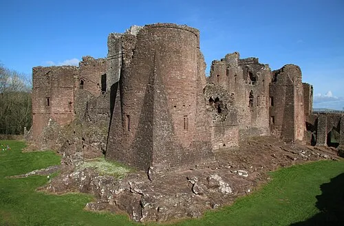 Goodrich Castle Historic site, Goodrich8.7 km S
-
Ridge Hill Transmitting Station Landmark, Much Marcle5.7 km NE
-
Penyard Castle Historic site, Weston under Penyard5.8 km S
Nearest towns and villages
-
Hill of Eaton Village, Foy0.6 km S
-
Brick End Village, Foy0.7 km NW
-
Foy Village, Foy0.9 km W
-
Ross on Wye Town, Ross Rural3.9 km S
Sources & licences
Data last updated: