Sellack
Located in Herefordshire, England Coordinates: 51°56′36″ N 2°37′43″ W
- Elevation
- 70 m
- above sea level
- Local time
- UTC+00:00
- Europe/London · UTC+00:00
- Places inside
- 6
- listed under Sellack
About Sellack
Sellack is a municipality. Location: Herefordshire, England. Elevation: 70 m.
In comparison
- Nearest larger town: Ross on Wye, 5 km SE
- 32 sights and natural places within 10 km Capel Tump, Eaton Tregoz Camp Field
- Listed here: Village: 6
Places in Sellack
6 places-
Baysham Village
-
Lower Grove Common Village
-
Pict's Cross Village
-
Sellack Village
-
Strangford Village
-
Upper Grove Common Village
Nearby attractions & nature
Everything nearby-
Capel Tump Historic site, Kings Caple1.7 km NW
-
Chapel Tump Historic site, Hentland4.4 km SW
-
Eaton Tregoz Camp Field Historic site, Foy3.7 km E
-
How Caple Mound Historic site, How Caple5.4 km NE
-
Kidley Hill Mountain, Little Dewchurch4.9 km N
-
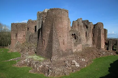 Goodrich Castle Historic site, Goodrich7.4 km S
-
Chase Wood Hill Mountain, Ross Rural5.9 km SE
-
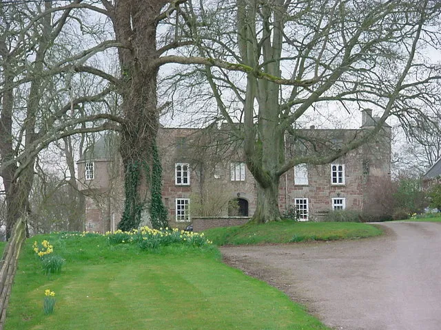 Treago Castle Historic site, St. Weonards8.6 km SW
Sources & licences
Data last updated: