Walford, Letton and Newton
Located in Herefordshire, England Coordinates: 52°20′04″ N 2°54′32″ W
- Elevation
- 131 m
- above sea level
- Local time
- UTC+00:00
- Europe/London · UTC+00:00
- Places inside
- 7
- listed under Walford, Letton and Newton
- Airports
- BHX Birmingham Airport80 km
- BRS Bristol Airport107 km
About Walford, Letton and Newton
Walford, Letton and Newton is a municipality. Location: Herefordshire, England. Elevation: 131 m. The best months to visit are June–August. The nearest airport is Birmingham Airport (80 km). Nearby sights include Brampton Bryan Castle and Wigmore Rolls.
Photos of Walford, Letton and Newton
-
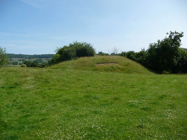
Lingen Castle Jeremy Bolwell · CC BY-SA 2.0 -
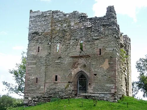
Hopton Castle Ostrich · CC BY-SA 3.0 -
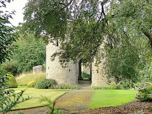
Brampton Bryan Castle Philip Pankhurst · CC BY-SA 2.0


Climate of Walford, Letton and Newton
Best months for sightseeingBest months for sightseeing: June–August.
This month · November
A cold month
Day 10° · Night 4° · Rain 93 mm
- Hottest month
- July (day 21°)
- Coldest month
- February (night 1°)
- Wettest month
- January (101 mm)
- Driest month
- July (55 mm)
Bars: average monthly low and high temperature. Below: precipitation. Monthly averages for 1970–2000 at about 18 km resolution, adjusted for elevation. Highlighted months are mild and relatively dry. Source: WorldClim 2.1 (CC BY 4.0).
Show values as a table
| Month | Jan | Feb | Mar | Apr | May | Jun | Jul | Aug | Sep | Oct | Nov | Dec |
|---|---|---|---|---|---|---|---|---|---|---|---|---|
| Average high (°C) | 7° | 7° | 9° | 12° | 16° | 18° | 21° | 20° | 17° | 13° | 10° | 8° |
| Average low (°C) | 1° | 1° | 2° | 4° | 6° | 9° | 11° | 11° | 9° | 6° | 4° | 2° |
| Precipitation (mm) | 101 | 72 | 77 | 61 | 59 | 67 | 55 | 72 | 79 | 87 | 93 | 101 |
How to get to Walford, Letton and Newton
The nearest airport is Birmingham Airport (BHX), 80 km to the east as the crow flies. The nearest large city is Telford, 49 km to the northeast.
Airports
- Birmingham Airport (BHX) Birmingham, West Midlands 80 kmeast
- Bristol Airport (BRS) Bristol 107 kmsouth
- Cardiff International Airport (CWL) Cardiff 109 kmsouth
Nearby large cities
- Telford Population: 155.6K 49 kmnortheast
- Worcester Population: 101.7K 50 kmeast
- Dudley Population: 199.1K 59 kmeast
- Wolverhampton Population: 263.7K 60 kmnortheast
- West Bromwich Population: 103.1K 65 kmeast
Straight-line distances; road distances are longer. Airport data: OurAirports.
Day trips from Walford, Letton and Newton
Within 100 km: 1,006 historic and cultural sites, 2,544 natural sites, 150 lakes, rivers and coasts.
0–25 km351 places
- The Island Island 15 kmSE
- Titterstone Clee Hill Mountain 22 kmE
- Beacon Hill Mountain 21 kmW
- Great Rhos Mountain 21 kmW
25–60 km1,276 places
- Bevere Island Island 47 kmE
- Withymoor Island Island 59 kmE
- Pen-y-gareg Reservoir Lake 48 kmW
- Llangorse Lake Lake 51 kmSW
60–100 km2,073 places
- Alney Island Island 69 kmSE
- Glover's Island Island 70 kmE
- Crescent Wood Island Island 82 kmE
- Denny Island Island 90 kmS
Straight-line distances.
Places in Walford, Letton and Newton
7 placesCities & villages3
Mountains & nature1
- The Mount · Mountain
Heritage & sights3
- Harris Tump · Historic site
- Letton Mound · Historic site
- Walford Motte · Historic site
Nearby attractions & nature
Everything nearby-
Brampton Bryan Castle Historic site, Brampton Bryan1.8 km NW
-
Wigmore Rolls Historic site, Adforton1.1 km SE
-
Lower Pedwardine Historic site, Brampton Bryan1.5 km SW
-
Upper Pedwardine Historic site, Brampton Bryan1.7 km W
-
Adforton Motte Historic site, Adforton2.2 km E
-
Upper Buckton Farm Mound Historic site, Buckton and Coxall2.1 km N
-
Birtley Earthworks Historic site, Lingen2.2 km SW
-
Wigmore Rolls Mountain, Wigmore2.3 km SE
Sources & licences
Data last updated: