- Elevation
- 449 m
- above sea level
- Local time
- UTC+00:00
- Europe/London · UTC+00:00
- Airports
- LBA Leeds Bradford Airport38 km
- MAN Manchester Airport44 km
About Thieveley Pike
Thieveley Pike is a mountain. Location: Cliviger, Burnley District. Elevation: 449 m. The best months to visit are July–August. The nearest airport is Leeds Bradford Airport (38 km). Nearby sights include White Hill and Carr and Craggs Moor.
Photos of Thieveley Pike
-

Turf Moor Adam Haworth · CC BY 2.0

Climate of Thieveley Pike
Best months for sightseeingBest months for sightseeing: July–August.
This month · November
A wet month
Day 7° · Night 2° · Rain 143 mm
- Hottest month
- July (day 17°)
- Coldest month
- January (night -1°)
- Wettest month
- November (143 mm)
- Driest month
- May (75 mm)
Bars: average monthly low and high temperature. Below: precipitation. Monthly averages for 1970–2000 at about 18 km resolution, adjusted for elevation. Highlighted months are mild and relatively dry. Source: WorldClim 2.1 (CC BY 4.0).
Show values as a table
| Month | Jan | Feb | Mar | Apr | May | Jun | Jul | Aug | Sep | Oct | Nov | Dec |
|---|---|---|---|---|---|---|---|---|---|---|---|---|
| Average high (°C) | 4° | 4° | 6° | 9° | 13° | 15° | 17° | 17° | 14° | 11° | 7° | 5° |
| Average low (°C) | -1° | -1° | 0° | 2° | 5° | 8° | 10° | 9° | 8° | 5° | 2° | 0° |
| Precipitation (mm) | 136 | 91 | 110 | 80 | 75 | 87 | 87 | 107 | 113 | 137 | 143 | 143 |
How to get to Thieveley Pike
The nearest airport is Leeds Bradford Airport (LBA), 38 km to the east as the crow flies. The nearest large city is Burnley, 7 km to the north.
Airports
- Leeds Bradford Airport (LBA) Leeds, West Yorkshire 38 kmeast
- Manchester Airport (MAN) Manchester, Greater Manchester 44 kmsouth
- Liverpool John Lennon Airport (LPL) Liverpool 63 kmsouthwest
Nearby large cities
- Burnley Population: 149.4K 7 kmnorth
- Blackburn Population: 146.5K 19 kmwest
- Oldham Population: 237.1K 23 kmsouth
- Bolton Population: 141.3K 23 kmsouthwest
- Salford Population: 129.8K 29 kmsouth
Straight-line distances; road distances are longer. Airport data: OurAirports.
Day trips from Thieveley Pike
Within 100 km: 683 historic and cultural sites, 1,492 natural sites, 248 lakes, rivers and coasts.
0–25 km152 places
- The Island Island 22 kmSW
- Pickup Bank Reservoir Lake 15 kmW
- Hollingworth Lake Lake 15 kmSE
- Winter Hill (boundary) Mountain 24 kmSW
25–60 km725 places
- Great Britain Island 32 kmNE
- Ainsdale Beach Beach 59 kmW
- St Anne's Beach Beach 55 kmW
- Bird Island Island 32 kmNW
60–100 km1,546 places
- High Moor Mountain 81 kmNW
- Thurstaston Beach Beach 77 kmSW
- Formby Beach Beach 63 kmW
- Roanhead Beach Beach 84 kmNW
Straight-line distances.
Nearest towns and villages
-
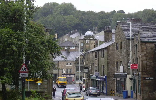 Bacup Town, Rossendale District4.1 km S
-
Holme Chapel Neighbourhood, Cliviger1.6 km N
-
Cornholme Village, Todmorden3.9 km E
-
Southward Bottom Neighbourhood, Cliviger2.2 km N
-
Weir Village, Rossendale District1.6 km S
-
Holme Chapel Village, Cliviger1.5 km N
Nearby attractions & nature
Everything nearby-
White Hill Mountain, Cliviger2.4 km W
-
Carr and Craggs Moor Mountain, Todmorden3 km SE
-
Crown Point Mountain, Habergham Eaves4.2 km NW
-
Forest of Rossendale Natural site, England4.4 km SW
-
Black Hameldon Mountain, Heptonstall4.7 km NE
-
Freeholds Top Mountain, Todmorden6.3 km SE
-
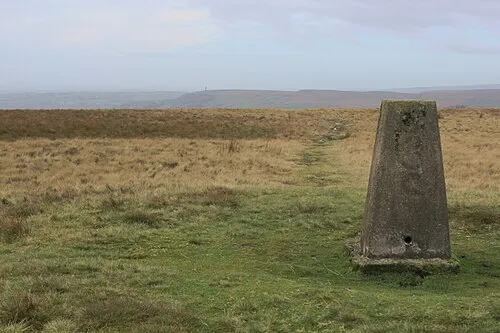 Cowpe Lowe Mountain, Rossendale District8.1 km SW
-
Rossendale Valley Natural site, England6.5 km SW
Sources & licences
Data last updated: