Little Singleton
Located in Singleton, Fylde District Coordinates: 53°50′52″ N 2°57′04″ W
- Elevation
- 24 m
- above sea level
- Local time
- UTC+00:00
- Europe/London · UTC+00:00
About Little Singleton
Little Singleton is a village. Location: Singleton, Fylde District. Elevation: 24 m.
In comparison
- Nearest larger town: Poulton-le-Fylde, 3 km SW
- 34 sights and natural places within 10 km St John the Evangelist Roman Catholic Church, Poulton, The English Martyrs Roman Catholic Church
Nearby attractions & nature
Everything nearby-
St John the Evangelist Roman Catholic Church, Poulton Attraction, Wyre District2.3 km W
-
The English Martyrs Roman Catholic Church Attraction, Wyre District3.3 km SW
-
St Martin de Porres and St Hilda of Whitby Roman Catholic Church Attraction, Wyre District3.8 km W
-
St Nicholas Owen Roman Catholic Church Attraction, Wyre District3.9 km NW
-
Warbreck Hill Mountain, Blackpool6.2 km W
-
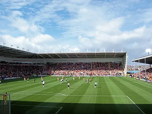 Bloomfield Road Landmark, Blackpool8 km SW
Sources & licences
Data last updated: