Vauxhall
Located in Liverpool, England Coordinates: 53°25′16″ N 2°59′23″ W
- Population
- 4,821
- 4.8K
- Elevation
- 18 m
- above sea level
- Local time
- UTC+00:00
- Europe/London · UTC+00:00
About Vauxhall
Vauxhall is a neighbourhood. Location: Liverpool, England. Population: 4,821.
Vauxhall is an inner city district of Liverpool, England, north of the city centre, bounded by Kirkdale to the north and Everton to the east, with the docks and River Mersey running along the west side. Vauxhall is in the Liverpool City Council ward of Kirkdale and the edge of the Central, Liverpool ward, although previously it was a ward itself. In the 1841 Liverpool Census the area was covered by two wards Scotland and Vauxhall. According to the 2001 Census, Vauxhall had a population of 6,699.
Read more on Wikipedia Text: Wikipedia contributors · CC BY-SA 4.0 · shortened
In comparison
- No. 23 of 27 places in Liverpool by population
- Nearest larger town: Liverpool, 1 km SE
- 31 sights and natural places within 10 km Vauxhall Chimney (historical), World Museum Liverpool
Climate of Vauxhall
Best months for sightseeing: June–August.
| Month | Jan | Feb | Mar | Apr | May | Jun | Jul | Aug | Sep | Oct | Nov | Dec |
|---|---|---|---|---|---|---|---|---|---|---|---|---|
| Average high (°C) | 7° | 7° | 10° | 12° | 16° | 18° | 21° | 20° | 18° | 14° | 10° | 8° |
| Average low (°C) | 2° | 1° | 3° | 4° | 7° | 10° | 13° | 12° | 10° | 7° | 4° | 3° |
| Precipitation (mm) | 68 | 48 | 60 | 50 | 51 | 58 | 55 | 70 | 74 | 86 | 85 | 78 |
Monthly averages for 1970–2000 at about 18 km resolution, adjusted for elevation. Highlighted months are mild and relatively dry. Source: WorldClim 2.1 (CC BY 4.0).
Airports nearest to Vauxhall
- Liverpool John Lennon Airport (LPL) Liverpool 13 km
- Manchester Airport (MAN) Manchester, Greater Manchester 48 km
- Leeds Bradford Airport (LBA) Leeds, West Yorkshire 101 km
Straight-line distance; airports with scheduled flights only. Source: OurAirports (public domain).
Nearby attractions & nature
Everything nearby-
Vauxhall Chimney (historical) Landmark, Liverpool0.4 km S
-
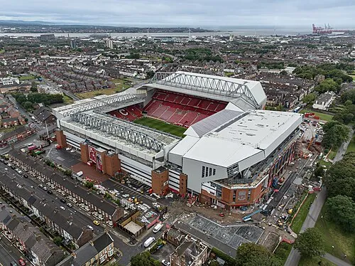 Anfield Landmark, Liverpool2.2 km NE
-
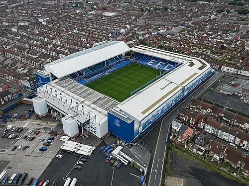 Goodison Park Landmark, Liverpool2.5 km NE
-
World Museum Liverpool Museum, Liverpool1.3 km SE
-
Maritime Mercantile City Historic site, Liverpool1.6 km S
-
Liverpool Landmark, Liverpool1.7 km S
Sources & licences
Data last updated: · 2 independent sources