Crumpsall
Located in Manchester, England Coordinates: 53°31′06″ N 2°14′40″ W
- Population
- 11,363
- 11.4K
- Elevation
- 80 m
- above sea level
- Local time
- UTC+00:00
- Europe/London · UTC+00:00
About Crumpsall
Crumpsall is a neighbourhood. Location: Manchester, England. Population: 11,363.
Crumpsall is an outer suburb and electoral ward of Manchester, in Greater Manchester, England, 3 miles (5 km) north of Manchester city centre, bordered by Cheetham Hill, Blackley, Harpurhey, Broughton, and Prestwich. The population at the 2011 census was 15,959. Historically part of Lancashire, Crumpsall was a township within the parish of Manchester, Salford hundred. North Manchester General Hospital is in Crumpsall.
Read more on Wikipedia Text: Wikipedia contributors · CC BY-SA 4.0 · shortened
At a glance
- Built
- 1973
Source: Wikidata
In comparison
- No. 13 of 16 places in Manchester by population
- Nearest larger town: Broughton, 2 km SW
- 41 sights and natural places within 10 km Heaton Park BT Tower, Heaton Park
Nearby attractions & nature
Everything nearby-
Heaton Park BT Tower Landmark, Manchester2.5 km N
-
Heaton Park Mountain, Manchester2.5 km N
-
Manchester Evening News Arena Landmark, Manchester3.4 km S
-
River Irk River, England3.9 km S
-
Urbis Manchester Museum, Manchester3.6 km S
-
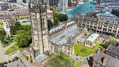 Manchester Cathedral Attraction, Manchester3.7 km S
Sources & licences
Data last updated: · 2 independent sources