Hulme
Located in Manchester, England Coordinates: 53°27′57″ N 2°14′56″ W
- Population
- 8,932
- 8.9K
- Elevation
- 36 m
- above sea level
- Local time
- UTC+00:00
- Europe/London · UTC+00:00
About Hulme
Hulme is a neighbourhood. Location: Manchester, England. Population: 8,932.
Hulme () is an inner city area and electoral ward of Manchester, in Greater Manchester, England, immediately south of Manchester city centre. It has a significant industrial heritage. Historically in Lancashire, the name Hulme is derived from the Old Norse word for a small island, or land surrounded by water or marsh, indicating that it may have been first settled by Norse invaders in the period of the Danelaw.
Read more on Wikipedia Text: Wikipedia contributors · CC BY-SA 4.0 · shortened
At a glance
- Area
- 2.2 km²
Source: Wikidata
In comparison
- No. 15 of 16 places in Manchester by population
- Nearest larger town: Moss Side, 1 km SE
- 38 sights and natural places within 10 km Halume Park, Darul Amaan Mosque
Nearby attractions & nature
Everything nearby-
Halume Park Natural site, Manchester0.3 km NW
-
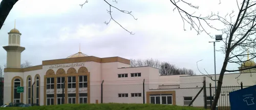 Darul Amaan Mosque Attraction, Manchester0.7 km SE
-
Manchester Museum (oxford road) Museum, Manchester1 km E
-
Manchester Central Landmark, Manchester1.2 km N
-
Saint Georges Park Natural site, Manchester1 km W
-
Manchester Museum of Science and Industry (MOSI) Museum, Manchester1.3 km N
Sources & licences
Data last updated: · 2 independent sources