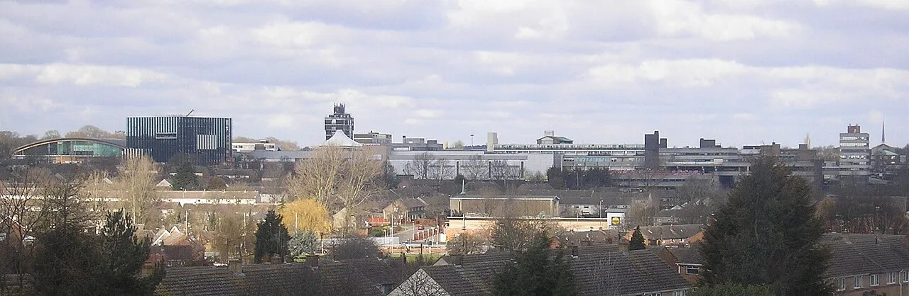
- Population
- 68,164
- 68.2K
- Elevation
- 114 m
- above sea level
- Local time
- UTC+00:00
- Europe/London · UTC+00:00
- Airports
- EMA East Midlands Airport57 km
- BHX Birmingham Airport72 km
About Corby
Corby is a town. Location: Corby District, North Northamptonshire. Population: 68,164. Elevation: 114 m.
Corby is a town and civil parish in the North Northamptonshire district, in Northamptonshire, England, 23 miles (37 km) northeast of Northampton. In 2021, the parish had a population of 62,341, while the wider built-up area had a population of 68,160. From 1974 to 2021, it was the administrative headquarters of the Borough of Corby; at the 2021 census, the former borough had a population of 75,571.
Source: Wikipedia · CC BY-SA 4.0
Photos of Corby
-

Forester2009 · CC BY-SA 3.0 -

David Howard · CC BY-SA 2.0 -
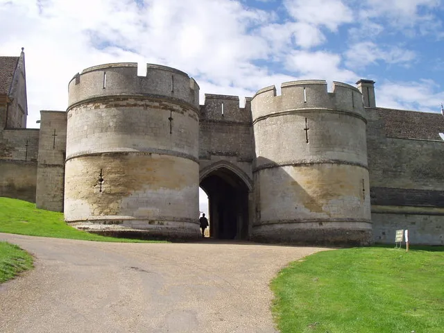
Rockingham Castle Brian Coleman · CC BY-SA 2.0


Travel notes for Corby
From Wikivoyage
Corby is a town of 57,000 people (2011) in Northamptonshire, England.
Understand+
Corby was once known as "Little Scotland" due to the large number of Scottish workers who came to Corby for its steelworks.
Get in+
By train:
1 Corby station is on the Oakham-Kettering line, which is served by one train per hour to and from London St Pancras via Kettering, Wellingborough, Bedford and Luton.
Source: Wikivoyage · CC BY-SA 4.0 · abridged
Climate of Corby
Best months for sightseeingBest months for sightseeing: June–August.
This month · November
A cold month
Day 9° · Night 3° · Rain 57 mm
- Hottest month
- July (day 21°)
- Coldest month
- February (night 1°)
- Wettest month
- August (60 mm)
- Driest month
- February (41 mm)
Bars: average monthly low and high temperature. Below: precipitation. Monthly averages for 1970–2000 at about 18 km resolution, adjusted for elevation. Highlighted months are mild and relatively dry. Source: WorldClim 2.1 (CC BY 4.0).
Show values as a table
| Month | Jan | Feb | Mar | Apr | May | Jun | Jul | Aug | Sep | Oct | Nov | Dec |
|---|---|---|---|---|---|---|---|---|---|---|---|---|
| Average high (°C) | 6° | 7° | 9° | 12° | 16° | 19° | 21° | 21° | 18° | 14° | 9° | 7° |
| Average low (°C) | 1° | 1° | 2° | 3° | 6° | 9° | 11° | 11° | 9° | 6° | 3° | 2° |
| Precipitation (mm) | 57 | 41 | 49 | 47 | 49 | 56 | 53 | 60 | 56 | 54 | 57 | 59 |
How to get to Corby
The nearest airport is East Midlands Airport (EMA), 57 km to the northwest as the crow flies. The nearest large city is Northampton, 30 km to the southwest.
Airports
- East Midlands Airport (EMA) Nottingham, Leicestershire 57 kmnorthwest
- Birmingham Airport (BHX) Birmingham, West Midlands 72 kmwest
- London Luton Airport (LTN) Luton, Luton 73 kmsouth
Nearby large cities
- Northampton Population: 245.9K 30 kmsouthwest
- Peterborough Population: 163.4K 31 kmeast
- Leicester Population: 368.6K 34 kmnorthwest
- Bedford Population: 106.9K 43 kmsouth
- Milton Keynes Population: 256.4K 51 kmsouth
Straight-line distances; road distances are longer. Airport data: OurAirports.
Day trips from Corby
Within 100 km: 633 historic and cultural sites, 424 natural sites, 137 lakes, rivers and coasts.
0–25 km65 places
- Brown's Island Island 18 kmN
- Rutland Water Lake 19 kmN
- Whatborough Hill Mountain 21 kmNW
- Life Hill Mountain 23 kmNW
25–60 km344 places
- Park Island Island 34 kmNE
- Heron Island Island 33 kmS
- Apple Island Island 40 kmS
- The Island Island 40 kmSE
60–100 km785 places
- Snettisham Beach Beach 87 kmNE
- Newark Island Island 65 kmN
- Horninglow island Island 72 kmNW
- Rose Isle Island 94 kmSW
Straight-line distances.
Corby and similar cities
Side by side with cities of similar size in the same country: population, elevation and climate.
| Measure | Corby | Stafford | Maidenhead | Wrexham |
|---|---|---|---|---|
| Population | 68.2K | 70.1K | 70.4K | 65.7K |
| Elevation | 114 m | 77 m | 32 m | 87 m |
| Summer day (hottest month) | 21° | 20° | 23° | 20° |
| Winter night (coldest month) | 1° | 1° | 2° | 0° |
| Annual rainfall | 638 mm | 806 mm | 681 mm | 673 mm |
| Best months | Jun–Aug | Jun–Aug | Jun–Aug | Jun–Aug |
| Distance | — | 103 km | 108 km | 167 km |
Climate values are 1970–2000 monthly averages; straight-line distance.
Nearby attractions & nature
Everything nearby-
Rockingham Castle Historic site, Rockingham3 km NW
-
Bringhurst Mountain, Bringhurst5.6 km NW
-
Pipewell Abbey Historic site, Wilbarston6.7 km SW
-
Prestley Hill Mountain, Lyddington7.8 km N
-
Spanhoe Wood Natural site, England7.7 km NE
-
Rushton Historic site, Rushton8.7 km SW
-
Boughton Park Natural site, Warkton8.9 km S
-
Rockingham Road Landmark, Kettering District9.9 km S
Sources & licences
Data last updated: · 2 independent sources