- Elevation
- 158 m
- above sea level
- Local time
- UTC+00:00
- Europe/London · UTC+00:00
- Airports
- LBA Leeds Bradford Airport25 km
- MME Teesside International Airport62 km
About Drebley
Drebley is a village. Location: Barden, Craven District. Elevation: 158 m. The best months to visit are June–August. The nearest airport is Leeds Bradford Airport (25 km). Nearby sights include Mill Island and Haugh.
Photos of Drebley
-
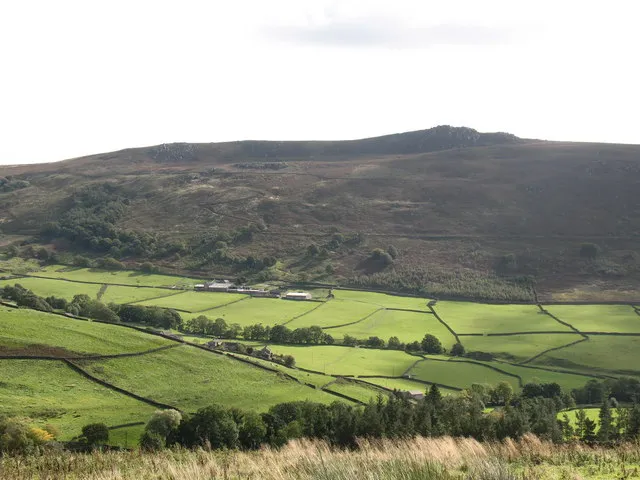
Simon's Seat Gordon Hatton · CC BY-SA 2.0

Climate of Drebley
Best months for sightseeingBest months for sightseeing: June–August.
This month · November
A wet month
Day 9° · Night 4° · Rain 154 mm
- Hottest month
- July (day 20°)
- Coldest month
- January (night 1°)
- Wettest month
- December (159 mm)
- Driest month
- May (88 mm)
Bars: average monthly low and high temperature. Below: precipitation. Monthly averages for 1970–2000 at about 18 km resolution, adjusted for elevation. Highlighted months are mild and relatively dry. Source: WorldClim 2.1 (CC BY 4.0).
Show values as a table
| Month | Jan | Feb | Mar | Apr | May | Jun | Jul | Aug | Sep | Oct | Nov | Dec |
|---|---|---|---|---|---|---|---|---|---|---|---|---|
| Average high (°C) | 6° | 6° | 8° | 11° | 15° | 17° | 20° | 19° | 16° | 13° | 9° | 7° |
| Average low (°C) | 1° | 1° | 2° | 4° | 6° | 9° | 11° | 11° | 9° | 7° | 4° | 2° |
| Precipitation (mm) | 155 | 111 | 123 | 92 | 88 | 94 | 99 | 121 | 127 | 146 | 154 | 159 |
How to get to Drebley
The nearest airport is Leeds Bradford Airport (LBA), 25 km to the southeast as the crow flies. The nearest large city is Bradford, 28 km to the southeast.
Airports
- Leeds Bradford Airport (LBA) Leeds, West Yorkshire 25 kmsoutheast
- Teesside International Airport (MME) Darlington, Durham 62 kmnortheast
- Manchester Airport (MAN) Manchester, Greater Manchester 79 kmsouth
Nearby large cities
- Bradford Population: 366.2K 28 kmsoutheast
- Burnley Population: 149.4K 33 kmsouthwest
- Leeds Population: 536.3K 36 kmsoutheast
- Huddersfield Population: 149K 43 kmsouth
- Wakefield Population: 109.8K 47 kmsoutheast
Straight-line distances; road distances are longer. Airport data: OurAirports.
Day trips from Drebley
Within 100 km: 698 historic and cultural sites, 1,676 natural sites, 275 lakes, rivers and coasts.
0–25 km132 places
- Great Britain Island 6 kmSW
- Lud Stream Islands Island 4 kmSE
- Mill Island Island 1 kmNW
- Beanlands Island Island 13 kmSE
25–60 km743 places
- The Island Island 29 kmNE
- Bird Island Island 32 kmW
- The Island Island 31 kmE
- Beal Island Island 59 kmSE
60–100 km1,774 places
- High Moor Mountain 82 kmW
- Formby Beach Beach 93 kmSW
- Ainsdale Beach Beach 89 kmSW
- St Anne's Beach Beach 80 kmSW
Straight-line distances.
Nearby attractions & nature
Everything nearby-
Mill Island Island, Appletreewick1 km NW
-
Haugh Mountain, Appletreewick0.7 km NE
-
Barden Tower Historic site, Barden1.6 km SW
-
River Dibb River, England2 km W
-
Barden Tower Landmark, Barden2.1 km S
-
Earl Seat Mountain, Barden1.9 km SE
Sources & licences
Data last updated: