- Elevation
- 542 m
- above sea level
- Local time
- UTC+00:00
- Europe/London · UTC+00:00
- Airports
- MME Teesside International Airport45 km
- LBA Leeds Bradford Airport61 km
About Blea Barf
Blea Barf is a mountain. Location: Grinton, Richmondshire District. Elevation: 542 m. The best months to visit are July. The nearest airport is Teesside International Airport (45 km). Nearby sights include Swale Dale and Conny Tammy Currack.
Photos of Blea Barf
-
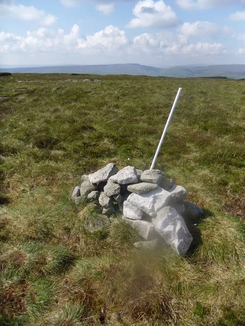
Rogan's Seat steven ruffles · CC BY-SA 2.0 -
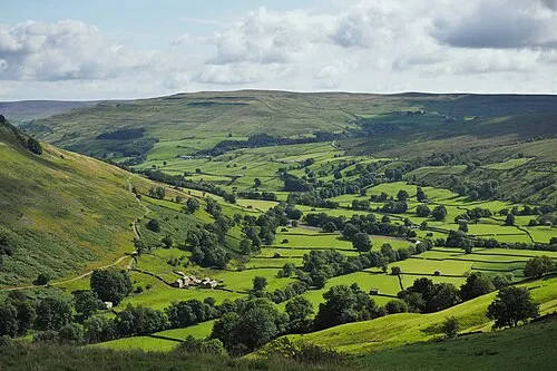
Swale Dale Kreuzschnabel · CC BY-SA 3.0


Climate of Blea Barf
Best months for sightseeingBest months for sightseeing: July.
This month · November
A wet month
Day 6° · Night 1° · Rain 158 mm
- Hottest month
- July (day 17°)
- Coldest month
- January (night -1°)
- Wettest month
- December (163 mm)
- Driest month
- May (90 mm)
Bars: average monthly low and high temperature. Below: precipitation. Monthly averages for 1970–2000 at about 18 km resolution, adjusted for elevation. Highlighted months are mild and relatively dry. Source: WorldClim 2.1 (CC BY 4.0).
Show values as a table
| Month | Jan | Feb | Mar | Apr | May | Jun | Jul | Aug | Sep | Oct | Nov | Dec |
|---|---|---|---|---|---|---|---|---|---|---|---|---|
| Average high (°C) | 4° | 4° | 6° | 8° | 12° | 15° | 17° | 17° | 13° | 10° | 6° | 4° |
| Average low (°C) | -1° | -1° | 0° | 1° | 4° | 7° | 9° | 8° | 7° | 4° | 1° | 0° |
| Precipitation (mm) | 162 | 113 | 130 | 92 | 90 | 92 | 101 | 121 | 130 | 151 | 158 | 163 |
Other places to visit in this season: July
How to get to Blea Barf
The nearest airport is Teesside International Airport (MME), 45 km to the east as the crow flies. For international flights: Leeds Bradford Airport (LBA) (61 km). The nearest large city is Middlesbrough, 59 km to the northeast.
Airports
- Teesside International Airport (MME) Darlington, Durham 45 kmeast
- Leeds Bradford Airport (LBA) Leeds, West Yorkshire 61 kmsoutheast
- Newcastle International Airport (NCL) Newcastle upon Tyne, Tyne and Wear 79 kmnorth
Nearby large cities
- Middlesbrough Population: 142.7K 59 kmnortheast
- Burnley Population: 149.4K 63 kmsouth
- Bradford Population: 366.2K 67 kmsouth
- Leeds Population: 536.3K 72 kmsoutheast
- Blackburn Population: 146.5K 73 kmsouth
Straight-line distances; road distances are longer. Airport data: OurAirports.
Day trips from Blea Barf
Within 100 km: 936 historic and cultural sites, 1,827 natural sites, 318 lakes, rivers and coasts.
0–25 km138 places
- Batt Island Island 12 kmSE
- Semer Water Lake 11 kmS
- Newsham Tarn Lake 22 kmNE
- Wild Boar Fell Mountain 20 kmW
25–60 km979 places
- Great Britain Island 40 kmS
- The Island Island 30 kmSE
- Tuft Rock Island 56 kmW
- Bird Island Island 46 kmSW
60–100 km1,964 places
- High Moor Mountain 71 kmW
- St Anne's Beach Beach 93 kmSW
- Roanhead Beach Beach 80 kmW
- Seaton Carew Beach Beach 66 kmNE
Straight-line distances.
Nearest towns and villages
-
Spring End Village, Muker1.2 km N
-
Gunnerside Village, Melbecks2 km N
-
Lodge Green Neighbourhood, Melbecks2 km N
-
Satron Village, Muker2.1 km NW
-
Nappa Scar Village, Askrigg5.3 km S
-
Low Row Village, Melbecks2.7 km NE
Nearby attractions & nature
Everything nearby-
Swale Dale Natural site, England1 km NW
-
Conny Tammy Currack Mountain, Askrigg1.9 km S
-
Oxnop Common - Blackstone Mountain, Muker3.4 km SW
-
Woodhall Greets Mountain, Askrigg3.7 km S
-
Pickerstone Ridge Mountain, Castle Bolton with East and West Bolton4.2 km E
-
Melbecks Moor Mountain, Melbecks4.6 km N
-
Rogan's Seat Mountain, Melbecks7.7 km NW
-
Great Pinseat Mountain, Reeth, Fremington and Healaugh6.7 km N
Sources & licences
Data last updated: