Stillingfleet
Located in Selby District, North Yorkshire Coordinates: 53°52′03″ N 1°05′45″ W
- Elevation
- 10 m
- above sea level
- Local time
- UTC+00:00
- Europe/London · UTC+00:00
- Places inside
- 1
- listed under Stillingfleet
- Airports
- LBA Leeds Bradford Airport37 km
- HUY Humberside Airport59 km
About Stillingfleet
Stillingfleet is a village. Location: Selby District, North Yorkshire. Elevation: 10 m. The best months to visit are June–August. The nearest airport is Leeds Bradford Airport (37 km). Nearby sights include Cawood Castle and River Wharfe.
Photos of Stillingfleet
-
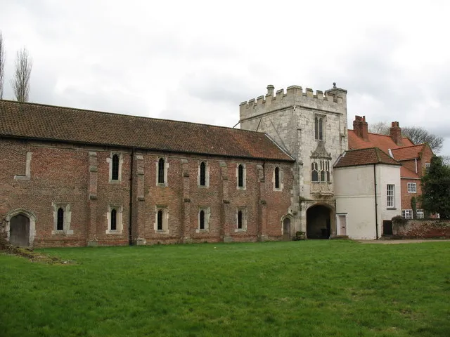
Cawood Castle Gordon Hatton · CC BY-SA 2.0

Climate of Stillingfleet
Best months for sightseeingBest months for sightseeing: June–August.
This month · November
A cold month
Day 9° · Night 3° · Rain 52 mm
- Hottest month
- July (day 21°)
- Coldest month
- January (night 1°)
- Wettest month
- December (58 mm)
- Driest month
- February (37 mm)
Bars: average monthly low and high temperature. Below: precipitation. Monthly averages for 1970–2000 at about 18 km resolution, adjusted for elevation. Highlighted months are mild and relatively dry. Source: WorldClim 2.1 (CC BY 4.0).
Show values as a table
| Month | Jan | Feb | Mar | Apr | May | Jun | Jul | Aug | Sep | Oct | Nov | Dec |
|---|---|---|---|---|---|---|---|---|---|---|---|---|
| Average high (°C) | 6° | 7° | 9° | 12° | 16° | 19° | 21° | 21° | 18° | 14° | 9° | 7° |
| Average low (°C) | 1° | 1° | 2° | 4° | 6° | 9° | 11° | 11° | 9° | 6° | 3° | 2° |
| Precipitation (mm) | 53 | 37 | 47 | 43 | 45 | 54 | 47 | 56 | 51 | 52 | 52 | 58 |
How to get to Stillingfleet
The nearest airport is Leeds Bradford Airport (LBA), 37 km to the west as the crow flies. The nearest large city is York, 10 km to the north.
Airports
- Leeds Bradford Airport (LBA) Leeds, West Yorkshire 37 kmwest
- Humberside Airport (HUY) Grimsby, Lincolnshire 59 kmsoutheast
- Teesside International Airport (MME) Darlington, Durham 75 kmnorth
Nearby large cities
- York Population: 156.1K 10 kmnorth
- Leeds Population: 536.3K 31 kmwest
- Wakefield Population: 109.8K 33 kmsouthwest
- Doncaster Population: 113.6K 38 kmsouth
- Bradford Population: 366.2K 44 kmwest
Straight-line distances; road distances are longer. Airport data: OurAirports.
Day trips from Stillingfleet
Within 100 km: 496 historic and cultural sites, 815 natural sites, 152 lakes, rivers and coasts.
0–25 km72 places
- The Island Island 12 kmNE
- Howden Dyke Island Island 22 kmSE
- Beal Island Island 17 kmS
- Bank Island Island 10 kmE
25–60 km448 places
- The Island Island 55 kmNW
- Read's Island Island 42 kmSE
- Whitton Island Island 33 kmSE
- The Island Island 35 kmNW
60–100 km943 places
- Great Britain Island 61 kmW
- Seaton Carew Beach Beach 88 kmN
- Redcar Beach Beach 84 kmN
- Whitby Beach Beach 76 kmNE
Straight-line distances.
Places in Stillingfleet
1 placeCities & villages1
- Stillingfleet · Village
Nearby attractions & nature
Everything nearby-
Cawood Castle Historic site, Cawood4.6 km SW
-
River Wharfe River, England3.1 km SW
-
Nun Appleton Priory Historic site, Appleton Roebuck4.3 km SW
-
Ryther Castle Historic site, Ryther cum Ossendyke4.8 km SW
-
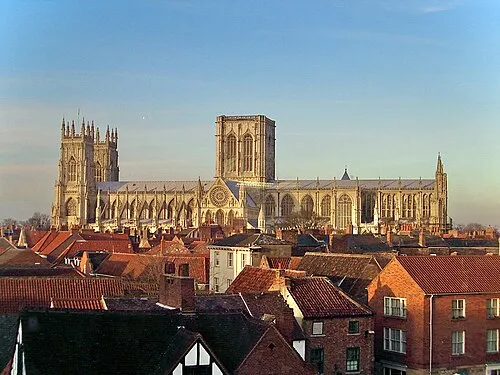 York Minster Attraction, York11 km N
-
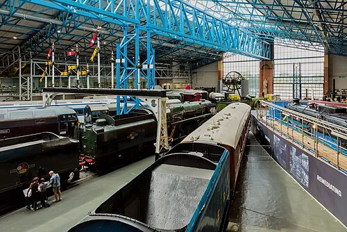 National Railway Museum Museum, York10 km N
Sources & licences
Data last updated: