- Elevation
- 88 m
- above sea level
- Local time
- UTC+00:00
- Europe/London · UTC+00:00
- Airports
- NCL Newcastle International Airport34 km
- MME Teesside International Airport83 km
About Gold Island
Gold Island is an island. Location: Birtley, Northumberland. The best months to visit are June–August. The nearest airport is Newcastle International Airport (34 km). Nearby sights include Houxty Burn and Wark on Tyne Pele Tower.
Photos of Gold Island
-
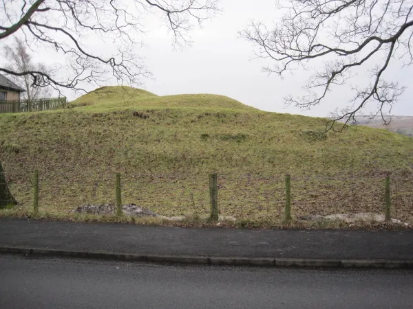
Bellingham Castle Les Hull · CC BY-SA 2.0 -
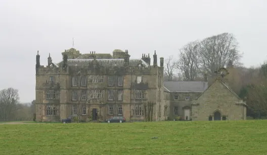
Chipchase Castle Les Hull · CC BY-SA 2.0 -
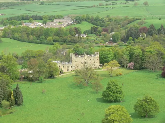
Haughton Castle Elwood · CC BY-SA 2.0


Climate of Gold Island
Best months for sightseeingBest months for sightseeing: June–August.
This month · November
A cold month
Day 9° · Night 3° · Rain 92 mm
- Hottest month
- July (day 20°)
- Coldest month
- January (night 1°)
- Wettest month
- January (98 mm)
- Driest month
- April (59 mm)
Bars: average monthly low and high temperature. Below: precipitation. Monthly averages for 1970–2000 at about 18 km resolution, adjusted for elevation. Highlighted months are mild and relatively dry. Source: WorldClim 2.1 (CC BY 4.0).
Show values as a table
| Month | Jan | Feb | Mar | Apr | May | Jun | Jul | Aug | Sep | Oct | Nov | Dec |
|---|---|---|---|---|---|---|---|---|---|---|---|---|
| Average high (°C) | 6° | 7° | 9° | 11° | 15° | 18° | 20° | 19° | 16° | 13° | 9° | 7° |
| Average low (°C) | 1° | 1° | 2° | 3° | 6° | 8° | 11° | 10° | 8° | 6° | 3° | 1° |
| Precipitation (mm) | 98 | 69 | 79 | 59 | 61 | 64 | 65 | 80 | 77 | 88 | 92 | 95 |
How to get to Gold Island
The nearest airport is Newcastle International Airport (NCL), 34 km to the east as the crow flies. The nearest large city is Newcastle upon Tyne, 41 km to the east.
Airports
- Newcastle International Airport (NCL) Newcastle upon Tyne, Tyne and Wear 34 kmeast
- Teesside International Airport (MME) Darlington, Durham 83 kmsoutheast
- Edinburgh Airport (EDI) Ingliston, Edinburgh 120 kmnorthwest
Nearby large cities
- Newcastle upon Tyne Population: 300.1K 41 kmeast
- Sunderland Population: 170.1K 58 kmeast
- Middlesbrough Population: 142.7K 86 kmsoutheast
- Edinburgh Population: 515K 114 kmnorthwest
- Burnley Population: 149.4K 144 kmsouth
Straight-line distances; road distances are longer. Airport data: OurAirports.
Day trips from Gold Island
Within 100 km: 733 historic and cultural sites, 2,319 natural sites, 459 lakes, rivers and coasts.
0–25 km189 places
- Broomhaugh Island Island 16 kmSE
- The Island Island 4 kmSE
- Greenlee Lough Lake 12 kmSW
- Kielder Water Lake 20 kmNW
25–60 km1,044 places
- Longhoughton Beach Beach 55 kmNE
- Saint Mary’s Island Island 49 kmE
- Coquet Island Island 51 kmNE
- Wooden Anna Island 58 kmN
60–100 km2,278 places
- Powillimount Beach Beach 90 kmW
- Cocklawburn Beach Beach 73 kmN
- Cheswick Sands Beach 72 kmN
- Seaton Carew Beach Beach 82 kmSE
Straight-line distances.
Nearest towns and villages
-
Wark Village, Wark1 km S
-
Birtley Village, Birtley2.6 km SE
-
Bellingham Village, Bellingham6 km N
-
Simonburn Village, Simonburn4.3 km S
-
Redesmouth Village, Bellingham4.4 km N
-
Gunnerton Village, Chollerton5.3 km SE
Nearby attractions & nature
Everything nearby-
Houxty Burn River, England1.1 km NW
-
Wark on Tyne Pele Tower Landmark, Wark0.9 km S
-
Wark on Tyne Castle Historic site, Wark1.1 km S
-
Birtley Castle Historic site, Birtley1.5 km E
-
Birtley Hall House Tower Landmark, Birtley1.6 km E
-
Blacka Burn River, England3.1 km W
-
Warks Burn River, England3.2 km S
-
The Island Island, Simonburn3.6 km SE
Sources & licences
Data last updated: