- Elevation
- 240 m
- above sea level
- Local time
- UTC+00:00
- Europe/London · UTC+00:00
- Airports
- NCL Newcastle International Airport59 km
- EDI Edinburgh Airport96 km
About Earle Whin
Earle Whin is a mountain. Location: Earle, Northumberland. Elevation: 240 m. The best months to visit are June–August. The nearest airport is Newcastle International Airport (59 km). Nearby sights include Horsdon and Hart Heugh.
Photos of Earle Whin
-
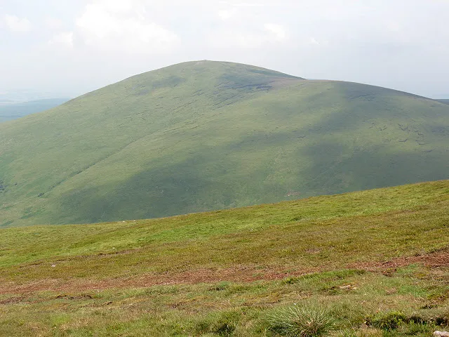
Hedgehope Hill Stephen Craven · CC BY-SA 2.0 -
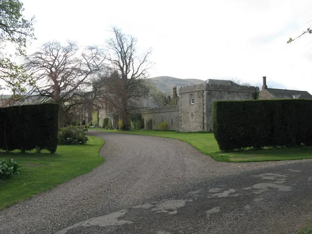
Coupland Castle Lisa Jarvis · CC BY-SA 2.0


Climate of Earle Whin
Best months for sightseeingBest months for sightseeing: June–August.
This month · November
A cold month
Day 7° · Night 1° · Rain 91 mm
- Hottest month
- July (day 18°)
- Coldest month
- January (night -1°)
- Wettest month
- January (91 mm)
- Driest month
- April (57 mm)
Bars: average monthly low and high temperature. Below: precipitation. Monthly averages for 1970–2000 at about 18 km resolution, adjusted for elevation. Highlighted months are mild and relatively dry. Source: WorldClim 2.1 (CC BY 4.0).
Show values as a table
| Month | Jan | Feb | Mar | Apr | May | Jun | Jul | Aug | Sep | Oct | Nov | Dec |
|---|---|---|---|---|---|---|---|---|---|---|---|---|
| Average high (°C) | 5° | 5° | 8° | 10° | 13° | 16° | 18° | 18° | 15° | 11° | 7° | 5° |
| Average low (°C) | -1° | -1° | 0° | 2° | 4° | 7° | 9° | 9° | 7° | 4° | 1° | -1° |
| Precipitation (mm) | 91 | 66 | 70 | 57 | 61 | 61 | 65 | 83 | 75 | 91 | 91 | 86 |
How to get to Earle Whin
The nearest airport is Newcastle International Airport (NCL), 59 km to the south as the crow flies. The nearest large city is Newcastle upon Tyne, 68 km to the southeast.
Airports
- Newcastle International Airport (NCL) Newcastle upon Tyne, Tyne and Wear 59 kmsouth
- Edinburgh Airport (EDI) Ingliston, Edinburgh 96 kmnorthwest
- Dundee Airport (DND) Dundee 120 kmnorthwest
Nearby large cities
- Newcastle upon Tyne Population: 300.1K 68 kmsoutheast
- Sunderland Population: 170.1K 81 kmsoutheast
- Edinburgh Population: 515K 87 kmnorthwest
- Middlesbrough Population: 142.7K 118 kmsoutheast
- Dundee Population: 148.2K 120 kmnorthwest
Straight-line distances; road distances are longer. Airport data: OurAirports.
Day trips from Earle Whin
Within 100 km: 539 historic and cultural sites, 1,461 natural sites, 379 lakes, rivers and coasts.
0–25 km349 places
- Cocklawburn Beach Beach 22 kmN
- Cheswick Sands Beach 22 kmN
- Old Law Island 20 kmNE
- Lindisfarne Holy Island Island 22 kmNE
25–60 km606 places
- Longhoughton Beach Beach 30 kmE
- South Wamses Island 28 kmNE
- North Wamses Island 28 kmNE
- Farne Islands Island 29 kmNE
60–100 km1,424 places
- Burntisland Beach Beach 95 kmNW
- Cramond beach Beach 94 kmNW
- Portobello Beach Beach 82 kmNW
- Gullane Beach Beach 76 kmNW
Straight-line distances.
Nearest towns and villages
-
Wooler Village, Wooler2 km NE
-
Earle Village, Earle0.7 km SE
-
Wooler Municipality, Northumberland1.3 km N
-
Humbleton Village, Akeld2 km N
-
Haugh Head Village, Wooler2.3 km E
-
North Middleton Village, Ilderton3 km SE
Nearby attractions & nature
Everything nearby-
Horsdon Mountain, Wooler1 km NE
-
Hart Heugh Mountain, Earle1.7 km SW
-
Humbleton Hill Mountain, Akeld2.2 km NW
-
Fredden Hill Mountain, Wooler2.5 km W
-
Harthope Burn River, England2.2 km SW
-
Green Castle Historic site, Akeld1.3 km N
-
Whitsunbank Hill Mountain, Chatton3.6 km E
-
Cold Law Mountain, Earle3.8 km SW
Sources & licences
Data last updated: