
- Elevation
- 223 m
- above sea level
- Local time
- UTC+00:00
- Europe/London · UTC+00:00
- Airports
- NCL Newcastle International Airport45 km
- MME Teesside International Airport82 km
About Once Brewed
Once Brewed is a village. Location: Henshaw, Northumberland. Elevation: 223 m.
Once Brewed (also known as Twice Brewed or Once Brewed/Twice Brewed) is a village in Northumberland, England. It lies on the Military Road (B6318). A motorist arriving over the B6318 from the east will see the place name shield "Once Brewed", while those coming from the west will read "Twice Brewed". Once Brewed lies just south of Hadrian's Wall, which runs along the top of the Whin Sill ridge above the village to the north. The Roman fort of Vindolanda is a couple of miles away to the south-east.
Source: Wikipedia · CC BY-SA 4.0
Photos of Once Brewed
-
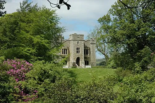
Bellister Castle Anthony Parkes · CC BY-SA 2.0

Climate of Once Brewed
Best months for sightseeingBest months for sightseeing: June–August.
This month · November
A wet month
Day 8° · Night 2° · Rain 117 mm
- Hottest month
- July (day 19°)
- Coldest month
- January (night 0°)
- Wettest month
- January (124 mm)
- Driest month
- April (69 mm)
Bars: average monthly low and high temperature. Below: precipitation. Monthly averages for 1970–2000 at about 18 km resolution, adjusted for elevation. Highlighted months are mild and relatively dry. Source: WorldClim 2.1 (CC BY 4.0).
Show values as a table
| Month | Jan | Feb | Mar | Apr | May | Jun | Jul | Aug | Sep | Oct | Nov | Dec |
|---|---|---|---|---|---|---|---|---|---|---|---|---|
| Average high (°C) | 6° | 6° | 8° | 10° | 14° | 17° | 19° | 18° | 15° | 12° | 8° | 6° |
| Average low (°C) | 0° | 0° | 1° | 3° | 5° | 8° | 10° | 10° | 8° | 5° | 2° | 1° |
| Precipitation (mm) | 124 | 87 | 98 | 69 | 69 | 72 | 76 | 91 | 94 | 111 | 117 | 122 |
How to get to Once Brewed
The nearest airport is Newcastle International Airport (NCL), 45 km to the east as the crow flies. The nearest large city is Newcastle upon Tyne, 50 km to the east.
Airports
- Newcastle International Airport (NCL) Newcastle upon Tyne, Tyne and Wear 45 kmeast
- Teesside International Airport (MME) Darlington, Durham 82 kmsoutheast
- Edinburgh Airport (EDI) Ingliston, Edinburgh 123 kmnorthwest
Nearby large cities
- Newcastle upon Tyne Population: 300.1K 50 kmeast
- Sunderland Population: 170.1K 65 kmeast
- Middlesbrough Population: 142.7K 88 kmsoutheast
- Edinburgh Population: 515K 118 kmnorthwest
- Burnley Population: 149.4K 134 kmsouth
Straight-line distances; road distances are longer. Airport data: OurAirports.
Day trips from Once Brewed
Within 100 km: 798 historic and cultural sites, 2,666 natural sites, 511 lakes, rivers and coasts.
0–25 km201 places
- Broomhaugh Island Island 19 kmE
- Gold Island Island 15 kmNE
- The Island Island 15 kmNE
- Tindale Tarn Lake 16 kmSW
25–60 km1,103 places
- Kirkland Scar Island 51 kmW
- Fishgarth Holm Island 31 kmSW
- Coathouse Island Island 31 kmSW
- Little Corby Island Island 29 kmW
60–100 km2,671 places
- High Moor Mountain 99 kmSW
- St. Bees Beach Seafront Beach 97 kmSW
- Powillimount Beach Beach 77 kmW
- Cocklawburn Beach Beach 86 kmN
Straight-line distances.
Nearby attractions & nature
Everything nearby-
Peel Crags Mountain, Henshaw0.6 km N
-
Peel Crag Landmark, Henshaw0.6 km N
-
Cranberry Brow Mountain, Henshaw1.3 km SW
-
Highshield Crags Mountain, Henshaw1.4 km NE
-
Winshield Crags Mountain, Melkridge1.2 km NW
-
Vindolanda Historic site, Henshaw1.8 km E
Sources & licences
Data last updated: · 2 independent sources