Knaresdale with Kirkhaugh
Located in Northumberland, England Coordinates: 54°51′19″ N 2°30′31″ W
- Elevation
- 308 m
- above sea level
- Local time
- UTC+00:00
- Europe/London · UTC+00:00
- Places inside
- 14
- listed under Knaresdale with Kirkhaugh
- Airports
- NCL Newcastle International Airport56 km
- MME Teesside International Airport80 km
About Knaresdale with Kirkhaugh
Knaresdale with Kirkhaugh is a municipality. Location: Northumberland, England. Elevation: 308 m. The best months to visit are June–August. The nearest airport is Newcastle International Airport (56 km). Nearby sights include Randalholme Hall and Black Fell.
Photos of Knaresdale with Kirkhaugh
-
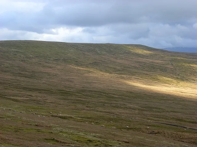
Black Fell Andrew Smith · CC BY-SA 2.0

Climate of Knaresdale with Kirkhaugh
Best months for sightseeingBest months for sightseeing: June–August.
This month · November
A wet month
Day 8° · Night 2° · Rain 124 mm
- Hottest month
- July (day 18°)
- Coldest month
- January (night 0°)
- Wettest month
- January (130 mm)
- Driest month
- April (70 mm)
Bars: average monthly low and high temperature. Below: precipitation. Monthly averages for 1970–2000 at about 18 km resolution, adjusted for elevation. Highlighted months are mild and relatively dry. Source: WorldClim 2.1 (CC BY 4.0).
Show values as a table
| Month | Jan | Feb | Mar | Apr | May | Jun | Jul | Aug | Sep | Oct | Nov | Dec |
|---|---|---|---|---|---|---|---|---|---|---|---|---|
| Average high (°C) | 5° | 5° | 7° | 10° | 14° | 16° | 18° | 18° | 15° | 12° | 8° | 6° |
| Average low (°C) | 0° | 0° | 1° | 2° | 5° | 7° | 10° | 9° | 8° | 5° | 2° | 0° |
| Precipitation (mm) | 130 | 92 | 102 | 70 | 71 | 73 | 79 | 92 | 98 | 117 | 124 | 128 |
How to get to Knaresdale with Kirkhaugh
The nearest airport is Newcastle International Airport (NCL), 56 km to the east as the crow flies. The nearest large city is Newcastle upon Tyne, 59 km to the east.
Airports
- Newcastle International Airport (NCL) Newcastle upon Tyne, Tyne and Wear 56 kmeast
- Teesside International Airport (MME) Darlington, Durham 80 kmsoutheast
- Leeds Bradford Airport (LBA) Leeds, West Yorkshire 123 kmsoutheast
Nearby large cities
- Newcastle upon Tyne Population: 300.1K 59 kmeast
- Sunderland Population: 170.1K 73 kmeast
- Middlesbrough Population: 142.7K 88 kmeast
- Burnley Population: 149.4K 119 kmsouth
- Blackpool Population: 145K 121 kmsouth
Straight-line distances; road distances are longer. Airport data: OurAirports.
Day trips from Knaresdale with Kirkhaugh
Within 100 km: 834 historic and cultural sites, 2,645 natural sites, 515 lakes, rivers and coasts.
0–25 km194 places
- Fishgarth Holm Island 18 kmW
- Coathouse Island Island 20 kmW
- Little Corby Island Island 21 kmW
- Holm Wrangle Island 16 kmW
25–60 km1,350 places
- Kirkland Scar Island 45 kmW
- Wood Howe Island 44 kmSW
- Seamew Crag Island 58 kmSW
- Little Isle Island 55 kmSW
60–100 km2,450 places
- High Moor Mountain 82 kmSW
- Roanhead Beach Beach 91 kmSW
- St. Bees Beach Seafront Beach 82 kmSW
- Powillimount Beach Beach 69 kmW
Straight-line distances.
Places in Knaresdale with Kirkhaugh
14 placesCities & villages5
- Ayle · Village
- Burnstones · Village
- Eals · Village
- Knarsdale · Village
- Slaggyford · Village
Mountains & nature8
- Ayle Common · Mountain
- Cold Fell · Mountain
- Great Blacklaw Hill · Mountain
- Grey Nag · Mountain
- Little Heaplaw · Mountain
- Pike Rigg · Mountain
- Three Pikes · Mountain
- Tom Smith's Stone Top · Mountain
Heritage & sights1
- Knarsdale Hall · Landmark
Nearby attractions & nature
Everything nearby-
Randalholme Hall Landmark, Alston Moor4.3 km SE
-
Black Fell Mountain, Alston Moor7.3 km S
-
Park Fell Mountain, Alston Moor6.2 km S
-
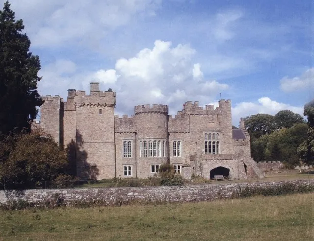 Featherstone Castle Historic site, Featherstone9.7 km N
-
Watch Hill Mountain, Kirkoswald7.2 km SW
-
Corby Gates Landmark, Alston Moor7.2 km SE
-
Middle Skelgill Landmark, Alston Moor7.5 km SE
-
Hard Rigg Mountain, West Allen7.9 km E
Sources & licences
Data last updated: