- Local time
- UTC+00:00
- Europe/London · UTC+00:00
- Elevation
- 11 m
- above sea level
- Airports
- LTN London Luton Airport77 km
- EMA East Midlands Airport79 km
About London Road Stadium
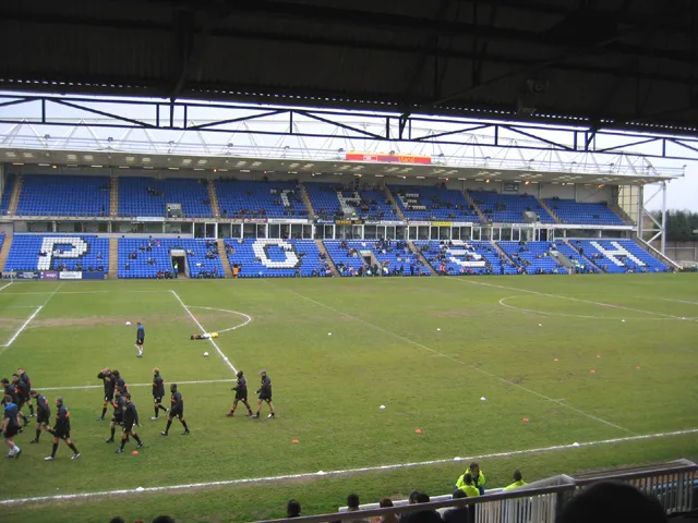
London Road Stadium is a landmark. Location: Peterborough, England.
London Road, currently known as the Weston Homes Stadium for sponsorship reasons, is a multi-purpose stadium in Peterborough, England. The stadium is in Fletton, south of the River Nene. It is currently used mostly for football matches and is the home ground of Peterborough United. The stadium holds 13,511 and was built pre-1891, though the present ground bears no resemblance to the original following several periods of redevelopment.
Source: Wikipedia · CC BY-SA 4.0
At a glance
- Built
- 1913
- Opened
- 1913
Source: Wikidata
Photos of London Road Stadium
-

Lovecookie22 · CC BY 4.0 -

Lovecookie22 · CC BY 4.0 -

Steve Daniels · CC BY-SA 2.0 -

Steve Daniels · CC BY-SA 2.0 -
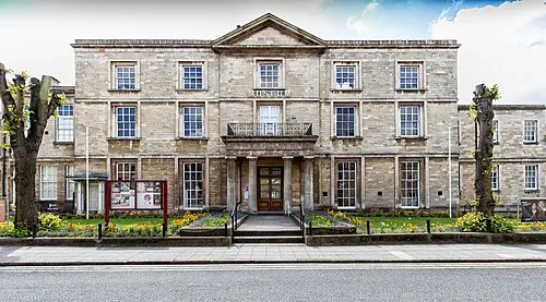
Peterborough Museum and Art Gallery David P Howard · CC BY-SA 2.0


Climate of London Road Stadium
Best months for sightseeingBest months for sightseeing: June–August.
This month · November
A cold month
Day 10° · Night 4° · Rain 53 mm
- Hottest month
- July (day 22°)
- Coldest month
- February (night 1°)
- Wettest month
- August (55 mm)
- Driest month
- February (39 mm)
Bars: average monthly low and high temperature. Below: precipitation. Monthly averages for 1970–2000 at about 18 km resolution, adjusted for elevation. Highlighted months are mild and relatively dry. Source: WorldClim 2.1 (CC BY 4.0).
Show values as a table
| Month | Jan | Feb | Mar | Apr | May | Jun | Jul | Aug | Sep | Oct | Nov | Dec |
|---|---|---|---|---|---|---|---|---|---|---|---|---|
| Average high (°C) | 7° | 7° | 10° | 12° | 16° | 19° | 22° | 21° | 18° | 14° | 10° | 8° |
| Average low (°C) | 1° | 1° | 3° | 4° | 7° | 10° | 12° | 12° | 10° | 7° | 4° | 2° |
| Precipitation (mm) | 53 | 39 | 44 | 43 | 47 | 53 | 44 | 55 | 49 | 47 | 53 | 53 |
How to get to London Road Stadium
The nearest airport is London Luton Airport (LTN), 77 km to the south as the crow flies. The nearest large city is Peterborough, 1 km to the northwest.
Airports
- London Luton Airport (LTN) Luton, Luton 77 kmsouth
- East Midlands Airport (EMA) Nottingham, Leicestershire 79 kmwest
- London Stansted Airport (STN) London, Essex 82 kmsoutheast
Nearby large cities
- Peterborough Population: 163.4K 1 kmnorthwest
- Cambridge Population: 145.7K 47 kmsoutheast
- Bedford Population: 106.9K 50 kmsouth
- Northampton Population: 245.9K 56 kmsouthwest
- Leicester Population: 368.6K 61 kmwest
Straight-line distances; road distances are longer. Airport data: OurAirports.
Day trips from London Road Stadium
Within 100 km: 572 historic and cultural sites, 278 natural sites, 122 lakes, rivers and coasts.
0–25 km40 places
- Park Island Island 10 kmN
- Monks Wood National Nature Reserve Natural site 18 kmS
- Church Natural site 14 kmW
- St Mary Attraction 25 kmNE
25–60 km243 places
- Snettisham Beach Beach 57 kmNE
- Inner Tidal Bank Island 46 kmNE
- Heron Island Island 47 kmSW
- Apple Island Island 50 kmS
60–100 km689 places
- Scolt Head Island Island 79 kmNE
- Warham Salt Marsh - West Island 89 kmNE
- Lodge Marsh Island 88 kmNE
- Ramsey Salt Marsh Island 79 kmNE
Straight-line distances.
Nearby attractions & nature
Everything nearby-
Peterborough Museum and Art Gallery Museum, Peterborough0.9 km NW
-
Mount Thorold Historic site, Peterborough1 km N
-
Peterborough River Bridge Landmark, Peterborough0.5 km NW
-
Peterborough Cathedral Attraction, Peterborough0.9 km N
-
Fengate Historic site, Peterborough2.6 km NE
-
Longthorpe Tower Landmark, Peterborough3.2 km W
-
Dogsthorpe Honey Hill Historic site, Peterborough4 km N
-
Must Farm Pile-dwelling Site Historic site, Whittlesey4.5 km E
Nearest towns and villages
-
Peterborough City, Orton Longueville1.1 km NW
-
New Fletton Neighbourhood, Peterborough0.6 km W
-
Old Fletton Neighbourhood, Peterborough0.6 km S
-
Eastgate Neighbourhood, Peterborough1.1 km NE
More sights in Peterborough
-
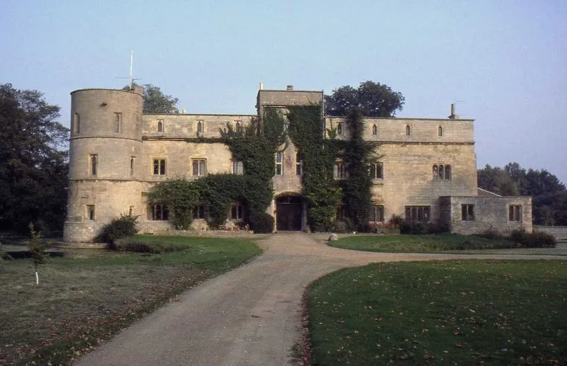 Woodcroft Castle Historic site, Etton8.6 km NW
-
Gunthorpe Mediumwave Transmitter Landmark, Newborough5.9 km N
-
Maxey Castle Historic site, Maxey13 km NW
-
Torpel Castle Ringwork Historic site, Bainton11 km NW
-
Burghley House Historic site, St. Martin's Without17 km NW
Sources & licences
Data last updated: · 2 independent sources