Potton Island
Located in England, United Kingdom Coordinates: 51°35′00″ N 0°49′00″ E
- Elevation
- 1 m
- above sea level
- Local time
- UTC+00:00
- Europe/London · UTC+00:00
About Potton Island
Potton Island is an island. Location: England, United Kingdom.
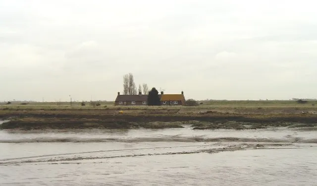
Potton Island is a sparsely populated island west of Foulness in Essex, England. It is connected to the mainland by a swing bridge with a traffic light system, and the road leads to Great Wakering. Unlike some of the other nearby islands which were formerly marshland, Potton Island has been inhabited at least since the Neolithic era. It was home to several arable farms until it flooded in 1884, leading to its temporary abandonment and longer-term use as pasture.
Read more on Wikipedia Text: Wikipedia contributors · CC BY-SA 4.0 · shortened
In comparison
- 13 sights and natural places within 10 km Brimstone Hill, Wallasea Island
Nearest towns and villages
-
Rochford Municipality, Essex<0.1 km NW
-
Great Wakering Town, Great Wakering3.6 km S
-
Barling Magna Village, Rochford1.5 km SW
-
Burnham-on-Crouch Town, Burnham-on-Crouch5.5 km N
-
Paglesham Village, Rochford2.7 km NW
-
Little Wakering Village, Barling Magna3.2 km SW
Nearby attractions & nature
Everything nearby-
Wallasea Island Island, England2.2 km NE
-
Havengore Island Island, England3 km SE
-
Rushley Island Island, Great Wakering2.2 km SE
-
New England Island Island, Foulness3.3 km SE
-
River Roach River, England3.9 km NE
-
Brimstone Hill Historic site, Barling Magna1.7 km SW
-
Foulness Island Island, England5.8 km E
-
River Crouch River, England5.9 km NE
Sources & licences
Data last updated: · 2 independent sources