- Population
- 13,807
- 13.8K
- Elevation
- 150 m
- above sea level
- Local time
- UTC+00:00
- Europe/London · UTC+00:00
- Airports
- MAN Manchester Airport35 km
- LBA Leeds Bradford Airport38 km
About Littleborough
Littleborough is a town. Location: Rochdale, England. Population: 13,807. Elevation: 150 m.
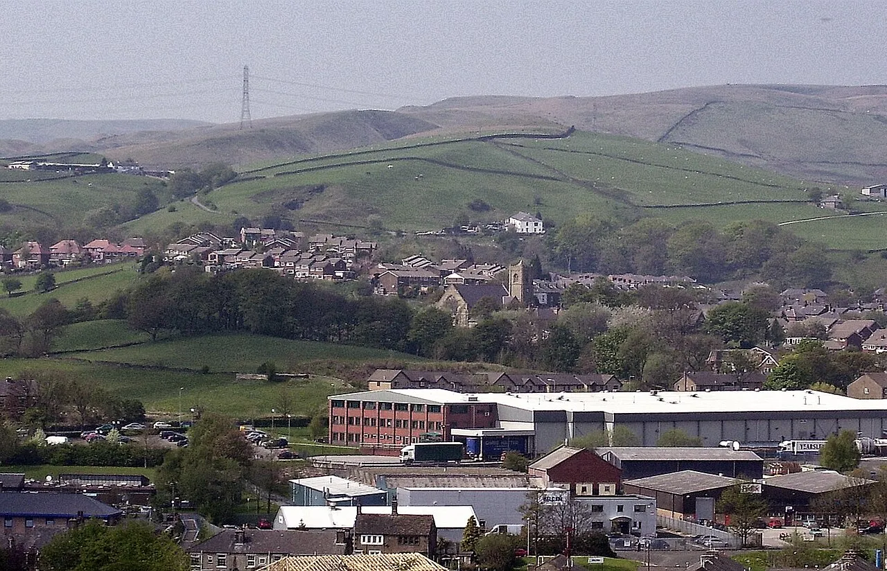
Littleborough ( LIT-əl-bər-ə) is a town in the Metropolitan Borough of Rochdale, Greater Manchester, England, in the upper Roch Valley by the foothills of the South Pennines, 3 miles (4.8 km) northeast of Rochdale and 13 miles (20.9 km) northeast of Manchester; Milnrow and the M62 motorway are to the south, and the rural uplands of Blackstone Edge to the east. According to the 2001 census, Littleborough, and its suburbs of Calderbrook, Shore and Smithy Bridge, had a population of 13,807.
Source: Wikipedia · CC BY-SA 4.0
Photos of Littleborough
-

Chris Heaton · CC BY-SA 2.0 -

Peter McDermott · CC BY-SA 2.0 -

Kevin Waterhouse · CC BY-SA 2.0 -

Kevin Waterhouse · CC BY-SA 2.0 -

michael ely · CC BY-SA 2.0


Travel notes for Littleborough
From Wikivoyage
Rochdale is a town in Greater Manchester in northwest England, 12 miles north of Manchester city centre. In 2021 it had a population of 111,000, with a similar number in the nearby small towns of Middleton, Milnrow, Wardle, Littleborough and Heywood that together comprise Rochdale Metropolitan Borough. Its main attraction is its Victorian centre and industrial heritage.
Understand+
Rochdale grew up from the 18th century as a textile town and transport hub: the Rochdale canal, completed in 1807, was the surest way to transport goods across the Pennines, a huge improvement on pack horses struggling over rough tracks. The textile trade collapsed in the 20th century and Rochdale, historically part of Lancashire, became part of Greater Manchester during the 1974 reorganisation. The town is best known as the birthplace of the Co-operative Movement in 1844, of the singer Gracie Fields (1898-1979) and (infamously it must now be said) of the politician Sir Cyril Smith (1928-2010). The poet Byron's title was Lord Byron of Rochdale but he had no link to the town.
Rochdale Council post local information online.
Get in+
By plane:
Manchester Airport (MAN IATA) has frequent trains to central Manchester. Pick a train that continues beyond Piccadilly to Victoria, where you change for the train or tram to Rochdale as below. You can ride the tram all the way from the airport and change trams at Deansgate, but that's much slower for scant fare saving.
By train:
Trains from Manchester Victoria run to Rochdale every 10 min, taking 15-20 min. These trains are part of longer mainline routes:
- from Blackburn via Accrington, Burnley, Todmorden, Littleborough, Rochdale, Victoria, Salford and Atherton to Wigan.
- from Leeds via Bradford, Halifax, Hebden Bridge, Todmorden and Rochdale to Victoria; also from Leeds to Wigan, and to Warrington and Chester.
- from Clitheroe via Whalley, Blackburn, Darwen, Bolton, Salford and Victoria to Rochdale.
1 Rochdale railway station is half a mile south of town centre. It has a staffed ticket office, waiting room and toilets. There’s step-free access to all platforms.
Metrolink trams (pink line) take 30 min from Manchester Victoria via Newton Heath, South Chadderton, Oldham, Shaw and Milnrow to Rochdale railway station and the Interchange. Rochdale is in Fare Zone 4 so a single journey from city centre is £4.60; trams run every 15 min 6AM-midnight. (The grey line only runs as far as Oldham.) Westbound, the line runs through Victoria to St Peters Square, Deansgate, Chorlton and East Didsbury. Change in city centre for all other lines.
2 Interchange is the bus and tram station, central in town.
By bus:
National Express Bus NX 540 runs daily from London Victoria to Rochdale Interchange, taking 6 hours. This bus also calls at the airport, Manchester city centre and Oldham but you can't use it for the short ride from there to Rochdale.
Local buses run to the Interchange every ten min on route 17 from Manchester Shudehill via Middleton and Castleton, taking 70 min. They also run here from:
Source: Wikivoyage · CC BY-SA 4.0 · abridged
Climate of Littleborough
Best months for sightseeingBest months for sightseeing: June–August.
This month · November
A wet month
Day 9° · Night 4° · Rain 120 mm
- Hottest month
- July (day 20°)
- Coldest month
- January (night 1°)
- Wettest month
- December (121 mm)
- Driest month
- May (69 mm)
Bars: average monthly low and high temperature. Below: precipitation. Monthly averages for 1970–2000 at about 18 km resolution, adjusted for elevation. Highlighted months are mild and relatively dry. Source: WorldClim 2.1 (CC BY 4.0).
Show values as a table
| Month | Jan | Feb | Mar | Apr | May | Jun | Jul | Aug | Sep | Oct | Nov | Dec |
|---|---|---|---|---|---|---|---|---|---|---|---|---|
| Average high (°C) | 6° | 7° | 9° | 11° | 15° | 18° | 20° | 20° | 16° | 13° | 9° | 7° |
| Average low (°C) | 1° | 1° | 3° | 4° | 7° | 10° | 12° | 12° | 10° | 7° | 4° | 2° |
| Precipitation (mm) | 116 | 82 | 94 | 73 | 69 | 81 | 75 | 92 | 95 | 116 | 120 | 121 |
How to get to Littleborough
The nearest airport is Manchester Airport (MAN), 35 km to the south as the crow flies. The nearest large city is Oldham, 12 km to the south.
Airports
- Manchester Airport (MAN) Manchester, Greater Manchester 35 kmsouth
- Leeds Bradford Airport (LBA) Leeds, West Yorkshire 38 kmnortheast
- Liverpool John Lennon Airport (LPL) Liverpool 61 kmsouthwest
Nearby large cities
- Oldham Population: 237.1K 12 kmsouth
- Burnley Population: 149.4K 20 kmnorthwest
- Manchester Population: 569K 20 kmsouthwest
- Huddersfield Population: 149K 21 kmeast
- Salford Population: 129.8K 22 kmsouthwest
Straight-line distances; road distances are longer. Airport data: OurAirports.
Day trips from Littleborough
Within 100 km: 689 historic and cultural sites, 1,234 natural sites, 236 lakes, rivers and coasts.
0–25 km186 places
- Saint George's Island Island 22 kmSW
- Woodhead Reservoir Lake 23 kmSE
- Valehouse Reservoir Lake 21 kmSE
- Torside Reservoir Lake 22 kmSE
25–60 km647 places
- Great Britain Island 40 kmN
- Bird Island Island 45 kmNW
- The Island Island 27 kmW
- Heron Island Island 59 kmE
60–100 km1,326 places
- High Moor Mountain 93 kmNW
- Thurstaston Beach Beach 77 kmSW
- Formby Beach Beach 67 kmW
- Ainsdale Beach Beach 64 kmW
Straight-line distances.
Nearby attractions & nature
Everything nearby-
Cleggswood Hill Mountain, Rochdale0.6 km SE
-
Hollingworth Hill Mountain, Rochdale1.6 km SE
-
Ratcliffe Hill Mountain, Rochdale1.8 km NW
-
Birch Hill Mountain, Rochdale1.9 km W
-
Snoddle Hill Mountain, Rochdale2.4 km NE
-
Heights Barn Hill Mountain, Rochdale2.8 km S
-
Dick Hill Mountain, Rochdale3.3 km S
-
Moy Hill Mountain, Rochdale4.2 km S
Other cities and towns in Rochdale
Sources & licences
Data last updated: · 2 independent sources