
- Elevation
- 111 m
- above sea level
- Local time
- UTC+00:00
- Europe/London · UTC+00:00
- Airports
- EMA East Midlands Airport55 km
- LBA Leeds Bradford Airport66 km
About Woodall
Woodall is a village. Location: Harthill with Woodall, Rotherham. Elevation: 111 m.
Woodall is a small hamlet in the civil parish of Harthill with Woodall situated in the Metropolitan Borough of Rotherham, South Yorkshire England. In the 2001 government census the parish as a whole had 1,909 inhabitants. It is home to a Welcome Break service station of the same name.
Source: Wikipedia · CC BY-SA 4.0
Photos of Woodall
-

Bill Boaden · CC BY-SA 2.0

Climate of Woodall
Best months for sightseeingBest months for sightseeing: June–August.
This month · November
A cold month
Day 9° · Night 3° · Rain 68 mm
- Hottest month
- July (day 21°)
- Coldest month
- February (night 1°)
- Wettest month
- December (77 mm)
- Driest month
- July (50 mm)
Bars: average monthly low and high temperature. Below: precipitation. Monthly averages for 1970–2000 at about 18 km resolution, adjusted for elevation. Highlighted months are mild and relatively dry. Source: WorldClim 2.1 (CC BY 4.0).
Show values as a table
| Month | Jan | Feb | Mar | Apr | May | Jun | Jul | Aug | Sep | Oct | Nov | Dec |
|---|---|---|---|---|---|---|---|---|---|---|---|---|
| Average high (°C) | 6° | 6° | 9° | 11° | 15° | 18° | 21° | 21° | 17° | 13° | 9° | 7° |
| Average low (°C) | 1° | 1° | 2° | 3° | 6° | 9° | 11° | 11° | 9° | 6° | 3° | 2° |
| Precipitation (mm) | 72 | 54 | 60 | 55 | 52 | 63 | 50 | 59 | 60 | 66 | 68 | 77 |
How to get to Woodall
The nearest airport is East Midlands Airport (EMA), 55 km to the south as the crow flies. The nearest large city is Chesterfield, 12 km to the southwest.
Airports
- East Midlands Airport (EMA) Nottingham, Leicestershire 55 kmsouth
- Leeds Bradford Airport (LBA) Leeds, West Yorkshire 66 kmnorthwest
- Manchester Airport (MAN) Manchester, Greater Manchester 67 kmwest
Nearby large cities
- Chesterfield Population: 113.1K 12 kmsouthwest
- Rotherham Population: 117.6K 13 kmnorthwest
- Sheffield Population: 556.5K 14 kmnorthwest
- Mansfield Population: 172K 22 kmsouth
- Doncaster Population: 113.6K 24 kmnortheast
Straight-line distances; road distances are longer. Airport data: OurAirports.
Day trips from Woodall
Within 100 km: 548 historic and cultural sites, 759 natural sites, 144 lakes, rivers and coasts.
0–25 km96 places
- Don Island Island 13 kmNW
- Redmires Lake 23 kmW
- Wharncliffe Chase Mountain 23 kmNW
- Beeley Moor Mountain 22 kmSW
25–60 km537 places
- Whitton Island Island 59 kmNE
- Newark Island Island 41 kmSE
- Howden Dyke Island Island 53 kmNE
- Beal Island Island 45 kmN
60–100 km818 places
- Great Britain Island 89 kmNW
- Sunk Island Island 88 kmNE
- Read's Island Island 63 kmNE
- Spurn Island Island 96 kmE
Straight-line distances.
Nearby attractions & nature
Everything nearby-
Fir Hill - Harthill Field Mountain, Harthill with Woodall1.6 km SE
-
Fan Field Mountain, North and South Anston6.1 km E
-
Laughton en le Morthen Castle Hill Historic site, Laughton-en-le-Morthen8.2 km NE
-
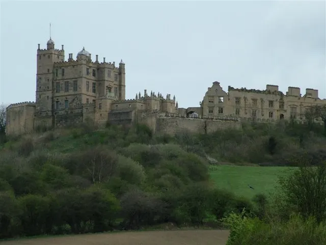 Bolsover Castle Historic site, Old Bolsover10 km S
-
Castle Hill Mountain, Laughton-en-le-Morthen8.2 km NE
-
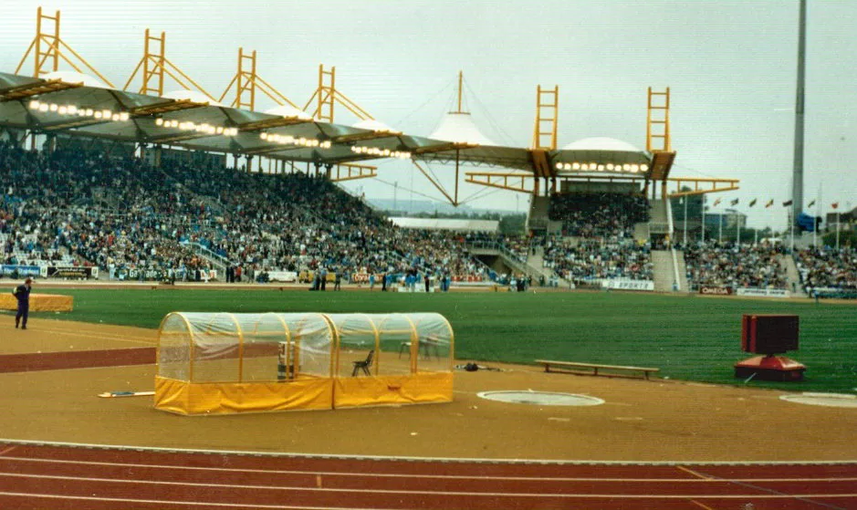 Don Valley Stadium Landmark, Sheffield13 km NW
Sources & licences
Data last updated: · 2 independent sources