- Elevation
- 117 m
- above sea level
- Local time
- UTC+00:00
- Europe/London · UTC+00:00
- Airports
- EMA East Midlands Airport47 km
- BHX Birmingham Airport73 km
About Gunthorpe
Gunthorpe is a municipality. Location: Rutland, England. Elevation: 117 m. The best months to visit are June–August. The nearest airport is East Midlands Airport (47 km). Nearby sights include Brown's Island and Oakham Castle.
Climate of Gunthorpe
Best months for sightseeingBest months for sightseeing: June–August.
This month · November
A cold month
Day 9° · Night 3° · Rain 60 mm
- Hottest month
- July (day 21°)
- Coldest month
- February (night 1°)
- Wettest month
- December (63 mm)
- Driest month
- February (45 mm)
Bars: average monthly low and high temperature. Below: precipitation. Monthly averages for 1970–2000 at about 18 km resolution, adjusted for elevation. Highlighted months are mild and relatively dry. Source: WorldClim 2.1 (CC BY 4.0).
Show values as a table
| Month | Jan | Feb | Mar | Apr | May | Jun | Jul | Aug | Sep | Oct | Nov | Dec |
|---|---|---|---|---|---|---|---|---|---|---|---|---|
| Average high (°C) | 6° | 7° | 9° | 12° | 15° | 18° | 21° | 21° | 18° | 14° | 9° | 7° |
| Average low (°C) | 1° | 1° | 2° | 3° | 6° | 9° | 11° | 11° | 9° | 6° | 3° | 2° |
| Precipitation (mm) | 58 | 45 | 50 | 50 | 50 | 57 | 52 | 61 | 57 | 57 | 60 | 63 |
How to get to Gunthorpe
The nearest airport is East Midlands Airport (EMA), 47 km to the northwest as the crow flies. The nearest large city is Leicester, 28 km to the west.
Airports
- East Midlands Airport (EMA) Nottingham, Leicestershire 47 kmnorthwest
- Birmingham Airport (BHX) Birmingham, West Midlands 73 kmwest
- London Luton Airport (LTN) Luton, Luton 88 kmsouth
Nearby large cities
- Leicester Population: 368.6K 28 kmwest
- Peterborough Population: 163.4K 32 kmeast
- Northampton Population: 245.9K 45 kmsouth
- Nottingham Population: 323.6K 46 kmnorthwest
- Bedford Population: 106.9K 59 kmsouth
Straight-line distances; road distances are longer. Airport data: OurAirports.
Nearby attractions & nature
Everything nearby-
Brown's Island Island, Hambleton1.9 km NE
-
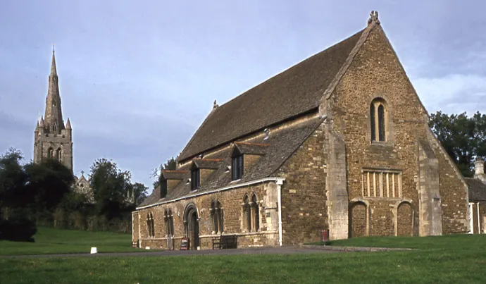 Oakham Castle Historic site, Oakham3.4 km N
-
Hambleton Hill Mountain, Hambleton3.3 km NE
-
Rutland Water Lake, England4.2 km NE
-
Uppingham Castle Hill Historic site, Beaumont Chase5.7 km SW
-
Cold Overton Park Mountain, Oakham5.4 km NW
-
Pilton Mound Historic site, North Luffenham6.5 km SE
-
Mount Alstoe Historic site, Burley6.7 km N
Sources & licences
Data last updated: