Glastonbury Abbey
Located in Glastonbury, Mendip District Coordinates: 51°08′46″ N 2°42′53″ W
- Local time
- UTC+00:00
- Europe/London · UTC+00:00
- Elevation
- 22 m
- above sea level
- Airports
- BRS Bristol Airport26 km
- CWL Cardiff International Airport52 km
About Glastonbury Abbey
Glastonbury Abbey is a tourist attraction. Location: Glastonbury, Mendip District.
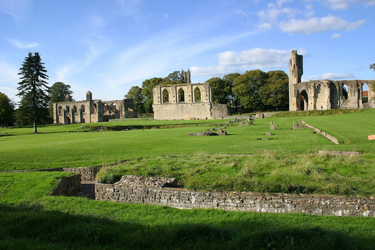
Glastonbury Abbey was a monastery in Glastonbury, Somerset, England. Its ruins, a grade I listed building and scheduled monument, are open as a visitor attraction. The abbey was founded in the 8th century and enlarged in the 10th. Destroyed by a fire in 1184, it was subsequently rebuilt, and by the 14th century it was one of the richest and most powerful monasteries in England. The abbey controlled large tracts of the surrounding land and was instrumental in major drainage projects on the Somerset Levels.
Source: Wikipedia · CC BY-SA 4.0
At a glance
- Built
- 712
- Architectural style
- Romanesque architecture, Gothic architecture
- Heritage designation
- Grade I listed building, scheduled monument
- Official website
- glastonburyabbey.com
Source: Wikidata
Photos of Glastonbury Abbey
-

Tilman2007 · CC BY-SA 4.0 -

Unknown author Unknown author · Public domain -

Simon Burchell · CC BY-SA 4.0 -

Rijksmuseum · CC0 -

Роман Рябенко · CC0


Climate of Glastonbury Abbey
Best months for sightseeingBest months for sightseeing: June–August.
This month · November
A cold month
Day 11° · Night 5° · Rain 78 mm
- Hottest month
- July (day 21°)
- Coldest month
- February (night 2°)
- Wettest month
- December (88 mm)
- Driest month
- April (50 mm)
Bars: average monthly low and high temperature. Below: precipitation. Monthly averages for 1970–2000 at about 18 km resolution, adjusted for elevation. Highlighted months are mild and relatively dry. Source: WorldClim 2.1 (CC BY 4.0).
Show values as a table
| Month | Jan | Feb | Mar | Apr | May | Jun | Jul | Aug | Sep | Oct | Nov | Dec |
|---|---|---|---|---|---|---|---|---|---|---|---|---|
| Average high (°C) | 8° | 8° | 10° | 13° | 16° | 19° | 21° | 21° | 18° | 15° | 11° | 9° |
| Average low (°C) | 2° | 2° | 3° | 4° | 7° | 10° | 12° | 12° | 10° | 7° | 5° | 3° |
| Precipitation (mm) | 84 | 61 | 62 | 50 | 53 | 60 | 54 | 64 | 71 | 74 | 78 | 88 |
How to get to Glastonbury Abbey
The nearest airport is Bristol Airport (BRS), 26 km to the north as the crow flies. The nearest large city is Bristol, 35 km to the north.
Airports
- Bristol Airport (BRS) Bristol 26 kmnorth
- Cardiff International Airport (CWL) Cardiff 52 kmnorthwest
- Exeter International Airport (EXT) Exeter, Devon 67 kmsouthwest
Nearby large cities
- Bristol Population: 479K 35 kmnorth
- Bath Population: 101.6K 35 kmnortheast
- Cardiff Population: 372.1K 49 kmnorthwest
- Newport Population: 161.5K 53 kmnorth
- Poole Population: 151.5K 70 kmsoutheast
Straight-line distances; road distances are longer. Airport data: OurAirports.
Day trips from Glastonbury Abbey
Within 100 km: 571 historic and cultural sites, 1,325 natural sites, 141 lakes, rivers and coasts.
0–25 km118 places
- Stert Island Island 23 kmNW
- Denny Island Island 23 kmN
- Fenning Island Island 23 kmW
- Cheddar Reservoir Lake 16 kmN
25–60 km654 places
- Chesil Beach Beach 58 kmS
- Charmouth Beach Beach 48 kmS
- Kilve Beach Beach 36 kmW
- Steep Holm Island 35 kmNW
60–100 km1,265 places
- Brownsea Island Island 73 kmSE
- Avon Beach Beach 83 kmSE
- Studland Beach Beach 76 kmSE
- Man O'War Beach Beach 66 kmSE
Straight-line distances.
Nearby attractions & nature
Everything nearby-
Chalice Well Attraction, Glastonbury0.6 km SE
-
Wearyall Hill Mountain, Glastonbury1.1 km SW
-
Glastonbury Tor Mountain, Glastonbury1.1 km E
-
Oaks of Avalon Historic site, Glastonbury2.1 km E
-
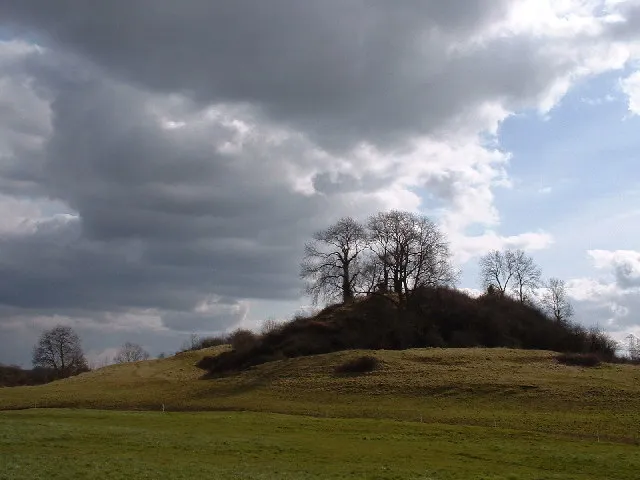 Fenny Castle Historic site, Wookey4.8 km N
-
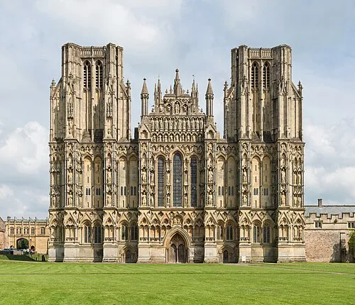 Wells Cathedral Attraction, Wells8.7 km NE
-
Dundon Beacon Historic site, Compton Dundon7 km S
-
Shapwich Railway Station (Ruins) Historic site, Shapwick8.1 km W
Nearest towns and villages
-
Glastonbury Town, Glastonbury0.4 km W
-
Street Town, Street3 km SW
-
Beckery Neighbourhood, Glastonbury1.1 km W
-
Northover Neighbourhood, Glastonbury1.4 km SW
Sources & licences
Data last updated: · 2 independent sources