Downside Abbey
Located in Stratton on the Fosse, Mendip District Coordinates: 51°15′17″ N 2°29′41″ W
- Local time
- UTC+00:00
- Europe/London · UTC+00:00
- Elevation
- 183 m
- above sea level
- Airports
- BRS Bristol Airport21 km
- CWL Cardiff International Airport61 km
About Downside Abbey
Downside Abbey is a tourist attraction. Location: Stratton on the Fosse, Mendip District. The best months to visit are June–August. The nearest airport is Bristol Airport (21 km). Nearby sights include Nunney Castle and Wells Cathedral.
Climate of Downside Abbey
Best months for sightseeingBest months for sightseeing: June–August.
This month · November
A cold month
Day 10° · Night 4° · Rain 83 mm
- Hottest month
- July (day 20°)
- Coldest month
- February (night 1°)
- Wettest month
- December (94 mm)
- Driest month
- July (53 mm)
Bars: average monthly low and high temperature. Below: precipitation. Monthly averages for 1970–2000 at about 18 km resolution, adjusted for elevation. Highlighted months are mild and relatively dry. Source: WorldClim 2.1 (CC BY 4.0).
Show values as a table
| Month | Jan | Feb | Mar | Apr | May | Jun | Jul | Aug | Sep | Oct | Nov | Dec |
|---|---|---|---|---|---|---|---|---|---|---|---|---|
| Average high (°C) | 7° | 7° | 9° | 12° | 15° | 18° | 20° | 20° | 17° | 14° | 10° | 8° |
| Average low (°C) | 1° | 1° | 2° | 3° | 6° | 9° | 11° | 11° | 9° | 7° | 4° | 2° |
| Precipitation (mm) | 91 | 64 | 70 | 55 | 60 | 65 | 53 | 66 | 77 | 81 | 83 | 94 |
How to get to Downside Abbey
The nearest airport is Bristol Airport (BRS), 21 km to the northwest as the crow flies. The nearest large city is Bath, 16 km to the northeast.
Airports
- Bristol Airport (BRS) Bristol 21 kmnorthwest
- Cardiff International Airport (CWL) Cardiff 61 kmwest
- Bournemouth Airport (BOH) Bournemouth 70 kmsoutheast
Nearby large cities
- Bath Population: 101.6K 16 kmnortheast
- Bristol Population: 479K 23 kmnorth
- Newport Population: 161.5K 51 kmnorthwest
- Cardiff Population: 372.1K 54 kmnorthwest
- Swindon Population: 201.7K 60 kmnortheast
Straight-line distances; road distances are longer. Airport data: OurAirports.
Day trips from Downside Abbey
Within 100 km: 630 historic and cultural sites, 1,257 natural sites, 144 lakes, rivers and coasts.
0–25 km150 places
- Denny Island Island 13 kmNW
- Cheddar Reservoir Lake 22 kmW
- Chew Valley Lake Lake 12 kmNW
- Barrow Gurney Reservoir 1 Lake 20 kmNW
25–60 km576 places
- Kilve Beach Beach 52 kmW
- Steep Holm Island 44 kmW
- Flat Holm Island 46 kmW
- Barry Island Island 57 kmW
60–100 km1,305 places
- Brownsea Island Island 73 kmSE
- Avon Beach Beach 79 kmSE
- Chesil Beach Beach 69 kmS
- Calshot Beach Beach 96 kmSE
Straight-line distances.
Nearby attractions & nature
Everything nearby-
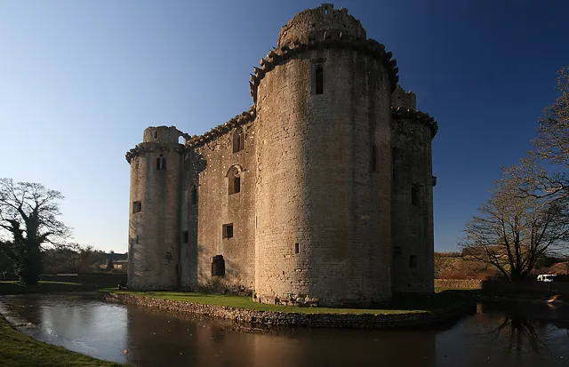 Nunney Castle Historic site, Nunney9.5 km SE
-
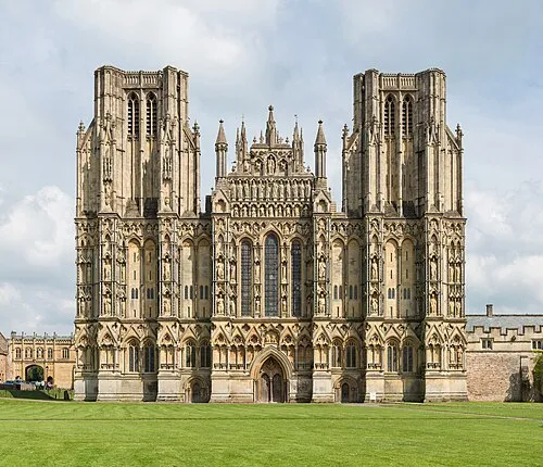 Wells Cathedral Attraction, Wells11 km SW
-
Radstock Round Hill Historic site, Norton-Radstock6.4 km NE
-
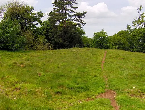 Richmont Castle Historic site, East Harptree11 km NW
-
Long Hill Mountain, Ashwick5.3 km SW
-
Cranmore Hill Mountain, Cranmore5.9 km S
-
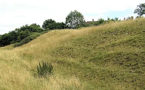 Culverhay Castle Historic site, Englishcombe14 km NE
-
 Twerton Park Landmark, Englishcombe15 km NE
Nearest towns and villages
-
Stratton-on-the-Fosse Village, Stratton on the Fosse0.2 km SE
-
Chilcompton Village, Chilcompton1.3 km NW
-
Holcombe Village, Holcombe1.8 km SE
-
Midsomer Norton Town, Norton-Radstock3.5 km N
Sources & licences
Data last updated: